Colorado warming and drying trend before next cold wave
A terrific Tuesday is on the way! We have a drying and warming trend breaking up the cooler and wetter shot that rolled in this weekend. On the GOES-16 water vapor map it shows drier air taking a big bite out of northeastern Colorado. This will lead to lots of sunshine for the day.
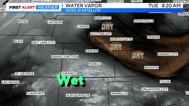
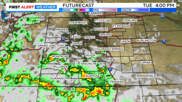
The southern half of the state still has moisture flowing in from the southwest. So any thunderstorms and showers that form up will be mainly south of I-70 into the southern stretches of the state. Northern Colorado will stay dry into Wednesday morning.
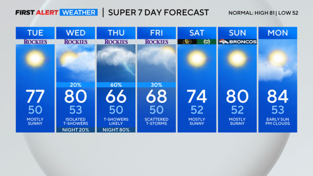
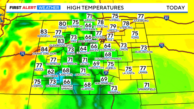
Highs across the eastern plains will warm up by about 10 degrees from the cool start to the week we had on Monday. High temperatures across most of the state will be in the 70s and 60s with a few low 80s on the Western Slope.
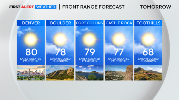
Wednesday may have a few afternoon thunderstorms with warmer temperatures.
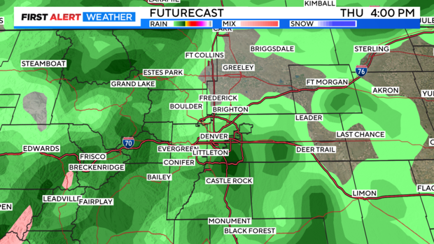
By Thursday into Friday another cold front will push thru mixing with moisture from the southwest creating a good chance of rain and dropping temperatures again into the 60s over the Denver metro area.