Colorado bracing for a La Nina winter, what does that mean?
Last winter featured cycles of snowstorms and wind events, followed by warm and dry periods. While there is always a level of uncertainty regarding the weather day to day, long-range forecasts can be useful to provide an overall summary of a season, and what to generally expect.
One of the big things we look at is what El Nino and La Nino are doing. It all has to do with the water temperatures off the coast of South America. You heard that correctly, a major pattern we use to make a forecast for the upcoming winter is based off the water temperatures thousands of miles away.
In the 1600's, a South American fishermen noticed periods of unusually warm water in the Pacific Ocean that peaked around Christmas time. This was eventually dubbed El Nino.
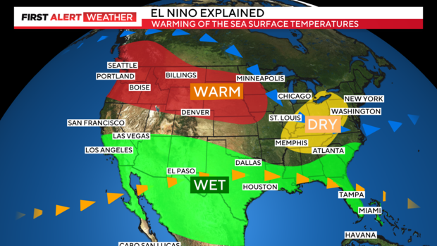
An El Nino occurs when trade winds along the equator weaken, allowing warm water to push east toward the coast of South America. This pushes the Artic and Tropical jet streams northward, allowing for warmer overall temperatures in the northern Rockies and more moisture to push into the southern half of the U.S.
This set-up can help upslope systems to occasionally pull a lot more moisture from southern areas of the nation. Statistically, northeast Colorado can receive higher precipitation in the winter season during an El Nino.
This happened in March of 2003 when the Front Range was slammed with a three day snow storm that buried parts of Colorado with one to three feet of snow. Denver officially had 31.8 inches. The second largest snow storm in Denver's history.
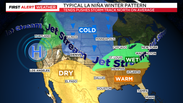
This winter season is forecast to be to be in a weak La Nina year. La Nina is opposite of El Nino in that the water is cooling off the coast of South America.
Stronger trade winds cool sea surface temperatures. As a result, storm tracks in the Northern Hemisphere are pushed further north. On average, northern Colorado tends to receive more precipitation in La Nina years than southern and central Colorado.
This scenario happened on March 13th thru 14th of 2021 when Denver was blasted with 27.1 inches of snow. Making it the mile high city's 4th largest snowstorm on record.
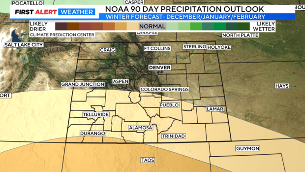
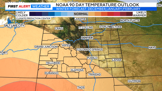
We are expecting a weak La Niña year this winter. The temperature profile for the next 90 days -- December, January, February -- has the Front Range and most of northern Colorado with equal chances of being warmer or colder. If the temperature regime is a normal year, that means there's pretty good snow production as far as winter goes in our state. The other thing we look at is the 90-day precipitation outlook. The southern part of the state is going to be dry. But in northern Colorado there are equal chances of drier or wetter outlooks. Let's say we have normal precipitation, the weak La Niña should deliver quite a bit of snow in the northern part of Colorado.

