Breezy and warm Tuesday prompts a Red Flag Warning in Colorado
Unusually warm weather will combine with dry soil, dry air, and occasionally gusty wind to elevate the wildfire threat in Colorado on Tuesday.
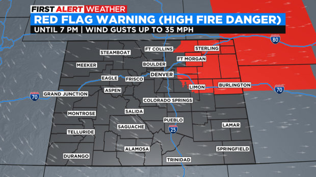
The most critical fire danger is across the northeastern plains of the state including communities such as Fort Morgan, Sterling, Julesburg, Akron, Deer Trail, and Limon. All of these areas are under a Red Flag Warning from 11 a.m. until 7 p.m. Tuesday. It's the first such warning in Colorado in several weeks.
The immediate Denver, Boulder, and Fort Collins areas have been left out of the Red Flag Warning but fire danger is still elevated. A fire could still spread quickly even outside the warned area.
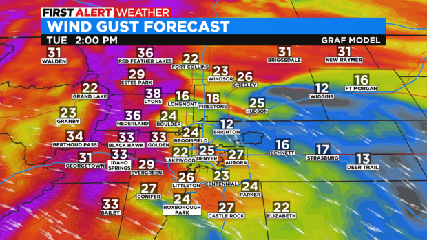
Wind gusts will reach at least 30 mph at times Tuesday afternoon below 6.000 feet and at least 40 mph above 6,000 feet including the foothills of Jefferson, Boulder, and Larimer Counties.
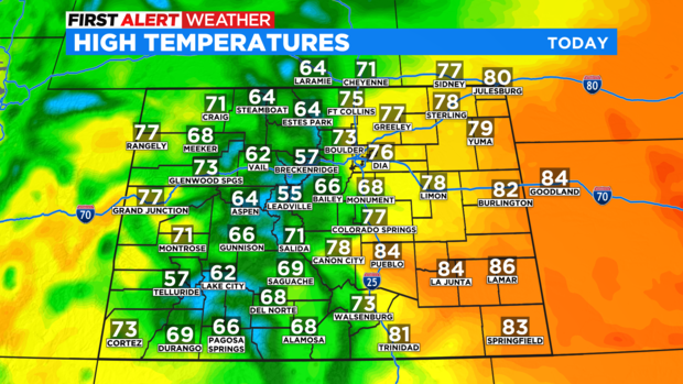
Meanwhile temperatures will be at least 10 degrees above normal along the Front Range Tuesday afternoon with 70s in the Denver in the Denver metro area.
A weak cold front will move across the urban corridor Tuesday evening causing an increase in clouds but not much else. A few sprinkles are possible in the Denver metro area between 5-8 p.m. but no measurable precipitation is expected.
The extended forecast for most of Colorado also looks quite dry with no good chances for moisture through at least the middle of next week.
