Chicago First Alert Weather: Mostly cloudy skies tonight, snow later this week

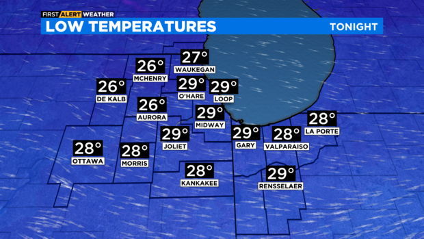
CHICAGO (CBS) -- Mostly cloudy skies this evening, but turning overcast overnight into Tuesday morning. Lows will be in the upper 20s, but a breezy west-northwest wind will make it feel like the low 20s with the wind chill.
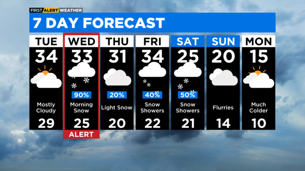
Mostly cloudy for Tuesday afternoon with highs in the low to mid 30s.
An area of low pressure will increase moisture over the area during the pre-dawn hours on Wednesday morning.
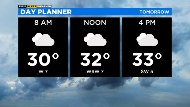
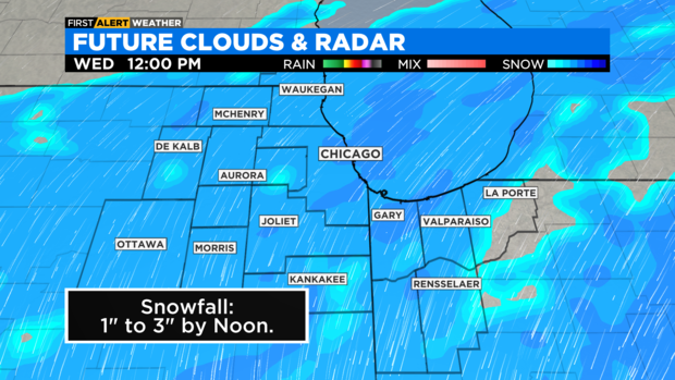
Snow chances increase by 5 a.m. and widespread snow is possible by 7 a.m. Slow and slick travel is possible for Wednesday morning due to the likelihood of accumulating snow.
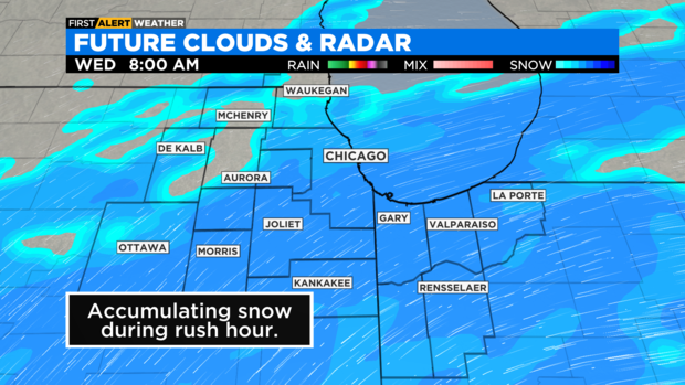
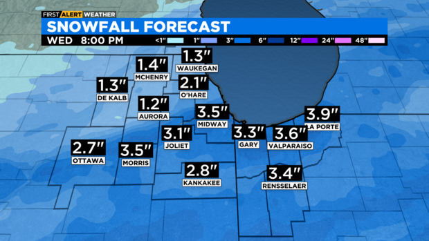
Snowfall chances continue through midday, then decrease by the mid to late afternoon. Total snowfall accumulations are expected to be between two to four inches, with lighter amounts in the northwest suburbs and higher amounts to the south, especially south of the Kankakee River Valley.

Additional snowfall chances will be with us late in the week, with flurries Thursday, scattered snow showers Friday and again late in the day Saturday. A much colder weather pattern arrives this weekend with highs in the 20s and then possibly only in the teens for highs by Monday of next week.
TONIGHT: Turning cloudy. Low 29°, with wind chills in the low 20s.
TUESDAY: Mostly cloudy. High 34°
WEDNESDAY: 90% chance of snow, especially in the morning. High 33°