Severe weather threat as storms arrive in Chicago on Wednesday


Multiple rounds of thunderstorms are in the forecast for Wednesday,
Scattered showers are possible Wednesday morning, but once we hit the afternoon, storms return to the forecast. The window of opportunity for severe storms will be between 1 p.m. and 9 p.m.
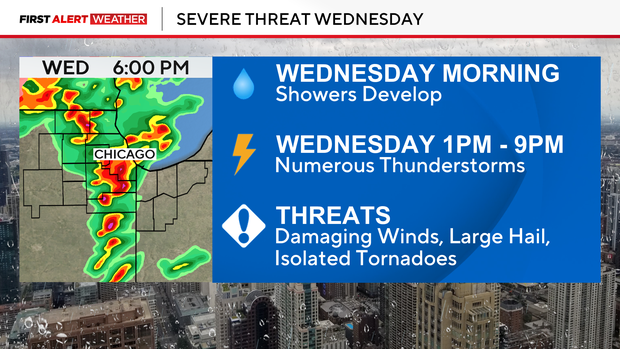
The main threat for Chicago will be between 4 p.m. and 6 p.m.
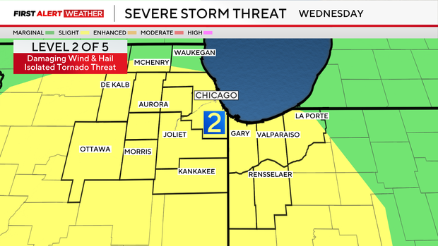
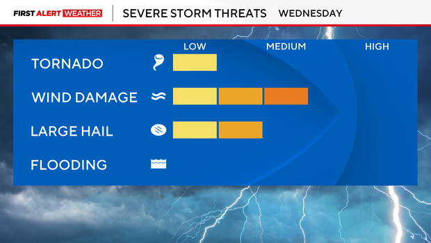
Damaging wind gusts, hail and brief isolated tornadoes will be possible.
After the severe weather threat, as temperatures plummet, expect snow. Slushy wet snow is expected overnight through the morning commute Thursday.
Higher snowfall accumulations (1" to 3") are expected for areas west of the city. Eastward, 0.5" to 1" of snow is possible. Windy conditions for both Wednesday and Thursday as gusts will top out near 40 mph.
Highs will be up in down, with 60s returning Wednesday, 40s Thursday and back into the 50s Friday.
More rain showers return to the forecast Thursday night. Cooler temperatures this weekend with more rain Sunday.
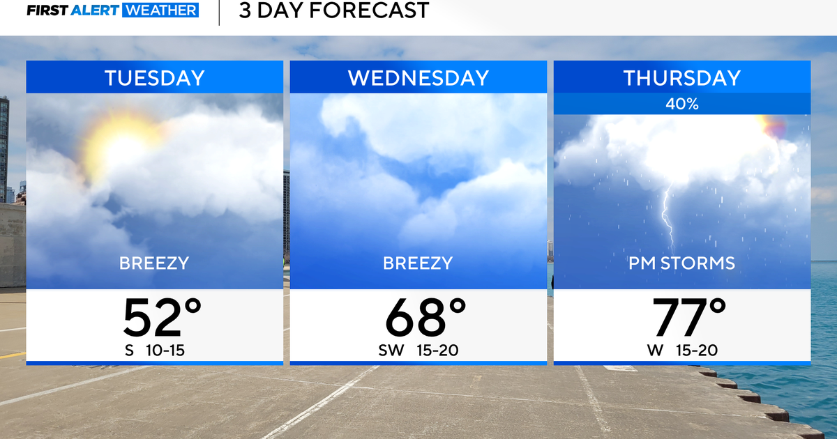
Forecast at a glance
Tonight: Mostly cloudy, low in mid-50s. Staying breezy
Tomorrow: High of 65. Windy, am showers. Pm severe storm threat.
Tomorrow night: Low of 32. Rain turns to snow. Snow continues through morning.