Snow falls fast in Chicago area after temperatures plummet


CHICAGO (CBS) -- A fast-moving cold front brought fast-falling snow to the Chicago area Friday evening.
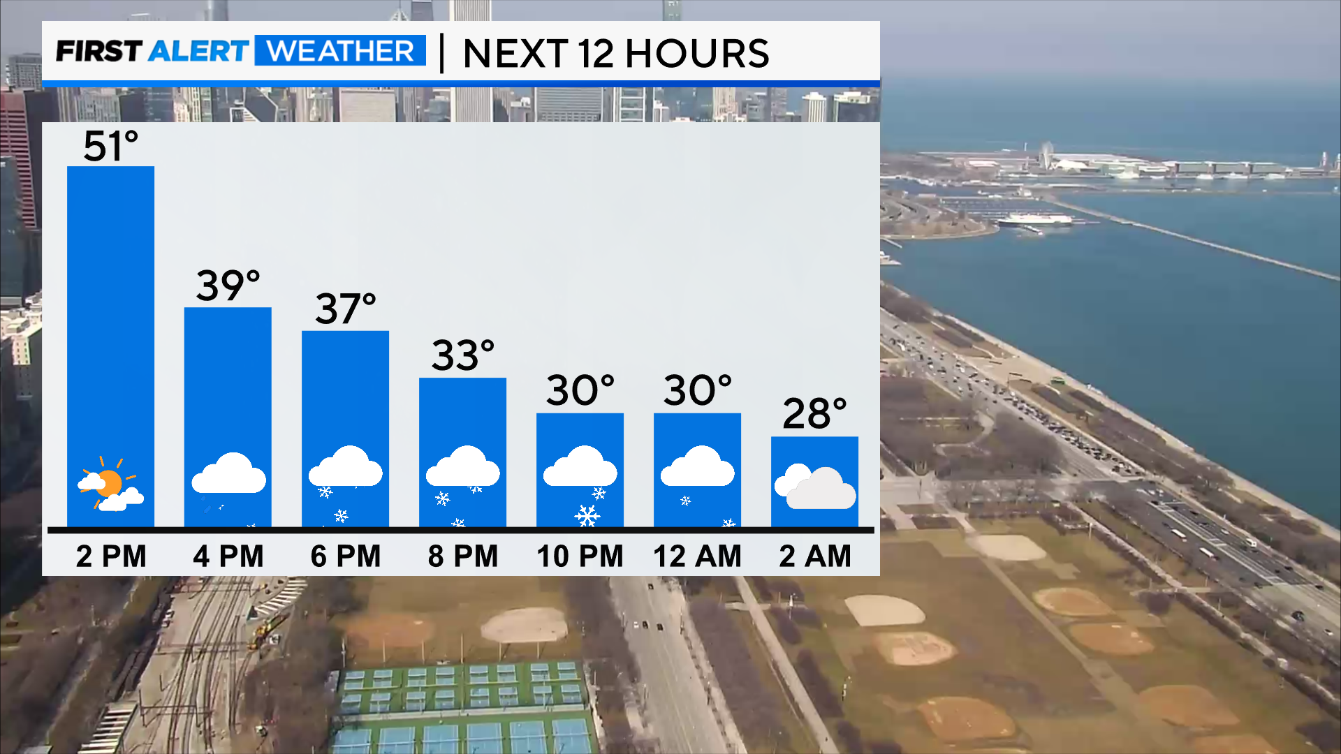
The precipitation followed a frontal passage as a cold front dropped southward from Wisconsin. It was in the 50s in the afternoon in Chicago, but temperatures had dropped to the 20s by the 10 p.m. hour and snow fell rapidly for hours around the area.
By the 10 p.m. hour, snow topped out at over 2.5 inches in Downers Grove. The snow was expected to reach 1 inch at O'Hare International Airport before moving out.
| 09:35 pm CST - 2/23/2024 | 2 SSE Downers Grove, IL | 2.6 |
| 08:00 pm CST - 2/23/2024 | 3 NNE West Chicago, IL | 1.8 |
| 09:45 pm CST - 2/23/2024 | 3 SSE Naperville, IL | 1.8 |
| 09:30 pm CST - 2/23/2024 | 1 NNE Elgin, IL | 1.7 |
| 08:45 pm CST - 2/23/2024 | 1 NW Lindenhurst, IL | 1.5 |
| 08:15 pm CST - 2/23/2024 | 9 WNW St. Charles, IL | 1.4 |
| 08:00 pm CST - 2/23/2024 | 3.0 SW Midway Airport, IL | 1.3 |
| 08:55 pm CST - 2/23/2024 | Rockford Airport, IL | 1 |
| 09:20 pm CST - 2/23/2024 | Marengo, IL | 1 |
| 08:55 pm CST - 2/23/2024 | O'Hare Airport, IL | 0.8 |
| 08:00 pm CST - 2/23/2024 | 2 WSW Elk Grove Village, IL | 0.7 |
Wind gusts ensured the snow blew around and diminished visibility – topping out at 32 at O'Hare International Airport, 33 at Midway, and 52 in Gary, Indiana. The visibility in Gary Friday night was 0.
The Chicago Department of Streets and Sanitation sent out snow plows to clear the roads and spread salt Friday night. Crews monitored arterial streets, DuSable Lake Shore Drive, and bridges and overpasses to ensure roads were safe.
By 10 p.m., the light snowfall was shifting south, and had come to an end for northern parts of the CBS 2 viewing area. The bulk of the snow was expected to move out just after midnight, but fingers of lake-effect snow were expected to persist through 6 a.m. Saturday.
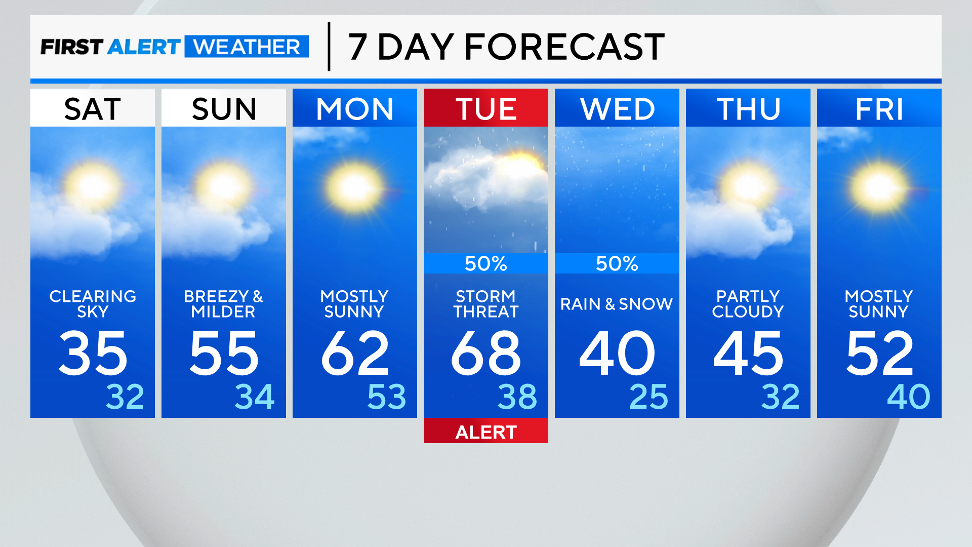
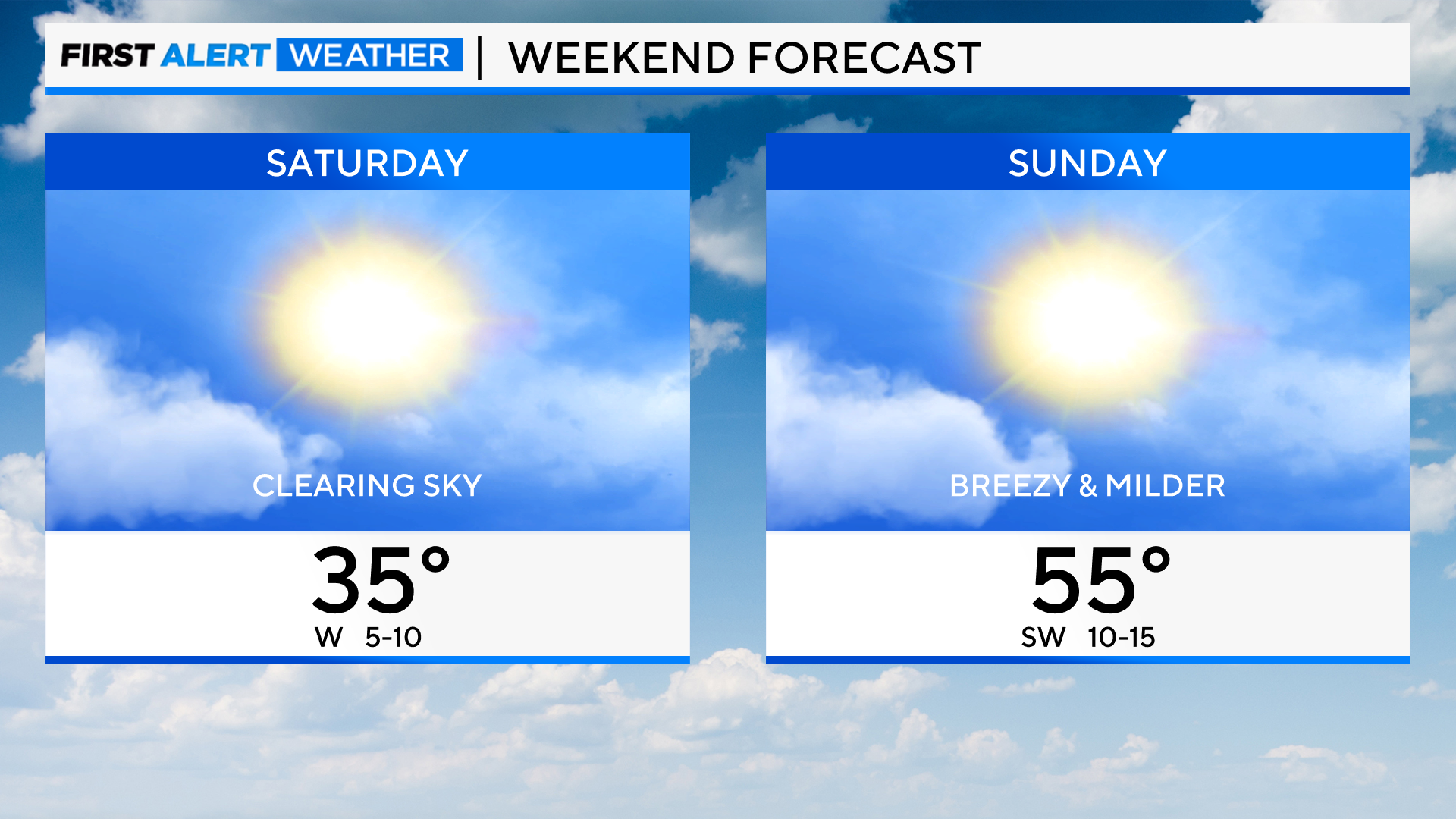
Clearing is expected for Saturday and colder with highs in the mid-30s but on Sunday we jump 20 degrees warmer!
Near-record warmth is coming early next week. Watch for a possible storm threat for Tuesday.
TONIGHT: Snow showers and chilly wind. Low 24.
SATURDAY: Gradual clearing High 35.
SUNDAY: Breezy and milder. Partly cloudy. High 55. The normal high is 39 degrees and Lake Michigan water temperature is 39 degrees.