Chicago Weather Alert: 2-4 inches of snow to make for slick, slow travel

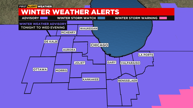
CHICAGO (CBS) -- A Winter Weather Advisory is in effect for the area starting tonight and lasting through Wednesday evening. Two to four inches of snowfall is in the forecast.
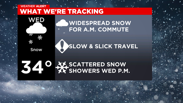
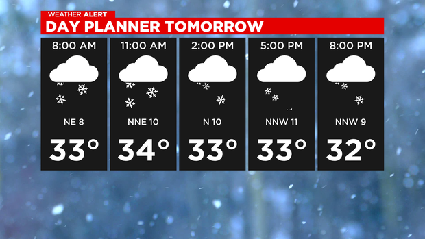
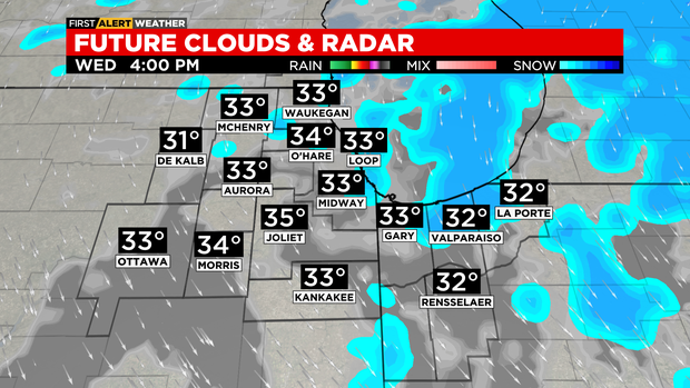
Snowy, slick and slow for your Wednesday morning commute. Snow will increase after midnight from south to north, and will be widespread over most of the area by 4 a.m. This is expected to be a wet and heavier snow, so plan on slushy accumulation for your morning commute.


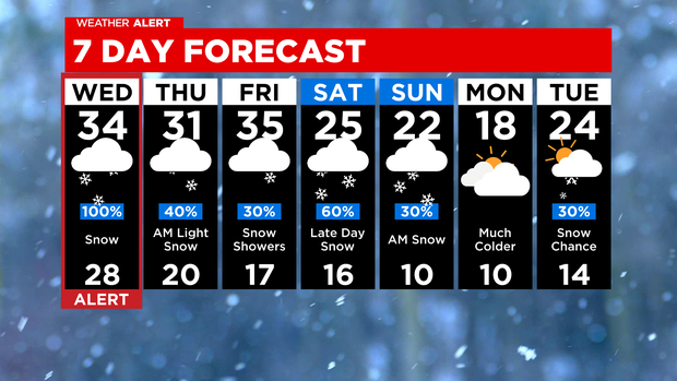
This slush could cause travel issues, that's why a Winter Weather Advisory is in effect for the area starting tonight and lasting through Wednesday evening. The snow will be less widespread after noon, so plan on scattered snow showers through the afternoon and evening commute, with light accumulations likely. Highs on Wednesday will be just above freezing.
Scattered snow shower chances continue Wednesday night and into Thursday morning. Only light accumulations are expected in this timeframe, but slick spots are still possible through Thursday morning.
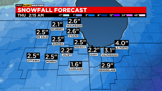
Snowfall accumulations through Thursday morning will be on average between 2 to 4 inches, with lighter amounts in the northwest suburbs, and isolated higher totals south of I-80.
Little to no accumulation is in the forecast for Friday, with just some lingering snow chances. We'll have another opportunity for measurable snowfall this weekend, especially late Saturday through Sunday morning. A few inches to several inches of accumulation will be possible then.
Turning much colder starting this weekend with highs in the 20s Saturday and Sunday, and only in the upper teens on Monday.
TONIGHT: Cloudy skies with increasing snow chances after midnight. Widespread snow by 4am. Low 30°
WEDNESDAY: Widespread snow in the morning, then scattered snow showers in the afternoon. High 34°
THURSDAY: Scattered morning snow showers. Cloudy skies. High 31°