Chicago Weather Alert: Wintry mix could bring freezing rain, flooding Wednesday

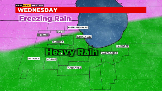
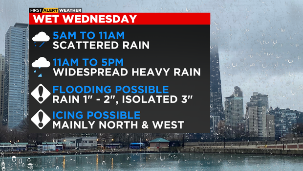
CHICAGO (CBS) -- A Weather Alert is posted for Wednesday due to heavy rainfall and a wintry mix that will cause slippery and slow travel. The highest impacts are expected on Wednesday afternoon and evening.
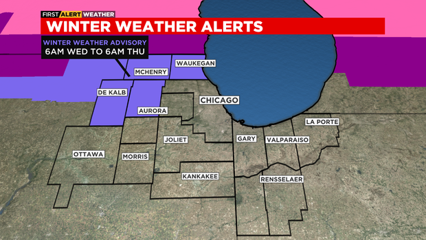
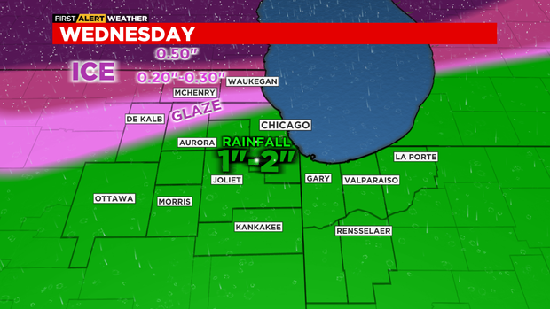
A Winter Weather Advisory is in effect for McHenry, Lake, Kane, and DeKalb counties from 6 a.m. Wednesday through 6 a.m. Thursday. This advisory is for the possibility of sleet and freezing rain accumulation. Ice accumulation of 0.20" to 0.30" is possible in Lake and McHenry County, with 0.10" of ice possible for Kane and De Kalb.
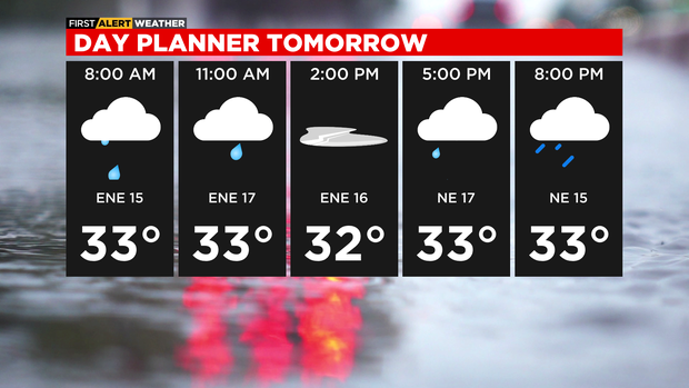
Scattered showers will increase Wednesday morning, then be widespread in the afternoon. Some of the rain will be heavy, which could trigger some street flooding and ponding on roadways. Some sleet and freezing rain accumulation is possible for areas mainly north of Chicago, near the Wisconsin and Illinois state line. Dangerous travel conditions could quickly increase in these areas that experience icy accumulations.
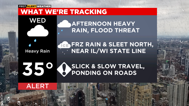
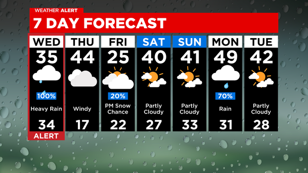
Rainfall amounts will average between 1 to 2 inches, but some isolated locations may see as much as 3 inches.
Windy and milder for Thursday, with highs in the low to mid 40s. Wind gusts on Thursday could be as high as 45 miles per hour. Temperatures drop starting Thursday afternoon into the 30s, then into the teens for Thursday night under a partly cloudy sky.
Chilly on Friday with highs in the mid 20s and a slight chance for snow on Friday evening. Highs will be back in to the low 40s this weekend.
TONIGHT: Mostly cloudy with a slight chance for light snow showers north of Chicago. Low 33°
WEDNESDAY: 100% chance of heavy rainfall, especially in the afternoon. Some freezing rain and sleet accumulation possible, mainly north of Chicago. High 35°
THURSDAY: Cloudy skies and windy. High of 44°, then falling into the 30s by the late afternoon.