Cold weather advisory for much of Chicago area overnight Sunday into Monday

The Chicago area began to feel the cold changes Sunday night.
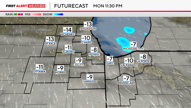
Lows were dropping toward zero degrees, and factoring in the brisk winds will make it feel like -15 to -25 degrees outside.
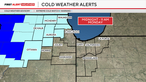
Due to the extreme cold, a cold weather advisory starts at midnight Sunday night until 11 a.m. Monday for the northwest suburbs and counties.
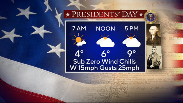
There will be no relief during the day, even though we will have rays of sunshine. Highs will barely climb in the positive single digits, where wind chills will remain below zero during the day.
Even colder air is in store Tuesday. Tuesday morning actual air temperatures will start around -3 degrees in Chicago, with afternoon highs barely reaching the double digits again.
It will feel like -15 to -30 degrees, so make sure to plan accordingly.
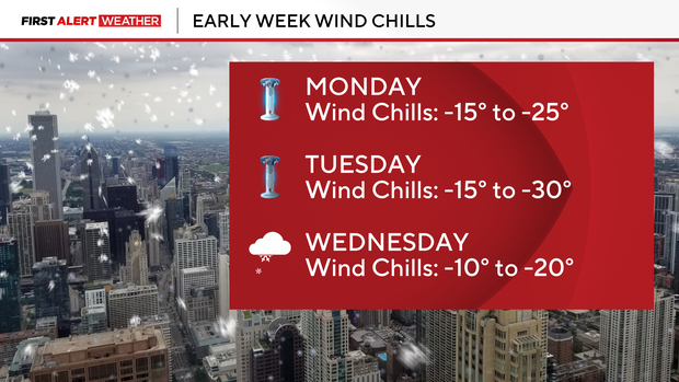
By Wednesday, cold temperatures remain, but snow returns to the forecast. Scattered snow showers are expected early Wednesday, lasting throughout the day.
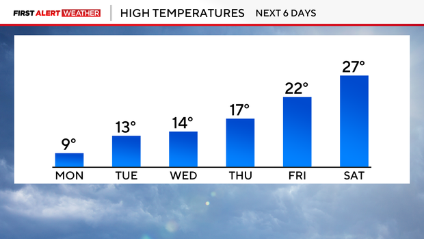
Drier, but still cold air remains for the end of the week and for the upcoming weekend, with highs remaining below normal for this time of year.
Forecast at a glance
Sunday night: Low of 1, flurries end. Feels like -15 to -25 degrees.
Monday: High of 9. Partly cloudy. Below zero wind chills all day.
Monday night: Low of -3, partly cloudy. Feels like -15 to -30.