Chicago area in for another cold night; wintry mix expected Monday
CHICAGO (CBS) -- Most of the lake effect snow in Northwest Indiana has shut down, but the whole Chicago area is in for another cold night.
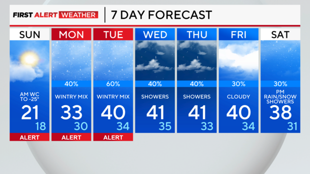
A wintry system is still expected to bring a wintry mix Monday into Tuesday.
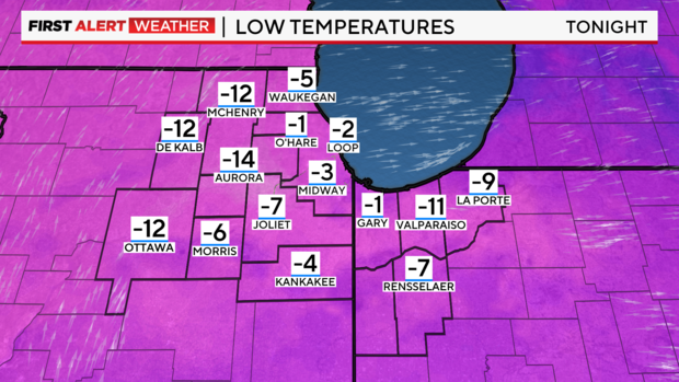
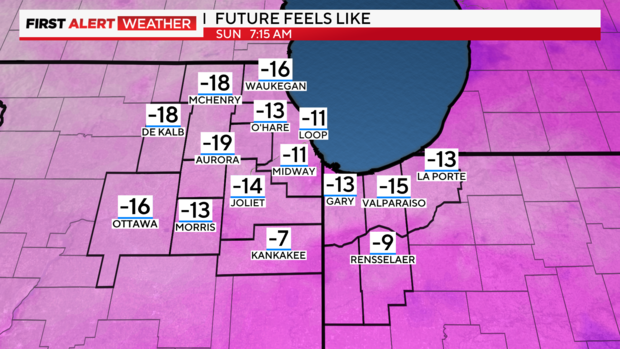
Saturday night brings mostly clear skies and low temperatures from 0 to 10 below. Wind chills will range from 10 below 0 to 25 below 0 Sunday morning.
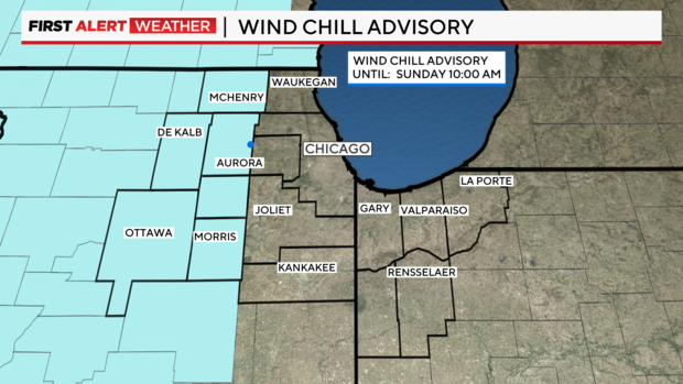
A wind chill advisory is in place for western counties in the area.
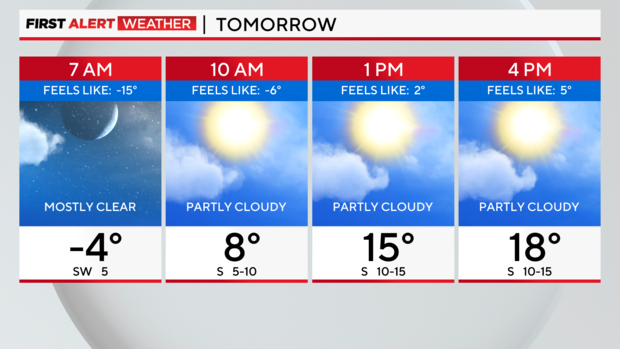
Expect a cold start in the morning and partly cloudy skies Sunday. High temperatures will reach 21 degrees.
Monday brings a chance of snow changing to sleet or freezing rain. Freezing rain may be possible through early Tuesday morning before changing to all rain.
Temperatures warm to the 50s through the end of the week.
FORECAST:
SATURDAY NIGHT: Mostly clear. Lows from 0 to -10. Wind chills from -10 to -25 by Sunday morning.
SUNDAY: Cold start, partly cloudy skies. High 21.
EXTENDED: Chance of snow changing to freezing rain or sleet Monday. May continue Tuesday before rain.