Chicago Weather: Light Snow Sunday Morning, But More Than 6 Inches Possible Monday To Tuesday
CHICAGO (CBS) -- The biggest snow of the season so far is coming to the Chicago area. A winter storm watch has been issued for the area from Monday at 4 p.m. until Tuesday at 5 p.m.
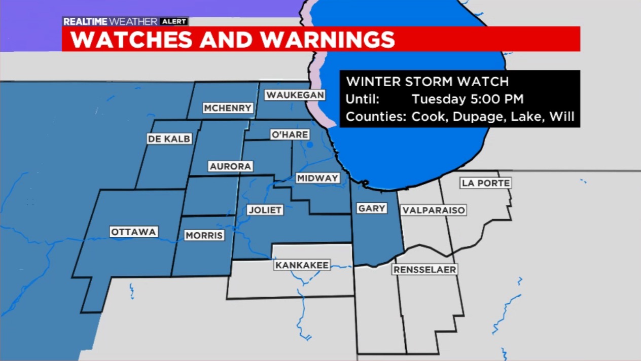
This is expected to be a disruptive snowstorm with more than 6 inches of total accumulation possible, so it is a good time to prepare.
The biggest impact will be to the Tuesday morning commute after heavy snow during the Monday to Tuesday overnight hours.
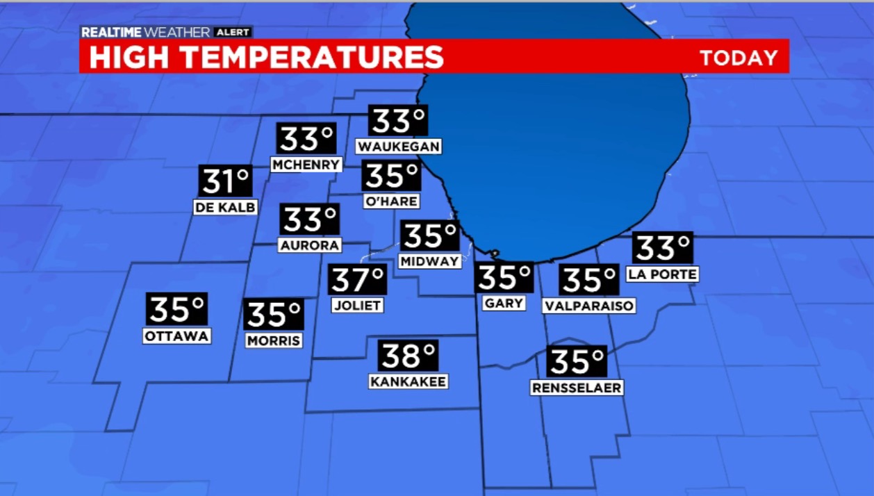
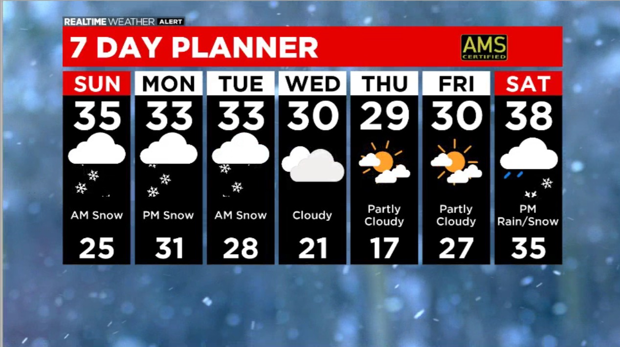
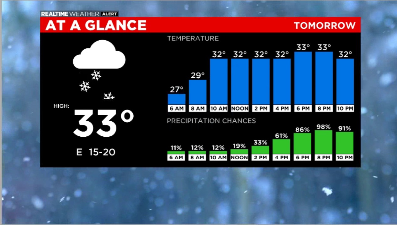
Sunday morning temperatures in the low 30s are a lot warmer than Saturday night as minor amounts of snow start the day. Expect a dusting to the south and more than one inch near the Wisconsin state line. The snow will end in the mid to late morning, but some freezing drizzle is possible to the south.
Sunday night will be cloudy and quiet.
Snow chances will ramp up Monday afternoon. Snow may fall heavily Monday night and early Tuesday. Areas south of Interstate 80 may see ice. Areas to the north where temps are more favorable, may see significant snow. More than 6 inches is a possibility. Progress of this system may be slower to advance than originally forecast. Snow will pick up Monday night. The Tuesday morning commute will likely be hard hit.
Forecast:
Sunday: Morning snow wraps up midday. HIGH: 35
Sunday night: Cloudy. LOW: 29
Monday: Winter storm watch. Snow by afternoon. HIGH: 32
Monday night: Snow, sometimes heavy. LOW 29
Sunday: Morning snow wraps up midday. HIGH: 35
Sunday night: Cloudy. LOW: 29
Monday: Winter storm watch. Snow by afternoon. HIGH: 32
Monday night: Snow, sometimes heavy. LOW 29