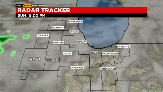
Chicago Weather Alert: Severe thunderstorms moving through area
CHICAGO (CBS) -- Most of the forecast this week feels like summer for the Chicago area. But there is a remote chance of a few severe storms in western Illinois spilling into the western and southern parts of the area Sunday evening.
A Severe Thunderstorm Watch is in place for much of the southwestern part of the Chicago area until 4 a.m.
Ping pong sized hail was also reported near the DuPage Airport in Kane County. Nickel sized hail was also reported in Saint Charles in Kane County.
Strong thunderstorms are also expected to affect northeastern Cook County until midnight.
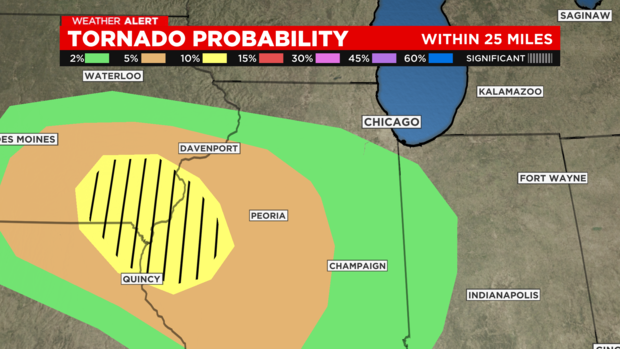
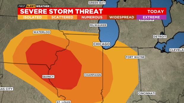
Storms will likely be south of Interstate 80 and west of Interstate 57, affecting LaSalle, Grundy, Kendall, Kane and Kankakee counties, and are most likely to come between 9 p.m. and midnight.
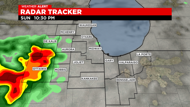
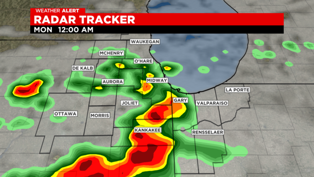
Thunderstorm warnings or an isolated Tornado Warning cannot be ruled out.
Any storms should end by sunrise. Sunday night's low temperature will reach 65 degrees.
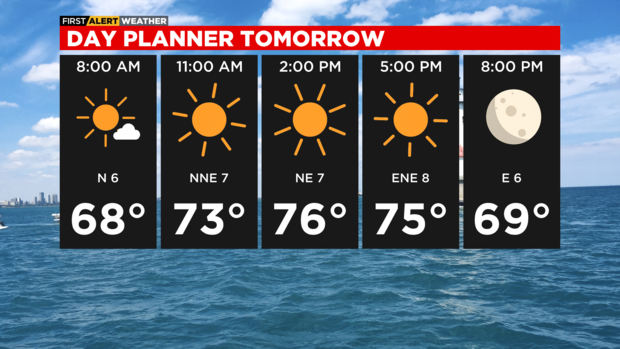
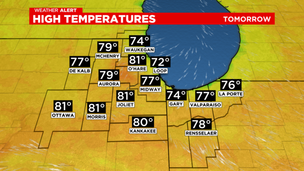
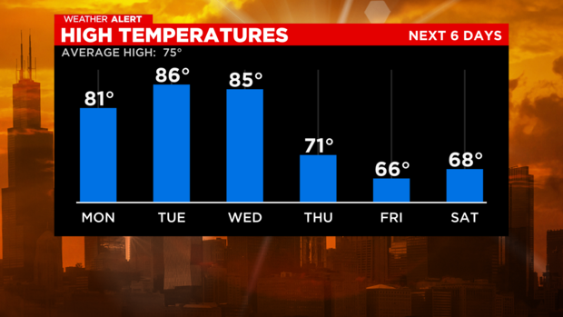
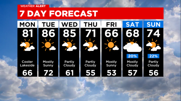
Summer weather continues Monday with partly cloudy skies and high temepratures reaching 81 degrees.
Temperatures will remain high through Wednesday, then miuch cooler. Fall arrives Thursday and cooler air arrives by the end of the week.