Storms keep popping up late into night south of Chicago

CHICAGO (CBS) — Severe storms missed the immediate Chicago area late Thursday, but did strike south of the city late into the night.
There had been concerns about hail larger than eggs and hurricane-force wind gusts of 74+ miles per hour.
A severe Thunderstorm Watch was issued for most of the Chicago area just before 2 p.m., and continued until 8 p.m. But it was well south of the city that the storms actually materialized.
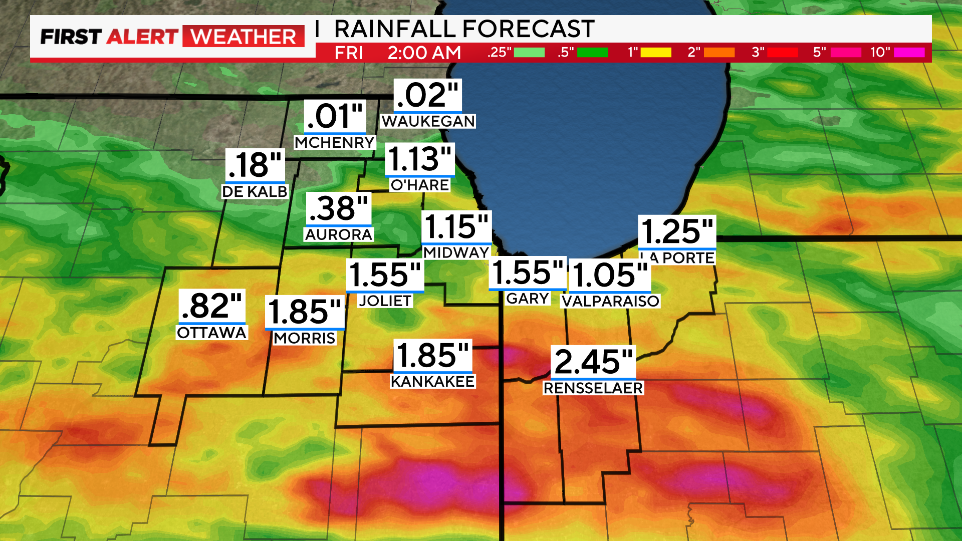
Thunderstorms continued popping up late into the night in areas south of Chicago—some of them strong and severe. Just after 10 p.m., a large cluster of thunderstorms passed over Joliet and Kankakee, prompting a severe thunderstorm warning.
These storms were severe, and carried a risk of 1-inch-sized hail and winds as high as 60 mph.
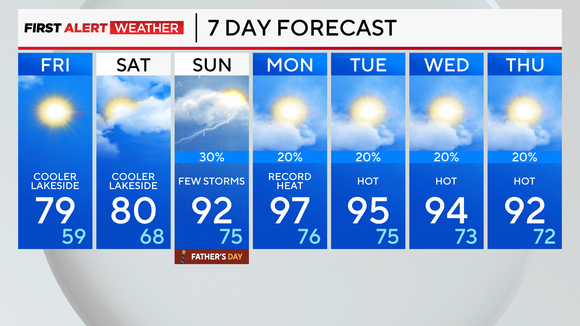
Storms exit the area overnight as a cool front brings more comfortable weather. Humidity and temperatures drop on Friday and Saturday as sunshine returns.
An early-season heat wave builds Father's Day into much of next week, with record-high temperatures possible and heat index values near 100 degrees.
Tonight: Thunderstorms early, some severe. Clearing late. Low: 63
Tomorrow: Mostly sunny and breezy. Cooler lakeside. High: 79
Saturday: Partly cloudy. Cooler lakeside. High: 80