Winter's Return...
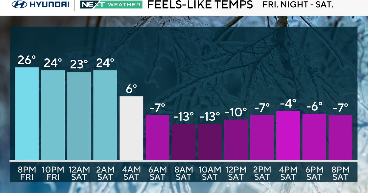
Our Winter break is coming to an end...an arctic cold front will pass through this evening and temps will take a nose-dive. As it slides through, a few flakes will fall and winds will pick up.
 Temps will fall fast the above is a snapshot of temps this evening and below a snapshot of temps in the morning...a frigid fall!

Low pressure will form along the front south of us as "Clipper" energy rushes to the Mid-Atlantic. This storm will be developing fast and even though there won't be much moisture the arctic air and intense lift will result in very efficient accumulation of snow...fluff-factor...and several inches will pile up.

The end result will be a very dry, fluffy several inches with highest amounts in SE Mass with a good chance to eclipse 6" and my be as much as 10"!


