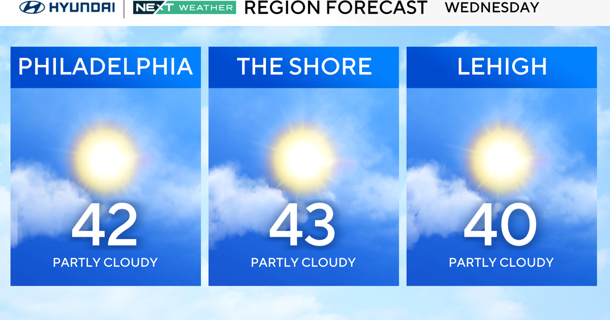
Winter Weather Hangs On...and On...
Downstream blocking that we had earlier this Winter is setting up again and looks to hold strong through the rest of the month. The NAO index is trending negative leading to a build up of cold air in Eastern North America. The result, colder than average temperatures and more chances for snow.
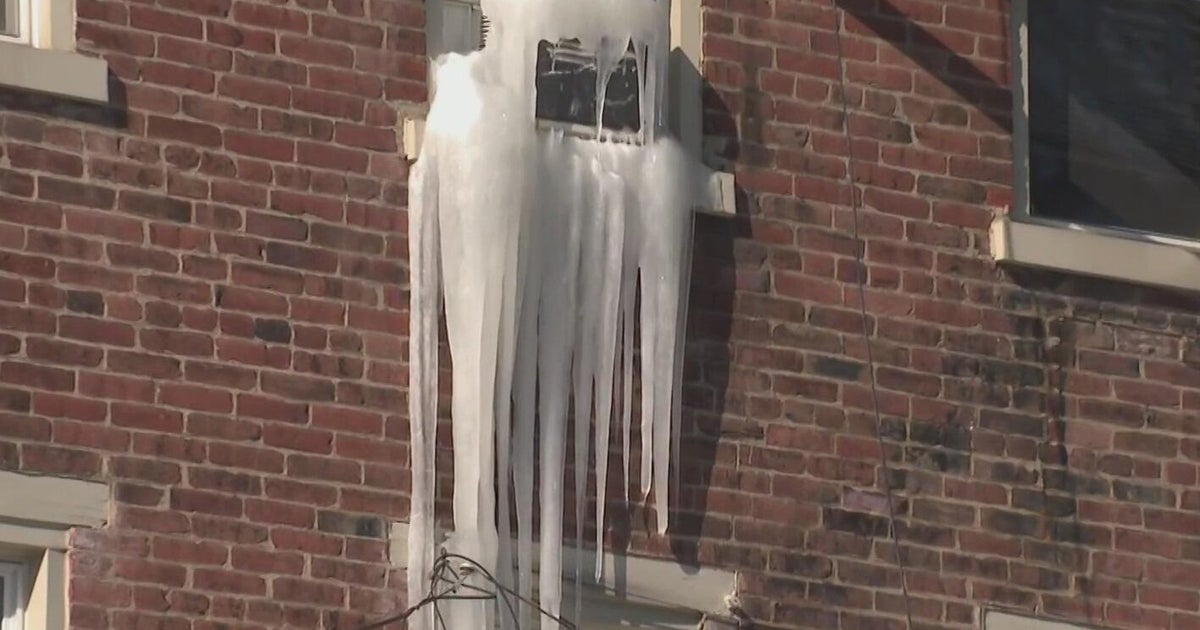
This one didn't amount too much just some coatings on the grass and cars...some areas did pick up a couple of inches, mostly in the elevated areas. The storm is pulling away now but some leftover moisture will keep some drizzle going for half the night. Late night some partial clearing may show up and temps will get close to 32 so some icy spots will be possible. The nice thing about Spring snow is that is USUALLY melts the next day and that will be the case tomorrow. The sun will mix with some cumulus or stratocumulus and there will be a bit of a breeze but highs will manage to get to the 45-50 range. This will be the best day of the week so take advantage if you can!
By late Wednesday another storm will be approaching. Any warmth from Tuesday will be long gone as high pressure noses in from Central Canada establishing the cold at the surface, while the trough aloft takes care of the rest of the column. So, as far as cold goes I don't see much of a problem achieving cold enough temps for snow for the majority of the event the question is more can we generate the precip. This one is a little tougher to answer due to the lack of model consensus with the NAM showing some robust precip amounts and the GFS and EURO showing lighter amounts. When breaking down the models it is easy to see why there is a discrepancy...the NAM has a ton more upper level support with it, especially at 850mb, than the other two. The track of the surface low will take it south of New England...so that is where most of the overrunning precip will be too. There is, however, the cut-off at 500mb that will send spokes of energy around it keeping periods of light snow going through Thursday and maybe even into Friday as well.
Right now I'm siding with the more conservative global models the first shortwave that is guiding the surface low looks to track pretty far south and therefore we should be on the northern edge of the good overrunning precip so higher amounts should stay south of us. Therefore just a couple of inches possible. Obviously, a slight shift in the track to the north will elevate those totals.