Winter Storm Warning For Eastern Mass., Blizzard Warning For Plymouth County, Cape & Islands
BOSTON (CBS) - Having fun yet?
Perhaps this will go down as "the year of the blizzard!"
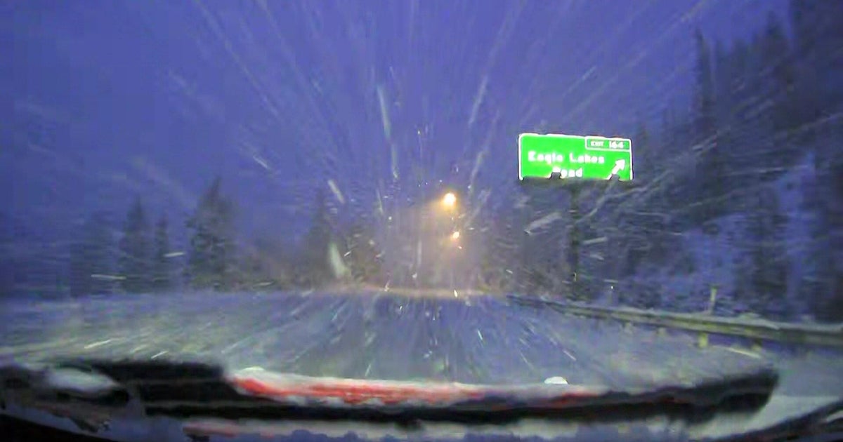
We started January off with a nasty nor'easter in which blizzard conditions occurred along parts of our coastline and now, yet another blizzard is expected, less than three weeks later.
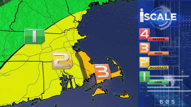
A Winter Storm Warning is in effect for eastern Massachusetts and a Blizzard Warning is in effect from 7 p.m. Tuesday until 1 p.m. Wednesday for eastern and southern Plymouth County and Cape Cod and Islands.
Check: Current Conditions | Interactive Radar | WBZ Weather Blog
Let's get right to the details.
TIMELINE
The snow will begin as early as 1 p.m. on Tuesday. The first to see flakes would be areas well to the south, along the South Coast, Cape Cod and the Islands.
While the actual storm would still be a good distance away from southern New England, there may be a long "arm" extending outward, starting the snow show a bit early.
By the Tuesday evening commute the snow will be expanding in coverage, enveloping a good portion of southeastern Massachusetts, creeping northward towards Boston.
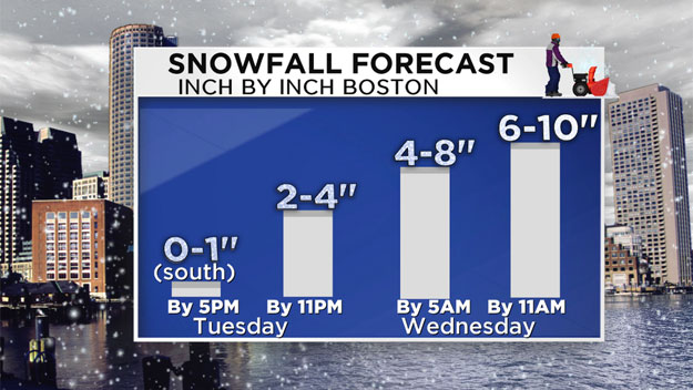
Just a dusting to an inch of snow is forecast by 5 p.m. on Tuesday and this would be mainly south of the Massachusetts Turnpike.
Between 5 p.m. and 11 p.m. Tuesday the snow will overspread the entire region and begin to ramp up in intensity.
Winds will pick up out of the north-northeast, especially along the coastline, gusting 20-to-40 mph.
You can expect about 2-to-4 inches on average by 11 p.m., the highest totals being south of Boston where it would have been snowing the longest.
Along the South Shore and South Coast, we may reach blizzard conditions during this timeframe.
A brief reminder of what a blizzard is:
- Falling and/or blowing snow.
- Winds frequently gusting over 35 mph.
- Reduced visibility under ¼ mile for at least 3 hours.
In other words, I would avoid traveling, if possible, within the blizzard watch area due to whiteout conditions and rapidly deteriorating road conditions.
Overnight, between 11 p.m. and 5 a.m., the storm will hit its stride and peak.
Snowfall rates could reach an inch per hour at times.
Winds will easily gust to 40 mph or greater along the coast, again, inducing blizzard conditions in parts of coastal Plymouth County and over Cape Cod.
By 5 a.m. on Wednesday most cities and towns should have about 4-to-8 inches of light and fluffy snow on the ground.
This would likely cause many schools to delay or close and certainly will make for a very slow and challenging Wednesday morning commute.
Between 5 a.m. and 11 a.m. Wednesday the snowfall intensity will gradually diminish and the back edge of accumulating snowfall will move from west to east, tapering off in the Worcester area between 7-9 a.m., in Boston between 9-11 a.m. and over Cape Cod after 11 a.m.
ACCUMULATION
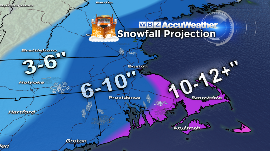
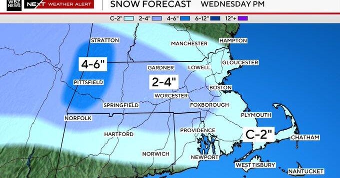
Final snowfall totals are expected to be 6-to-10 inches over most of the area including Boston and all of Metro West.
Ten-to-12 inches is a possibility along the South Shore and over Cape Cod, in the Blizzard Watch zone.
Far to the north and west in Vermont and up in New Hampshire ski areas, lesser amounts (about 3-to-6 inches) are expected. Unfortunately, the one place that they could actually use some snow is expected to get the least.
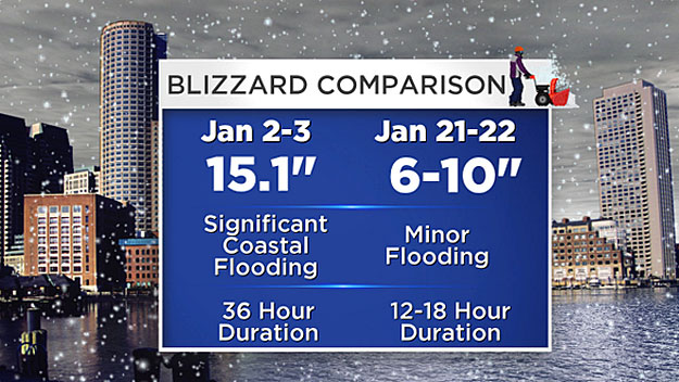
This storm will have many similarities to the nor'easter/blizzard in early January.
Once again it is going to be very cold during the storm. Single digit temperatures to the north and west and teens in the Boston area will make for very light and fluffy, Arctic-like snowfall.
The one major difference between this storm and the early January storm will be the lack of coastal flooding. Tides are at the astronomical minimum for this event, some 3 feet lower than the prior nor'easter.
Snow amounts will also be somewhat lighter in general and the duration of the event much shorter.
And this likely will not be the end.
An active jet stream/pattern is setting up over the next couple weeks leading to several more chances at snow.
One thing is for sure, there will be no lack of cold air. Temperatures will remain well below normal for the foreseeable future.
Follow Terry on Twitter @TerryWBZ
