Winter Storm Brewing
BOSTON (CBS) - It may be the tail end of Winter '12-'13, but it's going out with a bang! If you love the snow, you'll love the remainder of this write-up. If not, you may want to close your eyes!
Check: Interactive Radar | Current Conditions | Weather Blogs
Today will be sunny and cold as highs only hang near the middle 30's. Clouds will be taking over this evening ahead of this big winter storm. Tomorrow, the last full day of winter, will look like a winter wonderland for most of us.
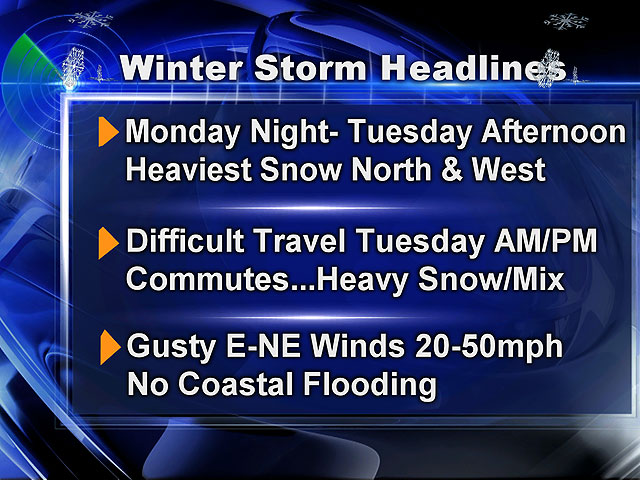
Snow will move in between 10 p.m. and 2 a.m.
Winter Storm Warnings and Watches have been issued for tonight through Tuesday. The snow will switch to a rain-snow mix to rain from the Cape slowly during the early morning hours (6-to-9 a.m.) and slowly do the same south for neighborhoods south of the Mass Pike between 9 a.m.-to-noon.
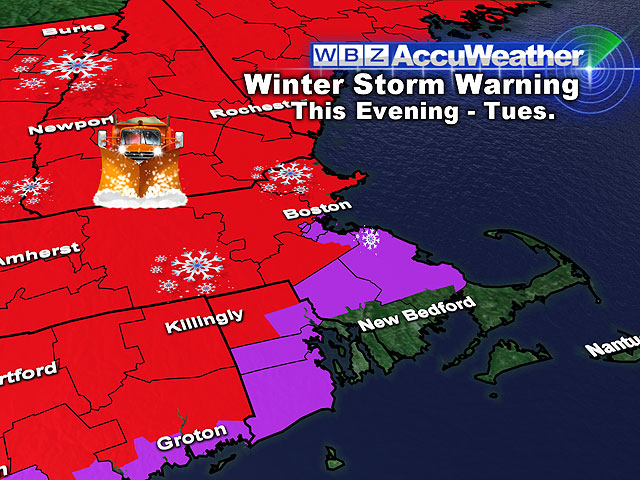
Then, the switch over will occur for Boston to the north shore to cities and towns along the Mass Pike from noon-to-3 p.m.
All of the cities and towns north of the Pike, including the Worcester Hills and points north, will remain all snow. These areas will receive the jackpot totals of 6-to-12+ inches of snow by Tuesday evening.
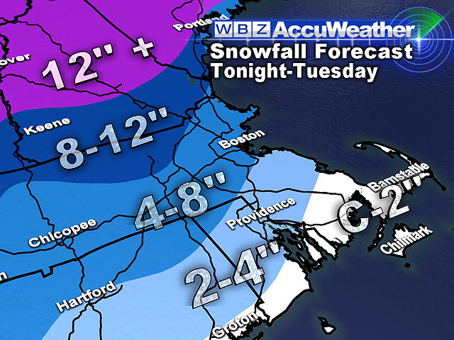
From the Mass Pike to the North Shore to Boston and Norfolk county, 4-to-8 inches of snow will fall before the Tuesday afternoon switch over.
From the Mass Pike to Plymouth and Bristol Counties, 2-to-4 inches of snow will fall before it transitions to rain. Cape Cod and the Islands will have a coasting to 2 inches tonight before some heavy rain begins to fall on Tuesday.
Even though the east-northeast wind will gust 25-50 mph at times, we are not expecting huge coastal issues. There is the potential of minor beach erosion, but thankfully, there is no serious threat of coastal flooding.
An upper level trough will hang tough through the end of the week. This will keep diurnal clouds and flurries-light snow in the forecast through the beginning of spring.
There will be the chance of a few inches of more snow falling for coastal Mass. early on Thursday as an area of low pressure wraps around the base of this 500H trough. Cooler-than-normal temperatures will stick with us through the next 7 days.
***Spring officially arrives at 7:02 a.m. on Wednesday!***
~Melissa :)


