Wildfire smoke in Boston may move closer to ground, potentially triggering air quality alerts
BOSTON - Smoke from wildfires out west continues to be visible in the skies above Boston and it may worsen on Friday, which could lead to air quality alerts.
Why is it hazy in Boston?
If you are a "Star Wars" fan, you undoubtedly are familiar with the dusty, desert planet of Tatooine. Perhaps you've even dreamed of one day visiting this fictional place. Well, today may be your day! Just step outside and look up!
Ok, maybe that is a bit dramatic, but our sky does have a hazy, brownish tint.
Those aren't clouds and it is not due to high levels of smog or humidity, it is smoke from the western Canadian wildfires.
Kind of crazy to think that these remote fires nearly 2,000 miles from Boston are somehow impacting our weather isn't it?
In actuality, the journey that the smoke is taking to get from there to here is MUCH longer than 2,000 miles. The smoke is largely traveling here via the upper level jetstream which is several thousand feet above our heads.
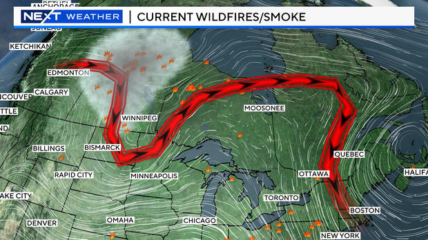
The current jetstream pattern is directing the smoke down into the upper Midwest, back up into eastern Canada and then straight south into New England. Quite the roller coaster ride!
It is fairly easy to detect on visible satellite imagery.
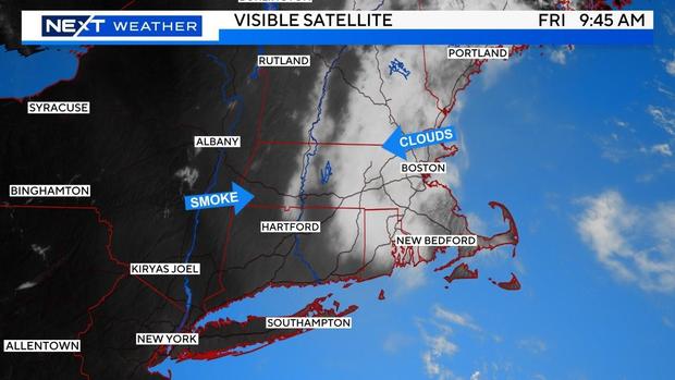
The bright whites are the clouds and the faded, grayish/brownish layer is the smoke.
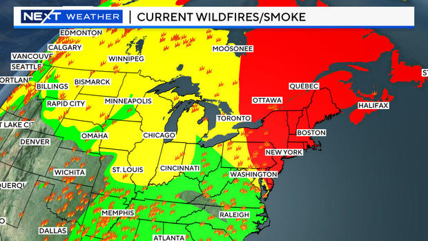
Wildfire smoke forecast in Boston
Boston currently does not have any air quality alerts largely because the smoke is not at the surface (ground level) but instead, several thousand feet above our heads.
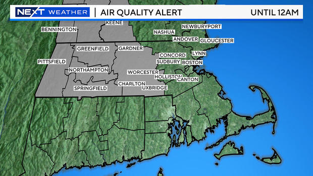
Friday is likely to be the smokiest and haziest day as models are projecting a fairly thick plume headed southward into New England.
There is even some smoke being modeled closer to the surface on Friday. If this were to occur, we may see some air quality alerts issued by the National Weather Service.
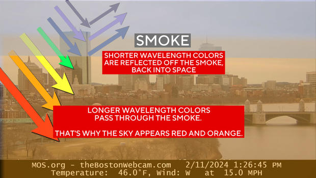
Why is the sun red?
The news isn't all bad. In fact, we may see some of the best sunrises and sunsets of the summer over the next few days!
When you have particulate matter (smoke for example) in the atmosphere it tends to scatter the shorter wavelengths of light (blues) and allow for longer wavelengths (reds and oranges) to be more prominent.
So, be alert Friday evening and perhaps again Saturday morning for some really great horizon shots!
This weekend, the jetstream will shift around as a trough forms in the Upper Midwest. This will bring southwesterly winds into New England.
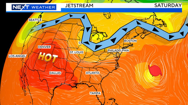
This will actually serve two very useful purposes: First it will kick the smoke out to sea. Secondly, it will also help to kick Hurricane Ernesto out to sea!
If you snap any colorful sky pictures, we would love to see them! Send them to weather@wbztv.com