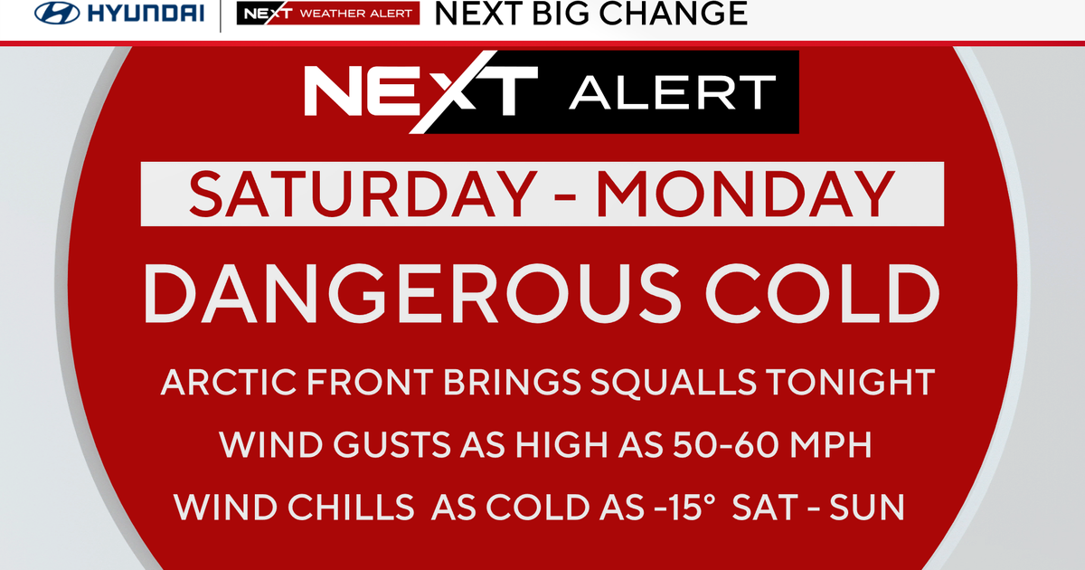
Wicked Cold...
Wicked cold...I just like saying that! While temps have been below average, it's not like we've never seen this stuff before. It's probably just the fact that we've haven't really adjusted to the cold yet...but this will season us for the months to come.
The core of the cold still hasn't arrived but it will...destined to pass over New England Thursday...when highs struggle to get to 30! The one positive about Thursday will be the lack of wind...win chill values will not be nearly as harsh as they have been. By Friday, as the deep cold departs, the warm air advection pattern will commence...this means an increase in clouds and with the influx of moisture some precip. For the most part we are looking at some light snow, but there may actually be a little rain that mixes in along the coast and points south and east due to the southerly flow. But again, we aren't looking at much precip and even if it were all snow we probably talking no more than one inch. Not enough to plow and hardly enough the shovel...probably just leave it because highs on Saturday will climb into the mid 40s.
We'll start next week with a good sized storm. Pacific energy will be steered around the base of a trough along the Canadian border inducing digging into the Deep South. This will promote deep southerly flow up the Eastern Seaboard shoving warmth into New England. Low pressure will be generated over the Appalachians and should travel up the spine of the them into New England but too far West for us to get snow. This looks like a very wet scenario...