Why Did The Tornado Outbreak Happen?
BOSTON (CBS) - June 1, 2011 will be a day that we will forever remember in New England. It is now etched in our minds along with other infamous weather dates like "The April Fool's Day Blizzard" in 1997, "The Perfect Storm" in 1991, Hurricane Gloria in 1985, and Hurricane Bob in 1991. Looking further back, we had the "Blizzard of 1978" and the Worcester Tornado on June 9, 1953.
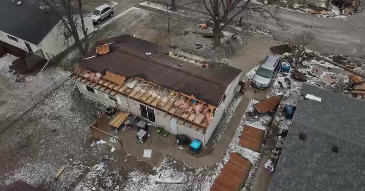
Wednesday's tornado outbreak, though, is likely the most violent weather event to occur in Massachusetts in many of our viewers' lifetimes. This is truly a once in a lifetime event, and lets hope that it is the last time in this life!
Why Did The Tornadoes Happen?
Many folks are wondering why this happened. What was different in the atmosphere yesterday compared with severe weather events in the past? The answer is not clear-cut.
Tornado outbreaks like Wednesday truly are not forecast-able. We can predict a likelihood of tornadoes based upon a diligent forecast, and there was a tornado watch issued just before 1 p.m. Wednesday, but many times there are no tornadoes after a watch is issued. Several factors have to line up perfectly for a severe weather outbreak like the one we experienced yesterday to occur. These are factors that are very rarely seen here in New England, more often in the Midwest.
WBZ-TV's Barry Burbank explains the tornadic outbreak and the E-F scale:
On a basic level, here is how things unfolded in the atmosphere:
A warm front came through the area during the early morning hours. Many of you may remember waking up or driving through some nasty downpours and hail around 9 a.m. These thunderstorms quickly raced offshore and very warm and humid air rushed in on southwest winds. The sun re-emerged and caused temperatures to rise sharply into the 80s, thus providing the spark the atmosphere needed.
At the same time, a cold front was rushing from northwest to southeast from New York State towards New England. This front represented a change in airmasses from the warm and humid over our area to a much drier and cooler Canadian airmass. This cold front provided the lift needed to create large thunderstorms.
A cold front is a wedge of cold, dense air…it literally cuts underneath the warm and moist air, forcing it to rise quickly up into the atmosphere. When warm air rises into cooler air, it condenses and forms clouds. When you have large amounts of very moist air rising very sharply, you get very large clouds (cumulonimbus) which become thunderstorms.
Wednesday's atmospheric conditions were ideal for all of these events to occur, but you still need more than that for tornadic supercells to form.
Three Key Factors
Gonna get a bit technical here, but there were at least three other factors in play that were crucial in turning these thunderstorms into deadly tornadoes.
1) The Lifted Index: This is a model forecasted number we look at as meteorologists during severe weather. Lifted Index is one of the most common ways to measure how unstable the atmosphere is. The value is obtained by computing the temperature that air near the ground would have if it were lifted to a higher level (around 18,000ft typically), and comparing THAT temperature to the actual temperature at that level. Negative values indicate instability…the more negative the number the more unstable the air. A typical severe weather day we may see LI's somewhere between -1 and -5, but on Wednesday, the LI was in the range of -8 to -10.
2) CAPE: This is another important meteorological term, which is short for Convective Available Potential Energy. Simply put, this is the measure of the amount of energy available in the atmosphere for convection (severe weather). CAPE is directly related to the maximum potential vertical speed within an updraft (in other words, how fast can the air rise within a thunderstorm); thus, higher values indicate greater potential for severe weather. Observed values in thunderstorm environments often may exceed 1,000 joules per kilogram (j/kg), and in extreme cases may exceed 5,000 j/kg. Wednesday's values approached 4,000 joules in Western Massachusetts.
3) Helicity: This is one more very important meteorological factor, especially with tornadic development. This one is perhaps the most difficult to explain. It is a measure of spin in the atmosphere and is measured by looking at a vertical wind profile of the atmosphere. The more wind shear you have (wind blowing at different speeds and directions in different layers of the atmosphere), the greater the rotation within a storm. Generally you are looking for a helicity number of 150 or greater for any type of significant rotation, and Wednesday's readings were between 200-300 in the bottom 3-km of the atmosphere.
So clearly, Wednesday was a day where just about everything lined up perfectly in the atmosphere, and we see the amazing and devastating results that can occur when this happens. It should serve as a reminder that while these events are rare, we should never take the threat of severe weather lightly and should always take the utmost precaution to protect our lives and the lives of those around us. Even the smallest of thunderstorms can be deadly.


