Maps show massive "heat dome" bringing excessive temperatures to the Northeast
BOSTON - The weather term of the week is "heat dome" as the Northeast anticipates record-setting temperatures from a heat wave over the next several days.
You won't find this one in the National Weather Service glossary. Any time there's a particularly rare or noteworthy weather event these days, there seems to be a need to label it with a fancy weather term ... think "bombogenesis," "polar vortex" or "snowmageddon."
What is a heat dome?
Typically, this is a term most used and heard in the southwestern United States during some of their more excessive heat waves. This week, the heat dome has moved to the East Coast.
So, what is a heat dome? This one is pretty simple.
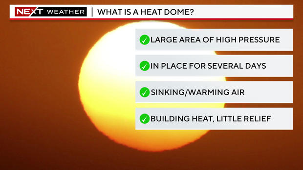
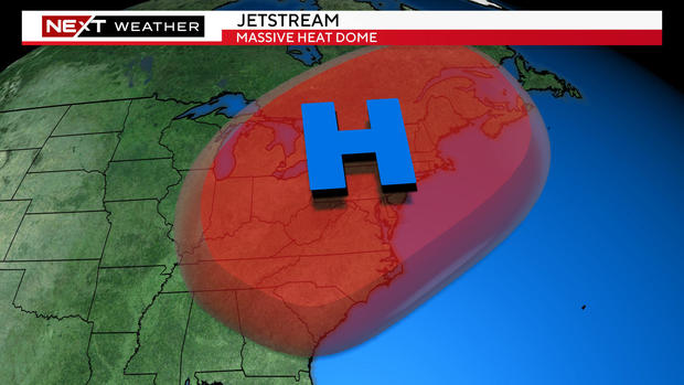
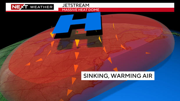
Essentially, all you need is a large area of high pressure (that big, blue H on the weather map) that is semi-stationary over several days during the warm season.
How does a heat dome form?
Picture a large dome in the atmosphere above the northeastern United States. It isn't something you can see, but the pressures at upper levels are much higher than what is typical or average.
Underneath this high-pressure dome (where we live), air is sinking from up above to the ground level. When air sinks, a few things occur.
- It creates a very stable atmosphere, meaning very few clouds and rain showers.
- It also compresses as it sinks, making it warmer and warmer. Warm air naturally rises, and as it rises, it hits the "dome" and then is forced downward again, further warming it.
- The airmass also often becomes very stagnant, thereby worsening air quality.
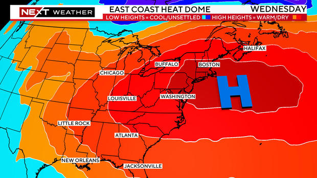
Heat dome will be right over New England
This will be our pattern for the next several days. The center and placement of this heat dome will be in the perfect location for some of the most excessive heat to be in the northeast, right over New England.
Peak conditions will occur Wednesday and Thursday.
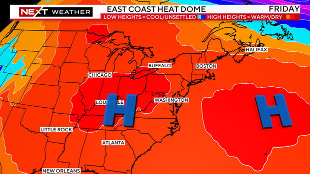
By Friday, the dome-pattern will begin to break down, splitting into two separate high-pressure centers.
This will be the beginning of the end of our heat wave, bringing some "cooler" temperatures and a risk of storms by Friday night and the weekend.
Stay with WBZ-TV, WBZ.com and CBS News Boston all week long for frequent updates on the heat wave.