Weekend Warm Up...Slow Moving Rain Tracks East
Plenty of clouds are locked in for the weekend...but southerly winds will be blowing in the feel of spring! High pressure cold off the coast help and early morning chill, but SW winds aloft are advecting warmer air into New England today. The inversion will likely help to prevent stronger winds from mixing down to the ground...but winds will start to pick up later today into tomorrow ahead of an approaching cold front. Drier weather near New Jersey, Long Island and just off the coast may help to punch a few holes through the overcast his afternoon, but the clouds will win the day this weekend...the dry weather will eventually be in retreat.
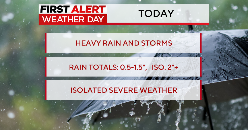
A boundary separating milder air surging up the Atlantic seaboard from the colder air diving down the Plains is the focus for heavy rain and thunderstorms today from the Ohio valley all the way down to the Gulf coast. High pressure off the coast is providing just enough stable sinking air to fight off most of the precipitation today...making for a pretty decent Saturday despite the clouds as temps will climb into the upper 40's and lwr 50's with a SSE wind at the surface. The dry weather will hold on into the evening...though a few showers may try to push into western New England. Some patchy fog or drizzle is possible overnight. Quiet night overall. Lows will bottom out near 40 around midnight and temps will start to rise towards dawn.
Though one batch of rain weakens tonight as it tries to push eastward...we have to watch energy coming out of the Gulf in the form of low pressure riding along a stationary front up into New England by the end of Sunday. I expect Sunday to start out dry in Eastern MA...but rain will begin to spread into western New England during the morning. By afternoon the heavier of the rain will be filling in across VT, Western MA, and CT. Showers will be spreading east towards the coast. The weekend looks entirely dry on Cape Cod! By evening with the Low and slow moving cold front tracking across the region, heavy rain with a few embedded thunderstorms moving through early Monday morning will be likely.
About .50-2" of rain is expected with the heaviest of the rain likely in Northern and western New England. Snow depth across the north is about 20-30" of snow on the ground with Ice on the rivers 1-3 feet thick. The snow will absorb the rain...simply adding to the flood potential down the road. The ice is too thick right now to cause any ice jam flooding. In the South, significant snow melt will occur all weekend. There is still about 12-18" of snow on the ground in Worcester county west. Part of this water will be released this weekend...along with a period of heavy rain...this could help to create some minor stream and small river flooding...as well as urban and poor drainage flooding...for a time Monday morning. 2-3" of rain is needed in 6 hours to create flash flooding...we are likely going to fall just below that threshold...but still there could be some rapid rises with many area streams already running high.
As the low pulls away Monday afternoon, colder air will move in with NW winds. We will likely see a brief change over to a light wintry mix before it all ends. Best chance of light accumulating snow showers will be in the NW hills...may be a brief mix with sleet towards the coast. Colder more seasonal air will follow in with building high pressure from Canada for the midweek with temps in the Upper 30's and Lwr 40's.
A next storm system will track from the Plains through the Great lakes and well est of New England. This will bring warmer air up the coast again for any early mix Thursday to change to a plain steady rain for the afternoon. Drier weather will return for the weekend of march 12th. After another cool start, as temps will be warming again...before another front moves through Sunday to cool it down again for Monday the 14th.
So the trend is very typical March weather. Very Typical for a La Nina pattern as numerous waves ride a boundary separating cold from Canada and the building warmth coming out of the Gulf. What is also typical of La Nina is some late season wintry weather which can last into April. I see a lot of quiet weather from the 14th and beyond. But what lies ahead towards the end of March is a bit more uncertain.
The NAO has been positive the past few weeks, and is starting to trend down...but does not show any signs of turning negative in the immediate future. In fact, it hovers in the neutral through the forseeable future...which should keep the pattern as is...with little snow for now.
Lately we have been seeing more ridging over the east and a trough out west. This pattern will likely change before the winter is all over. We have to watch for a trough building near Japan...for 10 days later, troughs tend to form over the northeast...If this along with a slightly negative NAO develop...we just may see a more wintry pattern to end the month with a trough over the northeast giving one more parting prize to this winter. It is possible...but hard to say right now...I am leaning towards that, but all signs are pointing to us slowly tip toeing through March with hopefully no major flooding problems for now. It is a fast active progressive pattern which will keep storms moving. The Problems are started when we find ourselves in a blocking pattern and storms stall...making for inches and inches of rain spring flooding. This could be April's story.
