Weekend Changes...
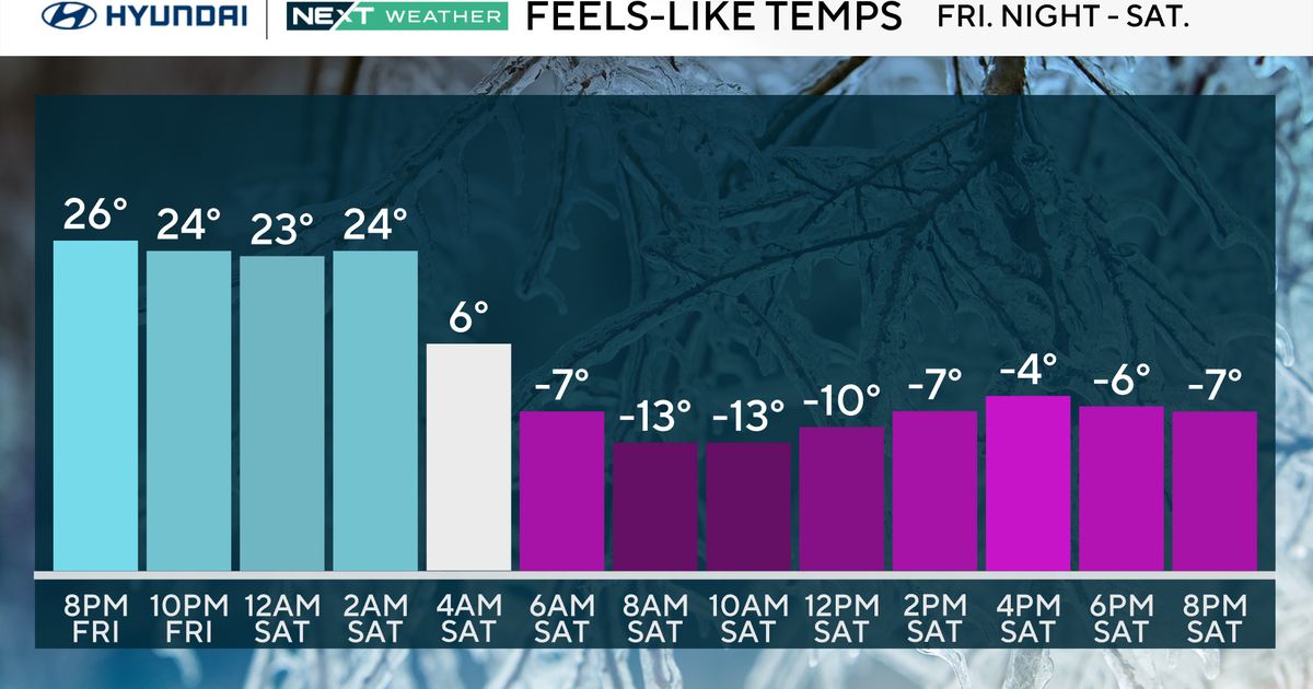
A coldfront is working through Northern New England...it is triggering numerous snow showers and squalls and the mountains will pick up several inches tonight. As the front works south into Southern New England, snow will dry up but clouds will still thicken. The front will settle just south of us tomorrow leaving us on the colder side. With a forecasted high of 34 degrees in Boston, tomorrow will be the coldest day since last February...it will feel like a mid-Winter day with very little sun and a light northerly breeze.
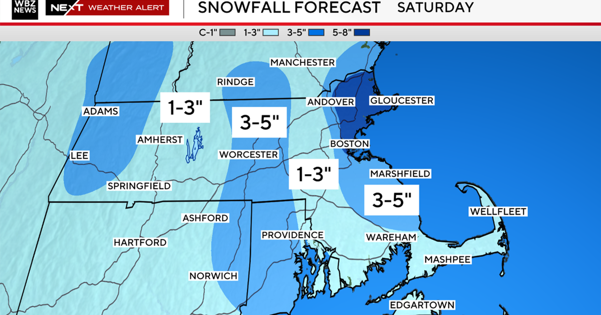
The cold air will be firmly in place at the surface Friday night and Saturday...at the same time, warmer air will be riding up and over it aloft. We call this overrunning and precip will be produced as a result. Temps will be cold enough throughout the column for most of it to fall as light snow and flurries but close to the coast, milder air may flow in mixing in some rain or maybe changing it completely over. Amounts will be paltry but coatings could accumulate on the grass especially away from the coast and in elevated areas on Saturday.
The surface warm air will trail the warm air aloft by several hours but it will arrive in time for Sunday. The sun will bust out and temps will jump into the 50s during the afternoon...day one of the thaw. A ridge of high pressure will park itself off the East Coast through the middle of next week, SW flow will continually pump in warmth through next Wednesday. Maximizing temps this time of year is tough due to the shorter daylight and lower sun angle but 60 degrees is not out of the question during this stretch. A coldfront will slice through New England on Wednesday with some rain showers and usher in cooler air for the second half of next week.


