Morning Snow Just Enough To Cause Traffic Issues
BOSTON (CBS) - By most hearty New Englanders standards this winter has been pretty wimpy.
Just 3.8 inches of snow has fallen in Boston thus far, more than a foot less than the average to date. This does, however, represent an increase in snow production from last winter, when we only had 1.5 inches of snow by now.
Check: Interactive Radar | Current Conditions | Weather Blogs
There is now good news for snow lovers - we will be adding to those low snow totals on Wednesday.
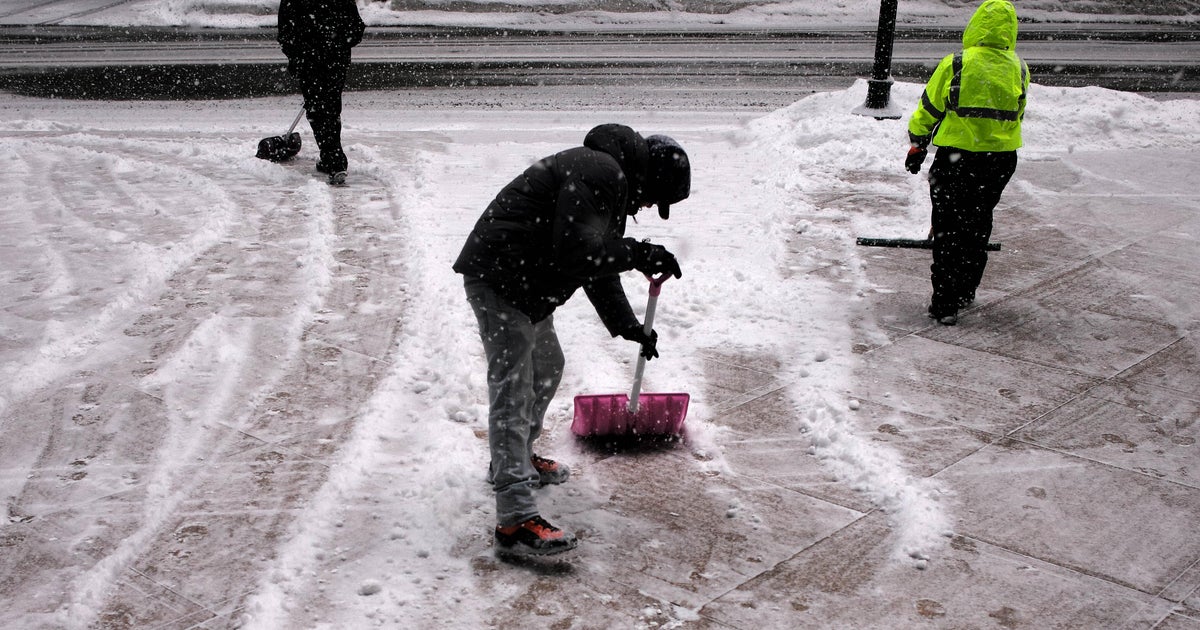
It's not a Nor'easter or a powerful ocean storm, but it will be just enough to cause some traffic issues and bring some much needed revenue to those hungry snow plow drivers.
TIMELINE
The snow will break out in extreme southern New England just after midnight.
It will start as rain over Cape Cod and stay that way for the entire duration of the storm.
The snow will move steadily northward and reach the Mass Pike and Boston between 3 and 5 a.m.
By 6-to-7 a.m. it should be snowing just about everywhere with a rain-snow mix along the immediate coastline.
Snow will continue moderately all morning and the rain-snow line will creep north and west as well.
By midday, it will be mainly rain in Boston, southeastern Massachusetts and along the coast with snow to the north and west.
That rain-snow line may reach as far northwest as Interstate 495 during the afternoon and at the same time the precipitation will be coming to an end. By the evening commute, there will just be a few drops and flakes leftover.
ACCUMULATION
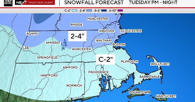
Snow amounts will average about 2-to-4 inches for most communities.
The exception will be along the immediate coastline, including Boston where 1-to-2 inches of wet, slushy slop will be left.
There will be little to no accumulation in extreme southeastern Massachusetts and over Cape Cod and the Islands.
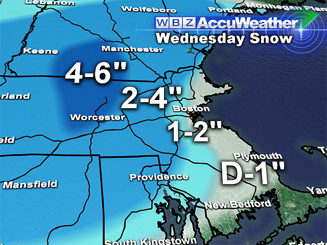
As for a snow "jackpot," it will likely be somewhere in Worcester County, in the elevated hills where as much as 5 or 6 inches could happen in places like Leicester, Gardner, Fitchburg or even over the New Hampshire border.
Thereafter, no big storms in sight, just a series of Arctic cold fronts bringing several rounds of frigid air down from Canada, lasting well into next week.
Winter is back, and it looks like it is here to stay this time!
You can follow Terry on Twitter at @TerryWBZ.
