Weather Up Through The Great Boston Marathon
Following Tuesday's passage of a ribbon of rain yielding a few tenths of an inch, a sprawling high pressure system will control our weather for the next several days. It is a stretch of easy forecasting for a change after the veritable potpourri of recent weeks.
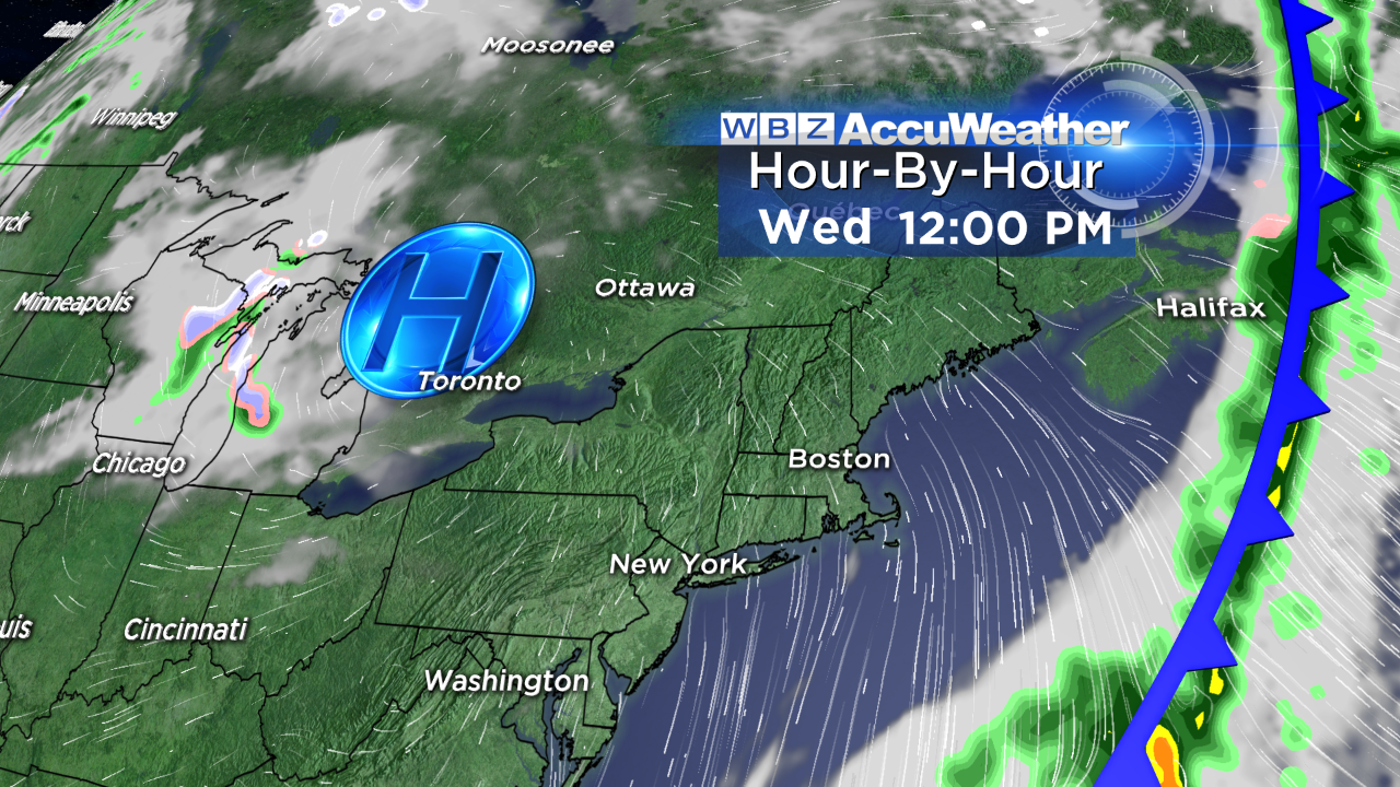
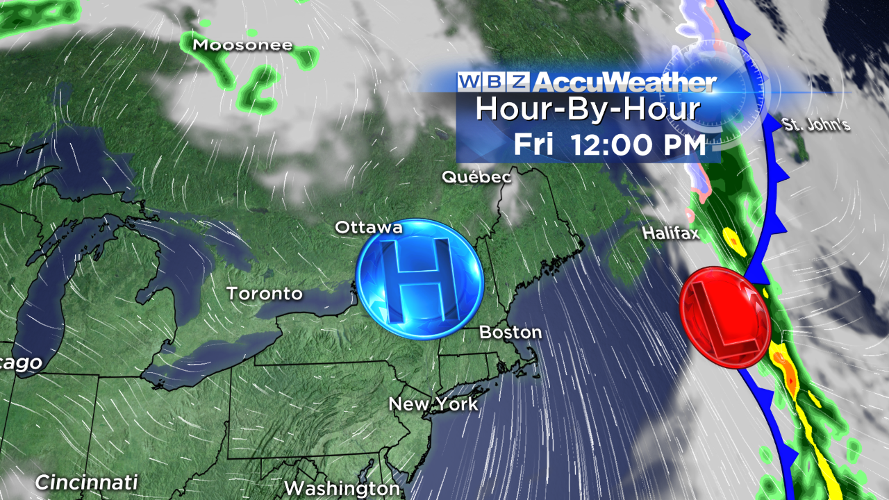
There will be only subtle changes from day-to-day through Saturday!
You will notice an increase in the wind from today's easterly breeze at 5-15 mph to a northeasterly wind at 15-30 mph tomorrow and Friday. The strongest wind will blow over Cape Cod and southern Plymouth County with lighter wind farther inland. Due to this onshore wind, the coastal plain will be chilled by the wind on those two days with temperatures not exceeding the middle 40s while much farther inland it warms to the lower to middle 50s. As the ridge of high pressure becomes more poised over the region on Saturday, the wind will relax in the afternoon.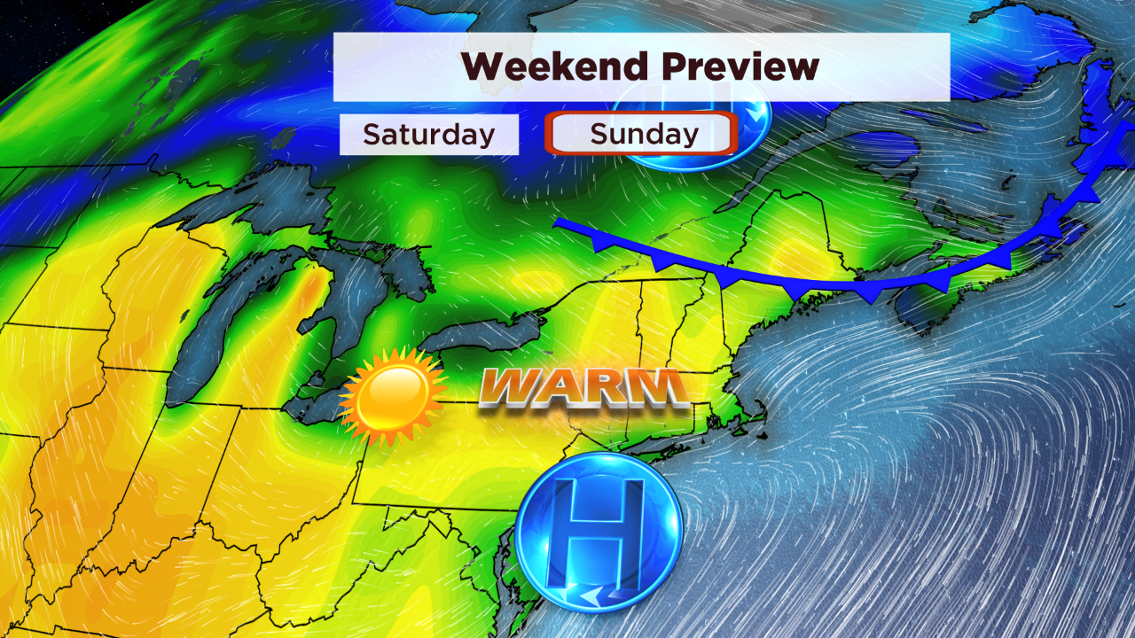
As the ridge shifts to the south of New England, the resultant clockwise flow will produce a west to southwesterly wind at 10-20 mph on Sunday. This is a breeze blowing from the warming land to the ocean so temperatures of 70-75 are likely even at the east-facing beaches on that day. The southwesterly component will keep the South Coast & Cape Cod area cooler in the 50s. We'll be watching that "backdoor" front shifting southward across ME. It will likely back down into coastal MA by Monday morning. 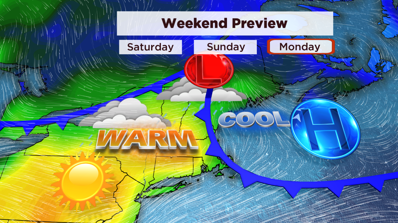
So the dilemma emerges on, you guessed it, Marathon Monday. Why can't it be as clear-cut as the next 5 days? At six days out, there is uncertainty in how it will shake out. Presently, it appears that the coastal front will result in an onshore breeze near the coast. That might be kicked out, however, if the low pressure system crossing northern ME intensifies. This will switch the surface wind to southwesterly ahead of the approaching cold front sinking south from northern New England. It's all about timing because if that front accelerates, it could be down in our area with attendant showers and temperatures in the 40s with a cold ocean wind on Monday. Some guidance is depicting that solution but more reliable data is delaying the arrival until late afternoon or evening.
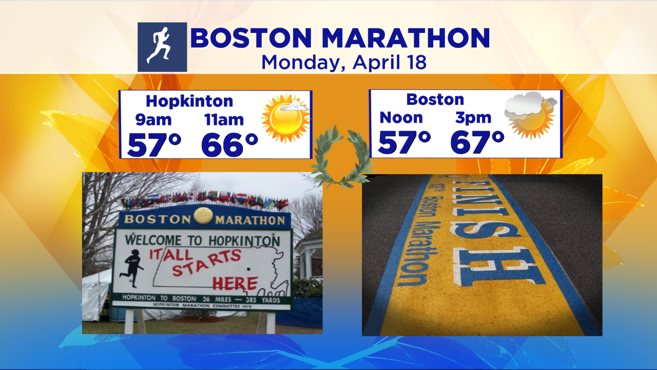
Based upon all of that, my current preliminary prediction calls for the temperature in Hopkinton to be in the upper 50s around 9am and middle 60s by 11am. As the runners proceed toward Boston, the temperatures will be rising to the lower to middle 70s. Within a few miles of Boston, the temperature is not highly confident at this time and it all is a function of the wind direction. Right now, I think the odds are the wind shifts enabling the warm air west of the city to flow to the coastline. Plus, I'll be optimistic and hold off the showers until late in the day.
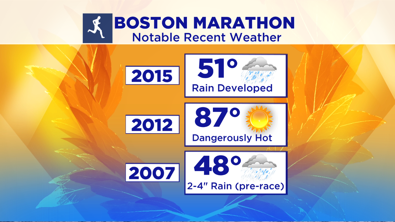
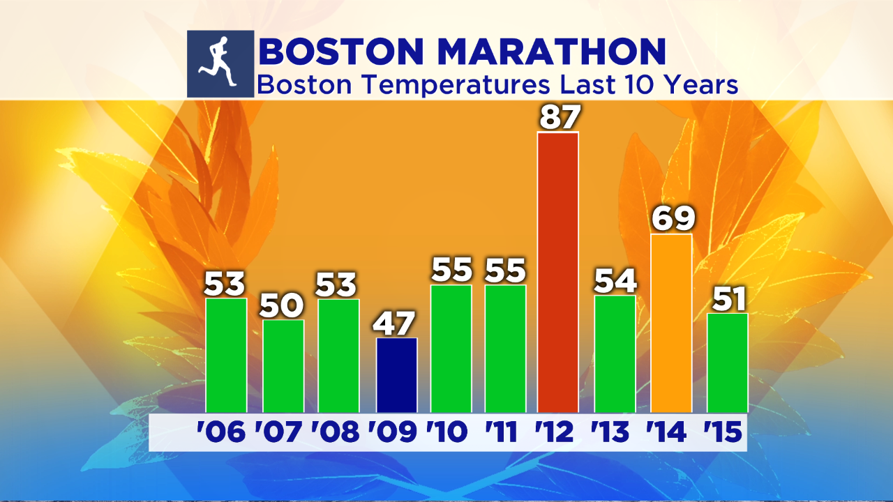
If all goes well, the Boston Marathon weather will be much more pleasant than last year's cold rain in the 40s! It may be closer to what happened two years ago in 2014. There will NOT be any snow as in 1967 when snow squalls occurred for the first 5 miles of the race. Heat and high humidity impacted the runners in 1905, 1909, 1915, 1927, 1931, 1952, 1958, 1976, 1987, 2004 and 2012. The so-called "Run For The Hoses" 1976 Boston Marathon took place in extreme heat with temperatures near 100 degrees in Metro West but a developing sea breeze saved the runners on the approach to Boston as the temperature dropped 20-30 degrees! In 1939, the first part of the race was unusually dark because of a rain storm plus a partial eclipse of the sun. In 2010, the eruption of a volcano in southern Iceland interrupted European travel for many weeks. Consequently, hundreds of Boston Marathon entrants could not make the trip!
GOOD LUCK to all of the runners in the 2016 Boston Marathon!
