Weather Forecast: Continued Coastal Flooding Likely From June Nor'easter
BOSTON (CBS) - This just ain't right! Bring back March!
Remember those warm, dry and sunny March days we had? And remember wondering if we were going to pay for it at some point? Well, it is payback time, and there's nothing like a good ol' June Nor'easter to dampen the spirits!
There is a major traffic jam going on and unfortunately it is not on the roads filled with people trying to get to the beach, it is in our atmosphere. A blocking pattern has set up, something we normally see in winter or early spring. So now, a large block is now in place over Greenland and the North Atlantic and it is shunting cold and stormy weather right into our backyard.
Check: Current Conditions | Weather Map Center | Interactive Radar
What we are experiencing Monday and really for the next few days is truly a June Nor'easter.
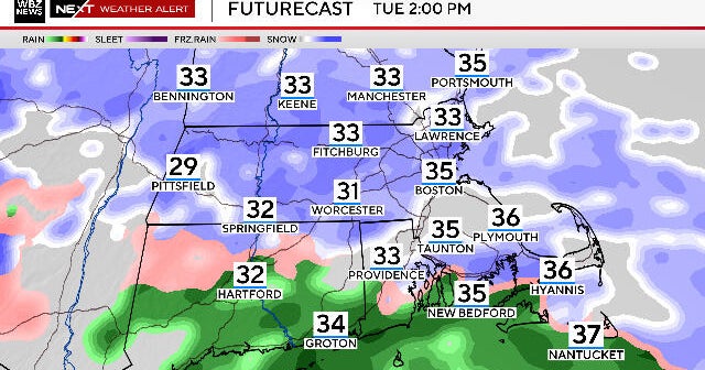
We have persistent onshore winds out of the northeast, causing minor to moderate coastal flooding, periods of rain, some heavy, and major flooding up in parts of Maine, where they have received upwards of 7" of rain in the last few days.
This blocking pattern will ensure that our cool and damp weather will not be going anywhere fast. In fact, we are not likely to see even a glimpse of sunshine until Wednesday and even then, temperatures will stay below normal and showers will remain scattered in the region.
By late week and this weekend, we will gradually see more and more sunshine again and get temperatures back where they should be, although a shower threat will still exist each day.
COASTAL FLOODING
Of immediate concern is the coastal flood threat. Tides are astronomically very high, the highest of the entire month right now, thanks to a full "strawberry" moon. Couple that with a strong, gusty and persistent onshore wind and you have the perfect recipe for coastal flooding.
Many of the flood prone areas have already had issues Sunday night and again Monday. If you had flooding problems Sunday night, get ready, because it is going to happen again Monday night.
Tides will peak Monday night just before midnight and therefore, the National Weather Service has issued a Coastal Flood Warning for the entire East Coast of Massachusetts (and all coastal areas of New England for that matter). Coastal residents need to prepare for significant flooding from 10 p.m. Monday night to 2 a.m. Tuesday.
We are expecting inundation of low lying areas and roads along the coastline and a good deal of beach erosion as well. Beach erosion is expected to be especially problematic along the east facing ocean side of Cape Cod, where seas have risen to nearly 10 feet.
Tides will remain high, only slowly receding for the next few days, so additional watches and warnings may be issued on Tuesday and Wednesday.
So hang in there, summer is just around the corner. We hope…
You can follow Terry on Twitter at @TerryWBZ.
