Weak, Fast-Moving Systems
A 'Clipper-like' system is moving through this morning, which is inducing a few light rain and snow showers. Skies will become mostly sunny afterwards. West-northwest winds will be gusting up to 30 miles per hour. High temperatures will be in the 35-40F degree range.
A warm front will be lifting northward tonight which will bring us our next light batch of snow after midnight through mid-morning. Areas north and west of Boston have to best chance of receiving a coating to 1" of snow by Tuesday morning's commute. Then, the warm front moves towards the Maine/NH border. A bulk of cloud cover will stick near ther region with more sunshine the farther south that you reside. Consequently, warm air advection will be responsible for mild temperatures that will be around for Tuesday and Wednesday. Highs on Tuesday will be in the upper 30s for southern NH to the lower 40s for Boston to the middle 40s for the Cape/Islands. Then, Wednesday will be partly sunny with highs in the lower 50s. Once the afternoon arrives, showers will develop ahead of a cold front that will sweep through Wednesday evening.
Thursday (Groundhog Day) will be slightly cooler behind the cold front as highs reach the lower 40s. The same cold front that will sweep through Wednesday night will stall to our east. Another surface low will develop along the front and bring us more snow showers Thursday evening through Friday morning. Friday will return to highs in the 30s.
The weekend is setting up to be uneventful. The latest GFSx and EURO models show a a dry Saturday while there will be a chance of snow showers on Sunday due to a low pressure system diving south on Sunday evening. Temperatures will be in the 30s on both days.
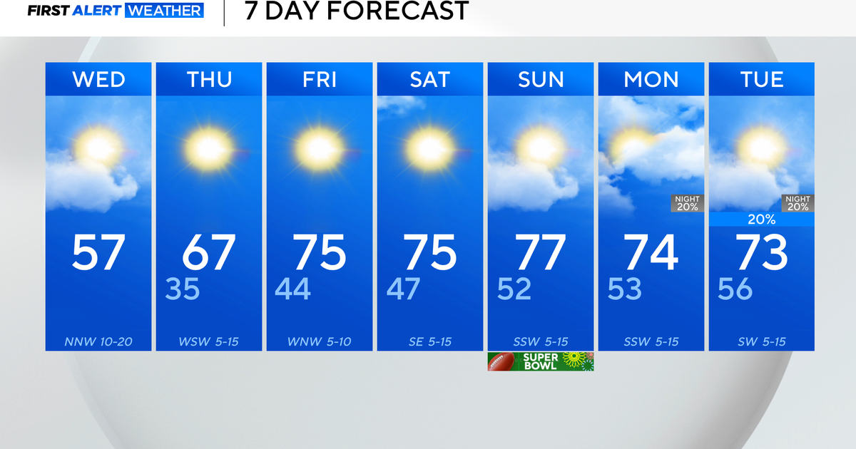
The forecast for Superbowl Sunday in Indy is...partly sunny with a slight chance of a few snow showers...highs in the upper 30s.
~Melissa :)


