Storm could bring several inches of rain, high winds to Boston area
By Terry Eliasen, Meteorologist, WBZ-TV Exec. Weather Producer
BOSTON - The WBZ Weather Team is issuing a NEXT Weather Alert, as it is going to be a very wet and windy Thursday night.
It has been a while since we had a widespread wind storm in our area. And, while Thursday night is sort of a borderline wind advisory-type event, we still expect there to be lots of leaves and limbs scattered about come early Friday morning.
TIMELINE:
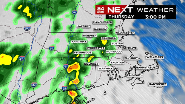
Most of the day Thursday will be dry with just some scattered showers here and there through about 5 p.m. We will start to see rain coverage increasing to our west by late afternoon.
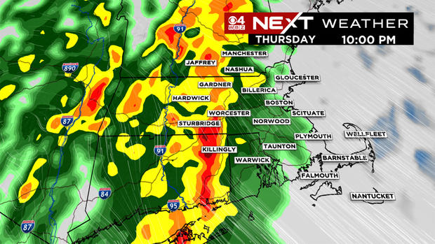
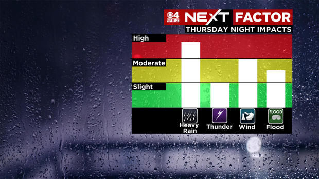
As the front approaches Thursday night, the rain will become heavy in central and western Mass. Rainfall rates of an inch an hour are possible at times, making travel in the Worcester area a bit tricky. This will lead to some localized flooding on roadways as well. In eastern Mass., we expect periods of rain later Thursday evening but will likely have to wait until after midnight for the heavy stuff to push eastward.
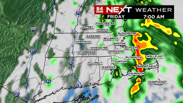
By early Friday morning, the front will crawl eastward and be in the vicinity of the coastline. The rain will essentially be over in central Mass. and the heavy downpours will largely be over southeastern areas, including the Cape and Islands. Heaviest rain in the Boston area comes sometime between 1 a.m. to 6 a.m.
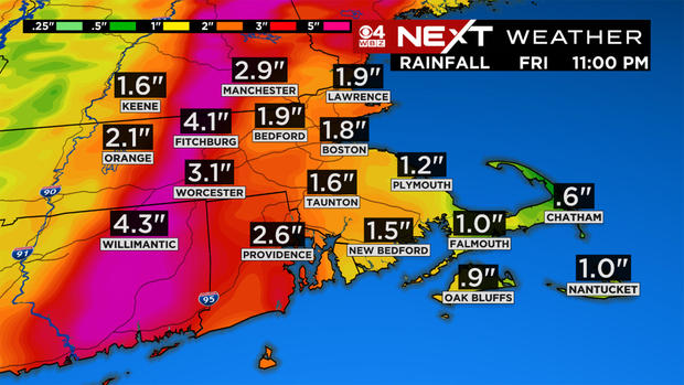
Rainfall totals will be quite hefty in areas where the front gets hung up. Right now, it appears that the heaviest totals may be located in parts of Worcester County with some models showing as much as 4-5" of water overnight.
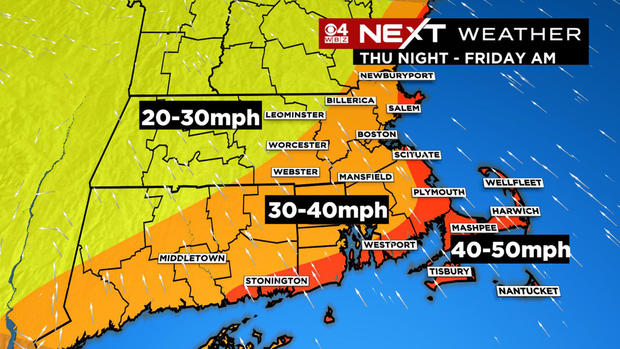
The rain won't be the only concern Thursday night. Southeast winds will gust 30-50 mph for much of the area for several hours overnight. In fact, we could see gusts over 40 mph over portions of the Cape and Islands.
Timing of the strongest winds. . . mainly between midnight and about 6 a.m.
There is also a slight risk of a few embedded thunderstorms, however the severe weather risk remains low.
We will certainly see lots of leaves flying around come Friday morning. Be sure to clear your storm drains and take caution driving over wet leaves on the roadways. It is unfortunate that this wind event is coming right in the peak of the fall foliage season. It won't be enough to completely strip the trees bare, but I would guess 10-20% of leaves will come down in many areas.
Some good news. . . we have another great weekend ahead! A great time for a road trip as the color will be peaking in many areas of New England.
