Warm, Hazy, Humid Weekend Ends With T'Storms
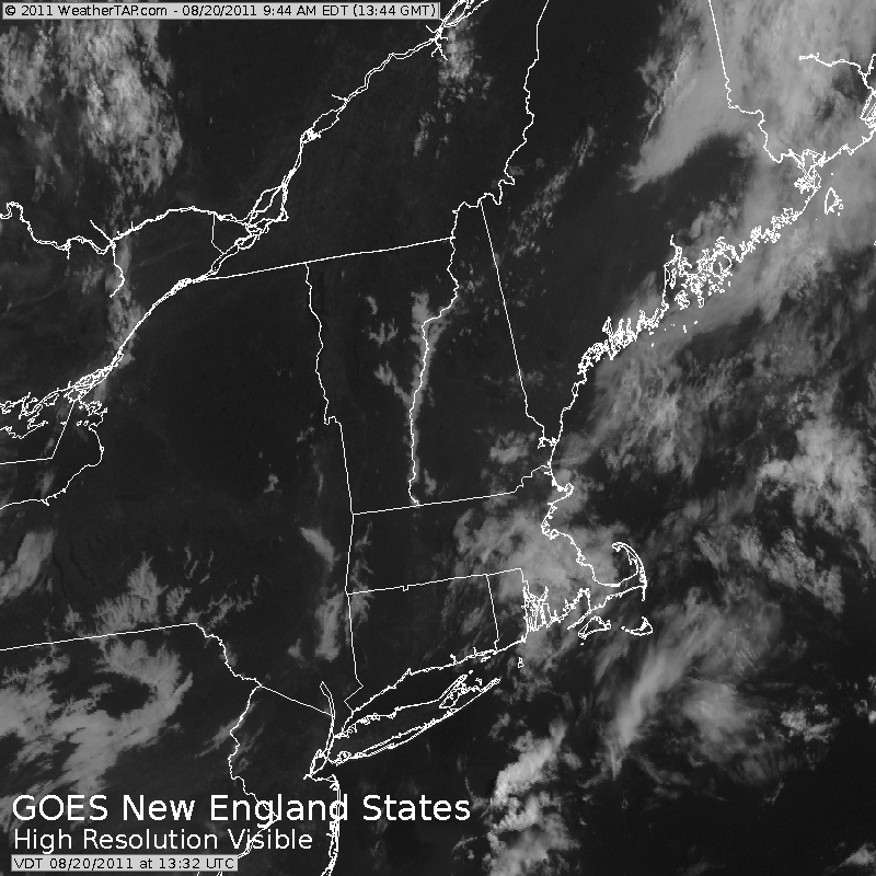
A deck of low and mid level pressure is pushing through eastern Mass. this morning along with an upper trough pushing off the coast.
Check: Interactive Radar | Current Conditions | Weather Map Center
These clouds are along with a stalled front which could act as a trigger for a few isolated showers or storms to form this PM with a thinning overcast and warming temps.
Watch Joe's forecast:
A seabreeze may try to shift in SE winds which may be just enough to fire up the convection. The National Weather Service has the region in a 15-20% chance of storms, so the risk is low...but do not be surprised for a few hit or miss downpours once after 2 PM...
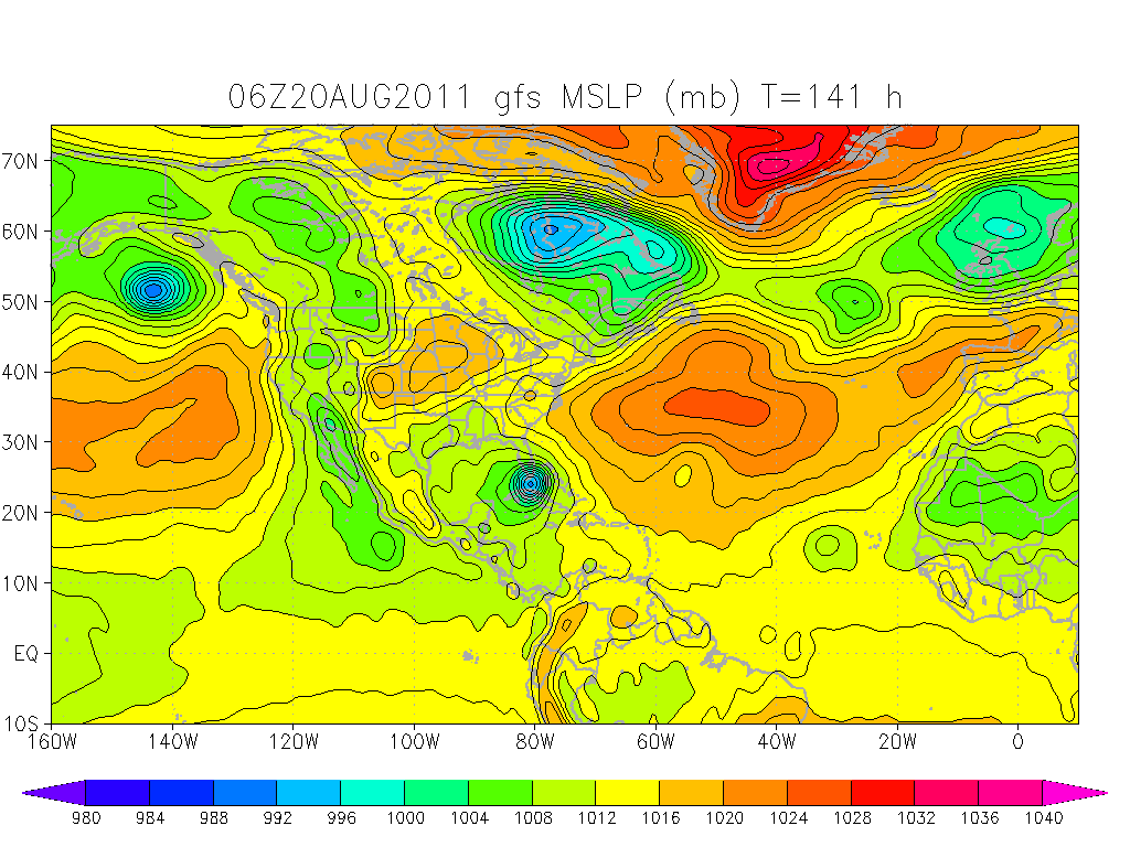
High pressure to our south is wrapping in warm humid light SW winds and providing enough dry sinking air that much of the weekend will remain dry... but humid with highs in the mid-upper 80's... near 80 on the Cape.
As the high pulls off the coast Sunday, a better chance for more widespread scattered storms will develop late tomorrow in the west. A cold front moving in from the Great Lakes, along with a vigorous trough, with stronger upper level winds, will help to form a line of storms which will track from west to east late Sunday... pushing into western New England by mid afternoon... and shifting east for the evening.
Thanks to stronger shearing winds aloft, daytime heating with low level moisture, the best chance of strong/ severe storms pushing through will be Sunday night in the form of a squall line delivering a period of gusty winds, hail and heavy rain.
Any showers should be winding down in the early morning hours of Monday as the front pushes off the coast. High pressure builds in from the west providing cooler, less humid air which will begin to push in Monday. A cool pool of air aloft could help to form afternoon cumulus with cooler temps in the 70's and lower 80's. The drier air will push in and hold for Tuesday and Wednesday with beautiful weather in the 70's and lower 80's.
Tropical Update:
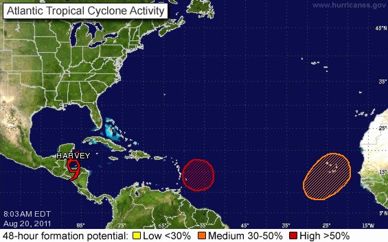
Tropical Storm Harvey has been getting stronger. Currently 60 mph sustained winds and could make landfall later today along the coast of Belize with winds to 70 mph... bring hurricane force conditions. The main problem will be the rain. Upto 6-10" of rain will fall over very hilly terrain which could mean deadly mudslides for some communities near Guatemala.
We are watching two other waves. The first is 400 miles off the coast of the Windward islands. The National Hurricane Center gives this tropical wave an 80% chance of developing into a tropical cyclone.
It is too early to really know where this could end up going, but the Euro and GFS both track this storm near Hispanola, Cuba, then direct it towards the southern tip of Florida as a hurricane.
Again, nothing is ceratin this far out. It is a storm which will likely become Irene. It is a storm which will likely become our first hurricane of the season. It is a storm which is showing signs of having an impact along the coast of the United States. All could easily change this far out.
