Warm and Muggy through Midweek
Can you feel it? The excitement in the air that summer has arrived. I do not know where spring went, but who cares! The feel of summer is here and everyone is getting busy living this weekend from BBQ's to beaches to parades. LOVE IT! This weekend is a celebration of life and our freedoms.
As the clouds and fog roll back into tonight, Sunday will start in similar fashion with low clouds. Clouds will give way to partly sunny skies again. The backdoor front will have washed out over us...as SW winds will prevail at the surface for most locations. This will make for a warmer more humid day all around. Places on the cooler side today...SNH and NE MA with be near the peak of the heat tomorrow...from 60's to 80s. Highs will hold in the Lwr to mid 80's tomorrow with 70's at the south coast and Cape & Islands. A front will remain stalled well west of the region which could remain the focus for afternoon convection. Slight chance of and afternoon t'storm in Northern and western New England.
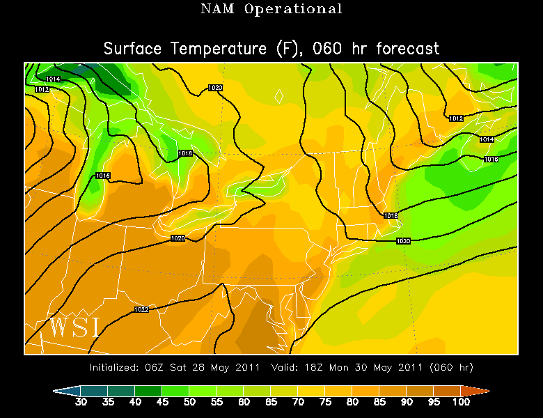
Cold front is on the move for Memorial Day. After the morning fog burns off..temps will quickly be on the rise. This will be the hot day as 850mb temps climb to 16-18 C. As this air mixes down to the ground, temps will be climbing into the upper 80's and Lwr 90's
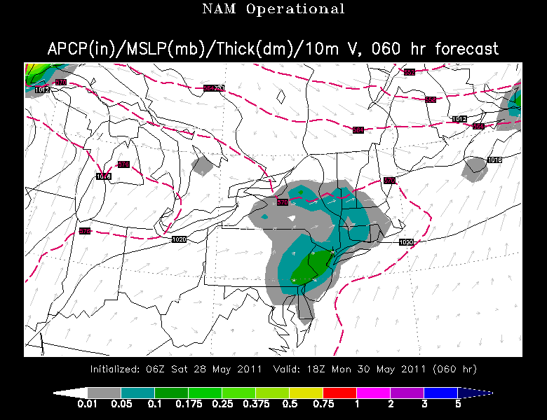
With the passage of a cold front during the afternoon, with heat and humidity in place, there is the potential for this front to touch off a few scattered storms. There does not appear to be alot of lift in the atmosphere or instability, but with strong surface heating and low level moisture it will not take much to trigger convection...The best chance will be in Southern New England.
An upper level ridge builds behind the front..which will be settling south as high pressure builds in from Canada. Cooler winds out of the ENE wrapping around the high will cool the coast into the 70's, with 80's holding on further inland in the sunshine.
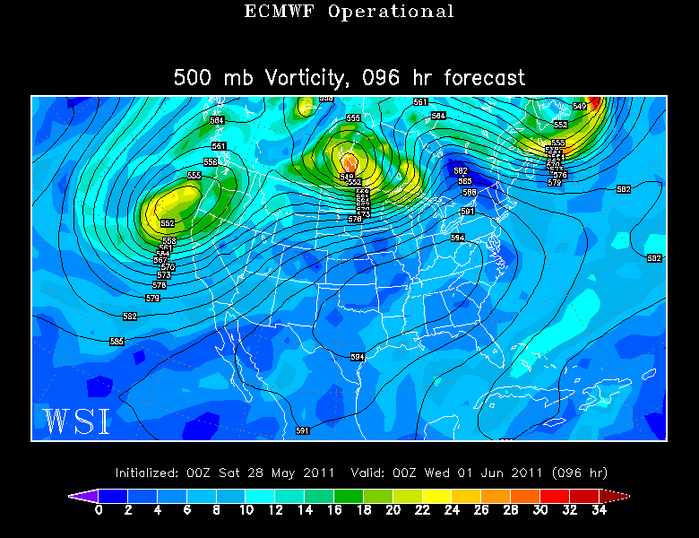
As the high shifts offshore, winds will be back to the SW to bring in warmer more humid air for Wednesday as temps should be able to shoot right back up into the 80's to near 90. Another cold front will approach by the end of the day. This will have more upper level support for stronger storms to form late thanks to a shortwave pushing through. T'storms will be likely from the mid afternoon and early evening.
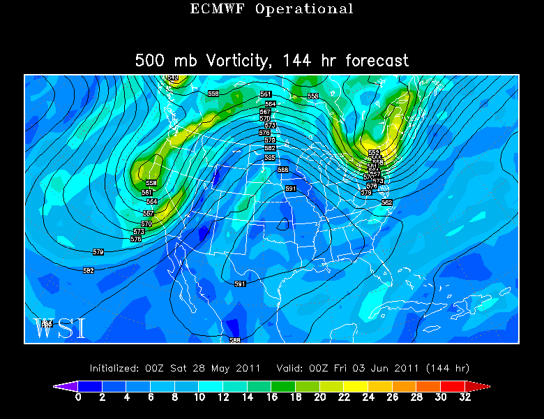
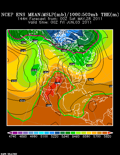
Check out the upper level winds digging in a trough across the northeast to end the week Thursday-Friday. Though this may look ominous, this will be nothing but beautiful sunny dry, cooler air with high pressure at the surface with day time temps near 70 by Friday and low humidity. Aaaah.
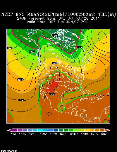
An upper level ridge will start to shift east by next weekend with warming temps...but the trough is likely to return to the northeast in the June 7-8th timeframe preventing any big warm up like we are experiencing now. This will help to keep temps just about right for all of our liking. Great to summer's triumphant to New England! It's like seeing a long lost friend...we all have some catching up to do!
Finally, we remember what this Memorial day weekend is all about. The countless men and women who made the ultimate sacrifice for this country by giving their lives fighting to protect our freedoms which we enjoy today. Those who fight and serve for our military are true patriots. Their courage and strength are beyond compare. It is heartbreaking to see how man soldiers have died over the course of history and how tragic and ugly war is. Arlington cemetery remains a place I need to go to someday to really understand. We have lost so many great soldiers in these recent wars. Our hearts go out to their families. What amazing people. Their service is recognized in this fullest honor this weekend.
