Tracking Storms...Severe & Tropical
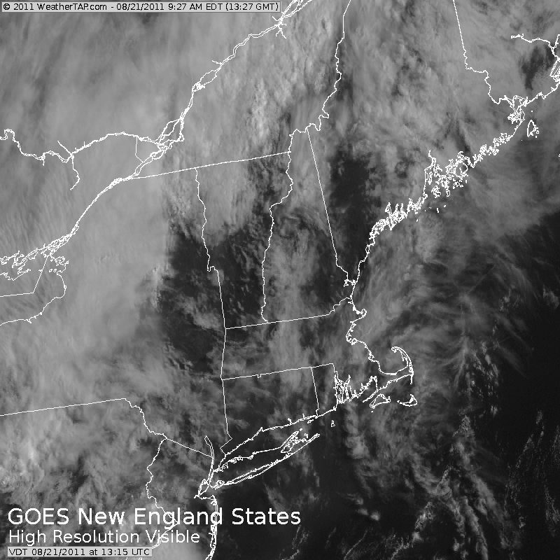
It is a hazy humid mix of sunshine and clouds today. SW winds will help to keeps temps warm in the Mid 80's for most, cooler on the Cape. This will be another pretty good beach day, despite the haze...it will be dry and warm.
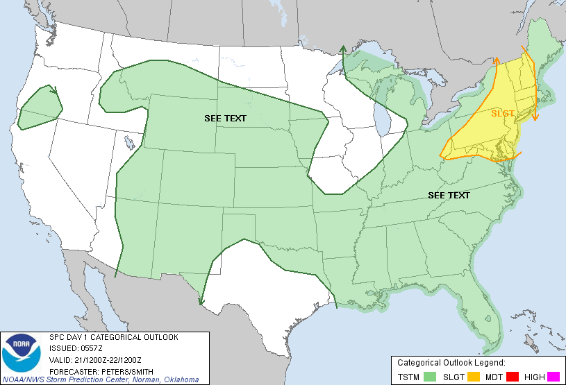
A cold front is on the move. Scattered storms have been forming in New York state and these will be pushing into western New England during the afternoon . The Severe storms prediction center has been busy analyzing the severe thunderstorm threat across the region and have much of New England, excluding the coast in a slight risk for severe storms.
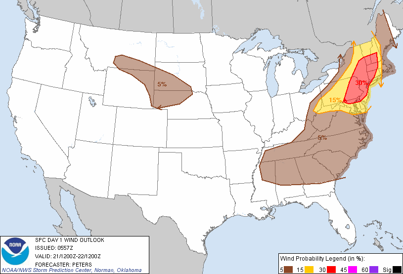
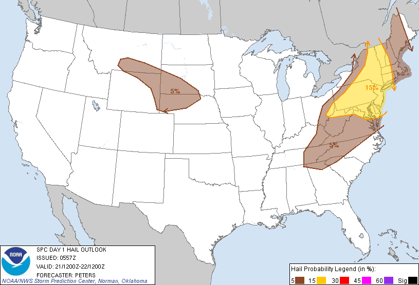
In these storms, there will be the potential for damaging winds and hail. The greatest risk of this will be in central and western new England where the SPC has us in 15% chance in these areas with less of a chance for damaging severe storms towards the coast.
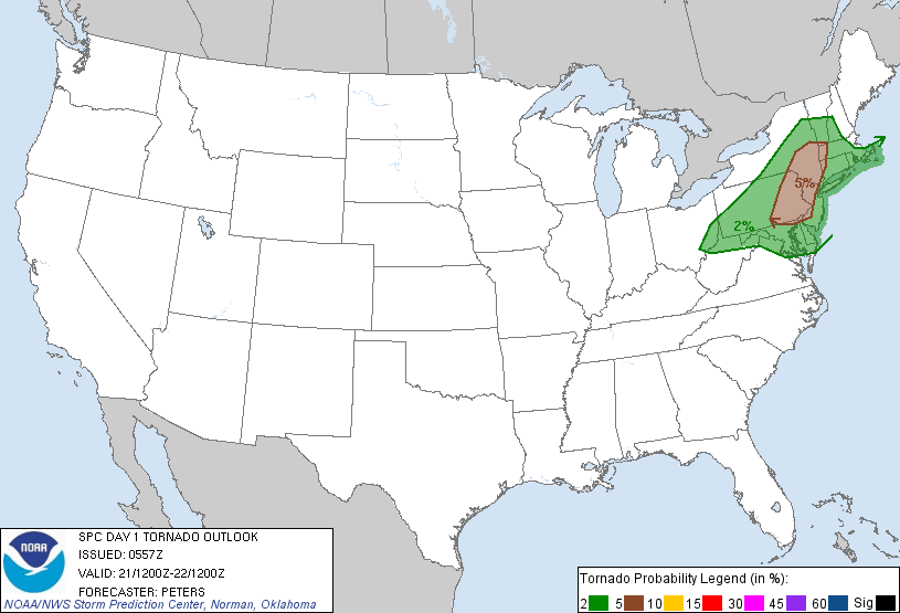
The warm humid airmass will give fuel to the storms as they move east, but the stronger upper level winds from the SW thanks to a vigorous trough digging in, will create strong updrafts and the potential for rotating storms which may trigger and isolated tornado. Again, the best chance of this will be in western New England, SE NY and NE PA. I think the greatest threat of tornadoes is in PA today...but we will watch how this all develops.
Deep low level moisture along with this increased lift in the atmosphere should create storms loaded with rain as precipitable water levels across the Northeast are upto 1-1.5" which will help to deposit some heavy rain when the storms move through. These storms will start to gather west during the mid-afternoon, but the cold front will still be far enough west to keep the coast mainly dry through the daylight hours.
The cold front will begin it's push tonight. Storms in the west will be pushing eastward during the evening. By Midnight, more widespread showers and storms will be finally pushing through Worcester county and heading into eastern MA for some early morning downpours and thunder. Without the energy of the sun, it will be hard for the storms to maintain their severity, but heavy rain and gusty winds are likely with passage of this front.
The cold front will be off the coast Monday morning with drier, less humid air moving in from west to east along with slightly cooler temps. Cooler air will also be moving in aloft, so building cumulus are likely during the afternoon. Temps in the 70's and Lwr 80's
High pressure and low humidity for Tuesday and Wednesday, gorgeous sunshine in the 70's Tues, a bit warmer Wednesday...80-85
Thursday will be in the mid 80's with increased humidity ahead of an approaching cold front which could give a late shower or thunderstorm. Behind that...more high pressure for a good start to the weekend. After that...all bets are off as we will then have to see what is coming out of the tropics and what this means for our weather for final week of August.
Tropical Update:
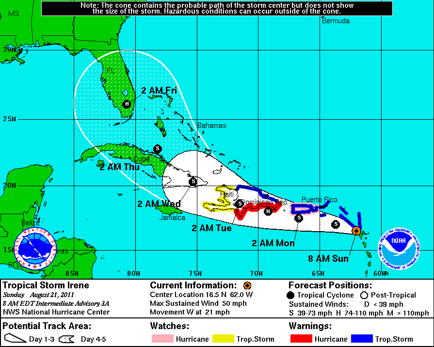
As you know, we now have Tropical storm Irene with 50 mph sustained winds. This storm is moving into a favorable environment for strengthening and will likely become a hurricane and possible a powerful storm. We will have to see how this storm reacts as it tracks near the islands of Puerto Rico, Hispanola and Cuba. The upper level ridge is expected to weaken just enough to allow a turn to the NW which will start the storm on a turn to Florida and a re-energizing of the storm. Models are showing more consistency in it's track with quite a few showing a powerful hurricane slamming into southern Florida. It also could hug the east coast of FLA and move further up the coast towards Georgia or the Carolinas. Places like Miami and Cape Canaveral should be on guard. It is still very early for any certainty...but the point is...there is a threat for a strong hurricane to impact the US coastline later this week. Where ever this storm hits it likely pack a serious punch. No landfalling storms in the past 2 years has officials worried about storm complacency and lack of preparation. We will have to track the heavy rain from the storm that will likely push up the coast from this storm during the week of the 28-30th of August.
