Tracking Cold...
The cold will be on the move over the next week...sometimes toward us and sometimes away from us...but one thing is for sure, a taste of true Winter cold will be felt by the weekend.
Today was another early Spring-like day with a high of 46 degrees in Boston...remarkable we climbed that high considering the lack of sunshine. The clouds that limited the sun were caused by a coldfront that took its sweet time passing the region but we finally worked in some drier air to give us sunny intervals in the afternoon. Clouds continue to diminish this evening and with colder air bleeding in we are in for a cold one...teens in the burbs! Don't forget to catch a look at the full "snow" moon and Mars to the east this evening...a great sight!
Tomorrow, a weak low pressure system will be approaching the Mid-Atlantic, along that coldfront that just passed us. This will increase the clouds through the day for us. Highs tomorrow on the colder side of the front will be in the mid 30s. Tomorrow night the low will be sliding south of us, out to sea. At the same time, its upper level energy will be traversing Southern New England. While most of the lift and moisture stays south of us, the northern flank will fringe the South Coast. For most that means just flurries, but enough lift is present for some thin coatings especially extreme SE Mass and the Islands...regardless, there won't be much and it will have minimal impact. Warmer air will move in following that system and ahead of an arctic front...Thursday and Friday will once again be in the 40s.
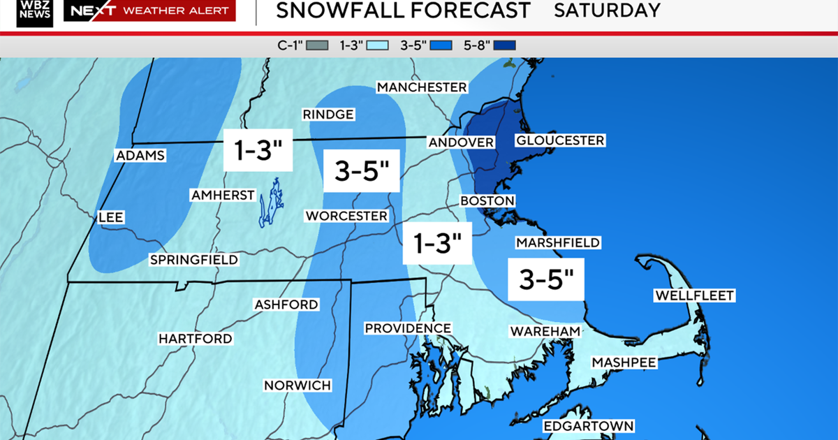
Then we hit the weekend. Models are still confused as to how much energy will work out of cut-off low in the SW US / Baja Mexico and into the base of the polar vortex invading the Northeast. The EURO ejects a solid vort into the base of the vortex inducing surface low pressure development along the arctic front. This would lead to a period of snow or mixed precip over New England Saturday afternoon. The GFS is not as generous with its transfer of upper level energy and keeps the front progressive with no surface wave to focus moisture. Therefore very little precip forms. For what it is worth, the Canadian also shows better surface low development. For now we have to go with a chance of snow and while we are skeptical of this materializing there is certainly potential for some accumulating snow on Saturday.
Aside from Saturday, all models agree that an arctic air intrusion is likely on Monday...allbeit, short-lived...with the EURO showing some pretty harsh stuff!


