Time to Focus on Midweek Snow Threat
I am going to bypass the quieter weather here Sunday Through Tuesday. Let's just say the forecast which we are all familiar with by now to just get it out of the way.
Sunday: Sunny, Breezy and Cooler. Highs in the 30's near 40. NW 15-30 mph
Sunday Night: Mostly clear, calm winds and cold. Some clouds increase overnight. Lows in the lwr 20's
Monday: A mix of clouds and sun, milder SW winds. Highs in the upper 40's and Lwr 50's
Tuesday: Mostly Sunny, a tad cooler. Highs in the Lwr-mid 40's
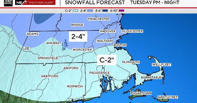
OK...with that out of the way....let's get onto the good stuff because we are tracking a potential snow event here Wednesday to Thursday. Models have been trending colder today and are coming in line with my earlier thinking of a more southern colder solution.
The storm/energy is still in the Pacific, so there is still plenty of real estate for this storm to cover before we can start nailing down any real details or have complete certainty. But this morning, I would say there is a higher "confidence" we will be dealing with some sort of wintry precipitation by this time.
One of the key players in this whole thing is the area of high pressure which follows in for Tuesday behind Monday night's cold front. This high will be lifting north Tuesday Night into Canada where it will begin to direct some bonafide cold arctic air our way with NE winds. So finally, this is one of the major factors which has been missing this winter is a cold high to our north supplying the cold. Once the low comes out of the southern Rockies, it will work it's way towards the Great Lakes. Instead of tracking west of us, like some storms have done this year, the high will act as a road block and deflect the low south of New England and eventually through the Mid-Atlantic. This should ensure colder NE winds will be in place upon the arrival of the moisture with enough cold air in place at all levels for snow to fall.
This is not expected to be a blockbuster type snow event as the northern and southern streams will likely not merge again. But the northern stream will usher trough a few pieces of energy as a series of strung out lows just south of the region. Temp profiles are showing temps will be cold enough to snow in most areas in the Wednesday to Thursday time frame in varying intervals. It is worth noting that this appears that it come with some considerable moisture upto .75"-to 1+" . Most of this could fall as snow or sleet in some areas. If this is the case we could be looking at several inches of snow. Of course, warmer boundary layer issues during the daylight hours will help to cut accumulations in half as has been the case the last couple go arounds. The latest GFS model run even has the low intensifying once it gets off the coast Thursday and really pelting us with some heavy snow and gusty NE winds. Then quickly pulls the storm away Friday. The Euro has ocean effect snow and flurries lagging into Friday with NE winds off the water.
At this point...this is all pure storm fodder for weather weenies. This will likely change in the coming days. But there is definitely something out there cold enough to snow Wed-Thursday, but could also come with some ptype issues depending on final track, thermal advection, and moisture content...as is always the case. Thanks for reading!


