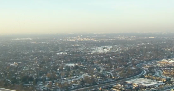
The Warmth We've Been Waiting For...
The last time we were above 65 degrees was November 12, 2012...and that is where we are heading...or even warmer in the next few days! So let's get it going! The leading edge of the warm air is arriving today in the form of a warm front which will be pushing through New England this afternoon. As a low in the Great Lakes tracks up into Canada, This front is coming with high-mid level clouds and a few sprinkles or a shower in the west. There is just too much dry air in the low levels for much if any precip to reach the ground. Skies will average partly sunny today with a milky appearance to sky as the clouds begin to increase during the midday and afternoon. SW winds will be picking up behind this front from the SW with gust to 30 mph. This warm wind will allow temps to climb into the mid-upper 50's this afternoon, while it will remain in the 40's and Lwr 50's at the south coast with a wind off the water. A transition day, but fine outdoor weather day over all.
A cold front will push through tonight with a few clouds and a spot shower. SW winds with clouds will help to keep lows steady in the 40's overnight. With a mild start to Monday, and Mostly Sunny skies behind the front with a light, drying WNW wind, expect temps to quickly climb into the mid-upper 60's by Monday afternoon! Winds will be light enough to turn onshore during the afternoon for a sea breeze to develop which will keep it cooler at the beaches for the second half of the day. It will be a great day at Fenway in the sunshine, Temps in the lwr 60's possible before any sea breeze kicks in by 2 PM.
Another low will track into Canada with another warm front moving through late Monday night and Tuesday morning which could trigger a few showers. After a damp start Tuesday, and the warm front through, clouds should break to some partial sunshine in the afternoon. With SW winds, temps will again be very mild in the upper 60's and Lwr 70's! If we get enough sunshine, 70-75 will be in reach in SNE. Lingering clouds could keep temps in 60's...but let's play this optimistic for now...since we have plenty of pessimism in the extended forecast!
As I mentioned yesterday, once past Tuesday, the forecast could be changing in the coming days. My initial thinking still holds for a gradual cool down, but we could be in for more in the way of rain towards the end of the week. Here is the set up. Unseasonal warmth will be across the eastern half of the nation. Meanwhile, energy coming out from the western states will form a deep trough where cooler air will begin to "pool". Severe weather will be triggered in the midwestern states from Mon-Wed along this dividing line between these two airmasses. The polar jetstream will begin to push colder from Canada further south too where this will create a boundary separating the unseasonal warmth form the incoming cool. Not only will the T-storms for tornadoes from Kansas to Arkansas, but the moisture will interact in the northern Plains for a winter storm. Energy will ride up and along this upper level ridge on the east coast. This stalling front will extend from New England back into the midwest, and will be a trigger for lift and periodic showers and thunderstorms as the cooler air undercuts the warmer air.
Monday through Tuesday SNE is on the Warmer side of the front with a mild surge of air. Spring like air in full! Wednesday will be a transition day, but mainly dry with clouds and sun and temps in 50's and 60's. The front will be sliding south through SNE where it will begin to stall along the coast or just over us...with a flat zonal flow to the upper level winds just over our heads. This will slow the pattern down right over us. The cool air will continue to push eastward energizing the front as a low will track along this front right into New England. NE winds at the surface supply the cool air at the surface, warmer SW winds aloft supply the warmer air overriding the cool air at the ground. It will be a perfect overrunning pattern to end the week with a few waves of rain. One batch of rain late Wednesday night, but a more significant batch of rain could move through Thursday night into Friday morning along with the low. Believe it or not, but another low with another wave of rain could push through late Friday night into Early Saturday! This could end up being quite a slug of rain by the time this all ends on Saturday with 1-2+" of rain.
Needless to say, some of this will change in terms of timing the slugs of Precip. As NE winds build in behind this stalling front south of us, temps will obviously cool into the 40's in the cloudy rainy and raw damp conditions. In these kind of set up many time our temperature reflects the where the air is coming from. NE winds would be off the 40 degree water. So by the end of the week, we could be dealing with a very chilly rain if the set up holds the way it looks now. The weekend will be drier with increasing sunshine and slowly warming temps.
Marathon Monday at this point looks ideal with an upper level ridge following in behind this ugly weather with sunshine and temps continuing to warm with light SW winds in the 50's by Monday afternoon.