The Doldrums...
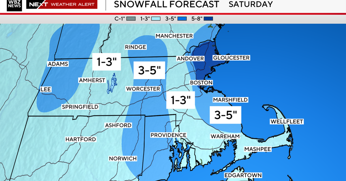
Some serious radiational cooling is taking place right now across the area...the temp in Norwood has gone from 17 to 5 in about 2 hours and this is common in many other suburbs. The free-fall will stop overnight as clouds thicken and temps will actually bounce off the bottom. This cold will be tough to displace tomorrow especially over the interior as some decent cold air damming will occur (it is already evident in the Appalachians where it's snowing in the mountains of North Carolina and ice in Central VA). High pressure at the surface is the key to the overall forecast...it's supplying the cold for snow at the start and it will supply the milder air for rain at the finish. If the high were to retreat to the north I'd say it's a no-brainer all snow event, but the high will retreat to the east and easterly winds will allow for milder maritime air to infiltrate Eastern New England. This will occur just after the morning commute so when the precip starts (either side of 6AM) it will start as snow...and inch or two will accumulate then a quick coating of sleet will fall before rain becomes the big player midday and afternoon. It will take much longer for the warm to chip the cold away and for most of Central and Western Mass and SW NH it likely won't succeed meaning a longer period of snow (3-6", with some locally higher amounts in the Worcester Hills and Manadnock Region) then an extended period of ice placing a solid glaze on everything. Where it turns to rain problems with drainage due to snowcover catch basins will make driving a real pain. Also, the existing snow on rooftops will act like a sponge and absorb all the rain weighing things down. In spots that shift to ice, glazes should become heavy enough for some branches and powerlines to give under the weight.
This looks like an active week with another vort lobe to pass through late Wednesday...leading edge of more cold...rain and snow showers are likely. Then another potent shortwave should give us a solid thumping Friday morning...early estimates look like around 6" of snow. Following that...the coldest air yet...daytimes highs in the teens and overnight lows near or below zero...FUN!


