The Countdown...
The countdown to our first measurable snowfall in Boston in over a month is now on. The last few hours of this snowless month will deliver a small accumulation in Boston effectively knocking us out of the top spot for least snowy Februarys on record. The storm approaching will be strung out and this will be a long event...with that said, all told many won't have that much to show for it.
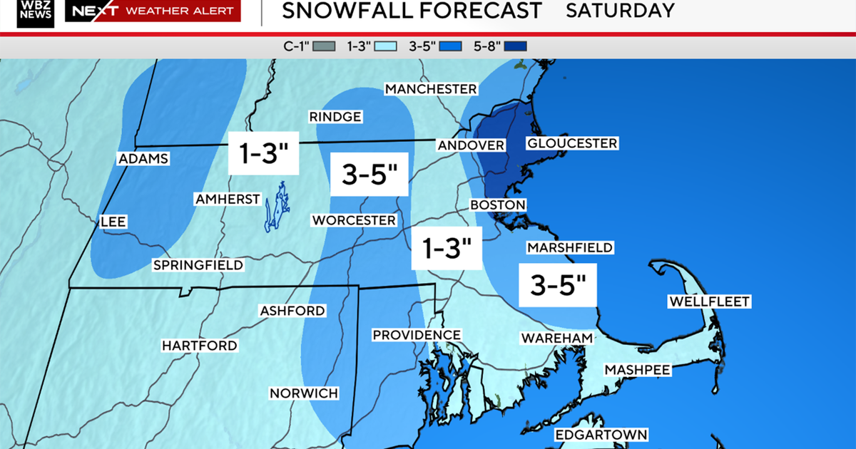
I still feel that tomorrow evening will be the worst part of the storm for much of the area. Snow will come in fast and start before the evening commute. Temperatures as the snow arrives will still be above freezing and even though there isn't a huge source of cold to the north, enough is present to aid in temp falls. The other source of cooling will come from the snow itself...in two ways...first, when precip falls into an unsaturated layer (tomorrow evening's surface air) some will evaporate and that cools the air. The second, and perhaps more concerning...when the snow hits the ground and pavement, it will immediately start to chill down the surface and accumulation can and will occur even with ASOS thermometers reading above 32 degrees. This speaks to a very slow and slippery evening commute for the entire Commonwealth and over the border into NH and VT. With this first round a general 1-3 inches is expected.
My confidence starts to go down following that...we will see several more waves of moisture but exactly how they will impact us all is still not completely clear. My feeling is that we won't see much more south of 495 and here is why. After that initial burst tomorrow evening, he lift starts to wane and the snow will get much lighter...at this time, warmer air in the lower levels will be trying to chew away at the cold already present. With light snow falling, the precip likely won't be heavy enough to overcome the lower level warming and may switch types to rain or a sleety mix...at the very least flake size will be minute and a poor accumulator. Now on Thursday, behind the wave, some low level drainage from the north should occur but at that point the sun will be up and even though it will be cloudy, we still should see some insolation bringing surface temps above freezing to limit accumulation by day...this is evident in wet bulb temps rising during the day above freezing.
Watch Todd's Forecast
There should be one final burst Thursday evening...with the sun going down and northerly winds draining down the coastal plain we should be more efficient at accumulating. However, our more trusted models are showing the heaviest precip then falling just north of Boston. So if all this unfolds the way I stated above...and that's a big IF, we should be looking at 1-3" south of Boston...3-6 N&W of Boston and 6+" falling through the hills of Worcester County and SW NH. This is clearly complicated and fluid so hang close to WBZ for updates. You can follow me on twitter: @ToddWBZ
