Thanksgiving storm forecast has rain, snow coming to Massachusetts. Maps show impacted areas.
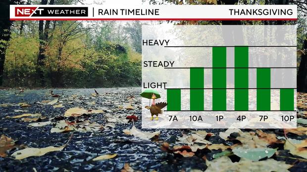
BOSTON - The Thanksgiving holiday will essentially be a washout in the Boston area with rain expected from mid-morning until the evening Thursday. There could be a little snow in western Massachusetts.
Thanksgiving weather forecast
It will be wet all day long. Most towns will get about a half-inch to an inch of rain. It will be steadiest from mid-morning through mid-afternoon and will start to dry out around 8 p.m.
Snow on Thanksgiving
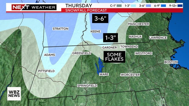
Snow will not be a major player in most of Massachusetts during this Thanksgiving storm.
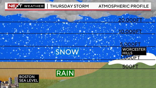
Like most early season storms, you will need some elevation in order to see any accumulation.
Areas most at risk of accumulating snow include the Green and White Mountains as well as the Berkshires in western Massachusetts.
In central Massachusetts, there's a chance of some wet snow mixing and a light accumulation in the northern Worcester Hills, particularly those towns with an elevation near or over 1,000 feet.
There is also potential for a period of gusty winds during the day on Thursday. While the winds are not a big concern with this storm, we could briefly see gusts of 25-to-45 mph along the immediate coastline. Thankfully, tides are astronomically low, so coastal flooding is not a concern.
Thanksgiving weekend weather forecast
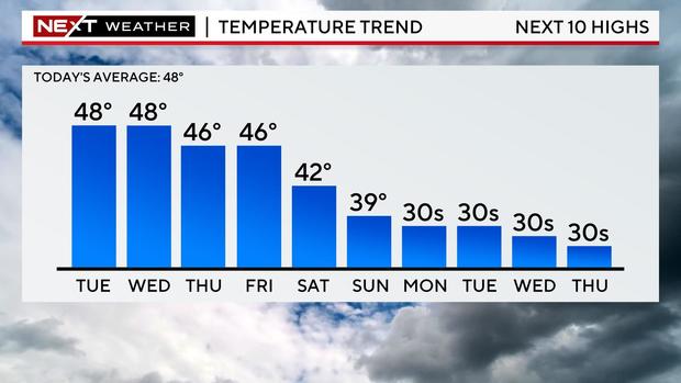
The weather looks much quieter on Friday and this weekend, but it is going to be rather chilly. The coldest airmass yet this season will pour into New England from Canada.
Daily highs will be stuck in the 30s and low 40s with periods of gusty winds making it feel even colder.
Stay with WBZ-TV and CBSBoston.com for the very latest.
