Snowy Tuesday Likely Followed By 'Coldest Thanksgiving In More Than 100 Years'
BOSTON (CBS) -- Merry Christmas! Oh wait, it's only November? Seems only fitting that we end this cloudy, wet (some would call it miserable) fall season with a blast of cold that would be called harsh even in the heart of winter. Next up a rainy and SNOWY Tuesday, (the ninth wet Tuesday in the last 11).
It's all about location, location, location today. From rain to several inches of snow in just a 25-to-50 mile drive, buckle up… literally.
TUESDAY TIMELINE:
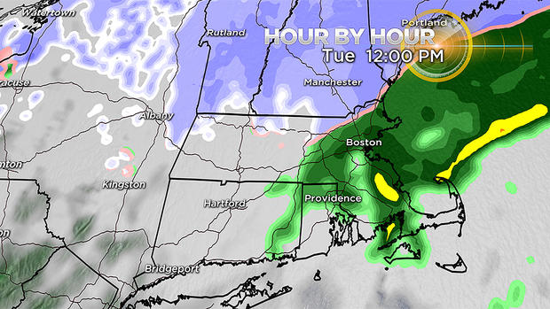
It will be a slow start, as most of the precipitation will be light and in the form of rain for the first several hours of the morning commute.
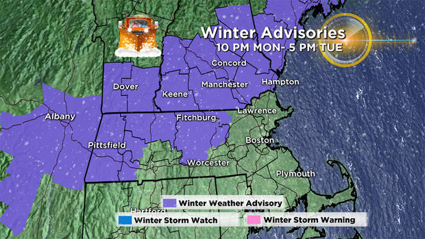
Precipitation will slowly get steadier and heavier. It will be mainly snow north of the Massachusetts Turnpike and northwest of I-495. From Route 128 to 495, it will be a flip-flop between snow and rain at times. To the south, including Boston and all points south of the Pike, it is rain.
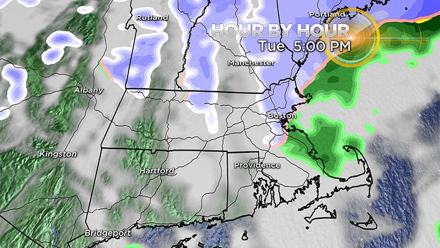
The rain and snow persist through the early afternoon, not tapering off fully until just before the evening commute. The rain will likely briefly change to snow in eastern Mass. for an hour or so right before it completely shuts off, but not much accumulation is expected along the coast.
We are also concerned about a flash freeze around the evening commute Tuesday as temperatures crash below 32 degrees. If you are traveling late tonight, be aware of untreated surfaces for icy spots.
SNOWFALL AMOUNTS:
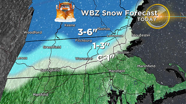
Coating to 1 inch:
Right along the Pike and a few miles on either side, also right along the coastline from Boston to Cape Ann. This actually may come at the tail end of the storm (Tuesday late afternoon) as colder air pushes east and the precipitation tapers.
1-to-3 inches:
Between 128 and 495 including Worcester, Marlboro, Lowell and Lawrence.
3-to-6 inches:
Northwest of 495 and north of Route 2 including Fitchburg, Nashua and Manchester, New Hampshire
6 inches +:
Best chance of a few higher amounts would be in the Monadnock region of southwest New Hampshire and perhaps very northernmost Worcester County at elevations over 500-to-1000 feet.
NEXT UP, WEDNESDAY SNOW SQUALLS:
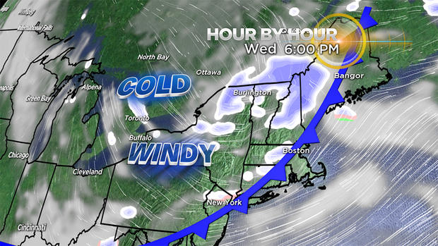
Continuing the winter theme of the week, a cold front arrives Wednesday afternoon, likely bringing with it some snow squalls and gusty winds.
Don't be surprised as you are traveling around Wednesday afternoon and evening if you get a quick burst of snow. Likely very short duration, but with the potential to coat the roads very quickly, potentially making for some hazardous travel.
AND THEN, WE GO COLD TURKEY. . . LIKE, RECORD COLD TURKEY:
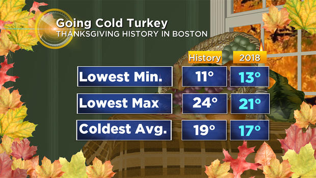
Bad news for those high school football games and turkey trots on Thursday morning. We are forecasting temperatures and wind chills just about as cold as you can get in mid-to-late November. Record lows and record low max temperatures are likely to be set this Thanksgiving.
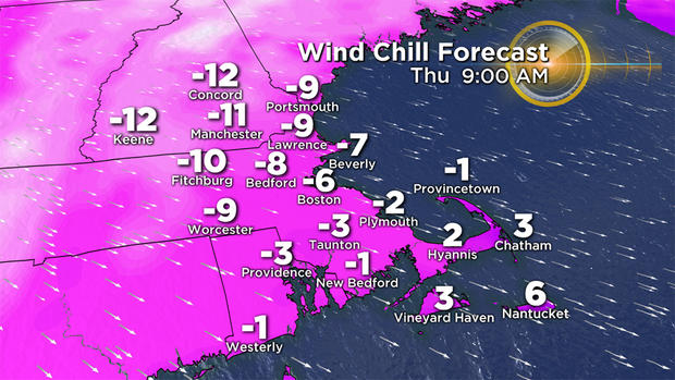
Wind chill values Thursday morning will be below zero. This should be the coldest Thanksgiving in more than 100 years and potentially the coldest ever recorded in Boston. Having fun yet?
SO WHEN'S THE WARMUP?:
May? I kid. . . sort of.
If you saw our winter weather forecast last week, you know we are forecasting a very cold and snowy winter. This November is likely just the beginning.
The cold lingers on Black Friday, highs mainly in the 20's, but there is something of a warm up coming this weekend!
Temperatures on Saturday will top 40 degrees! Heat wave!
Then we are watching the potential for another sizable storm sometime in the Sunday/Monday time frame. The jury is still out on that one; right now odds favor rain. Stay tuned though.
Follow Terry on Twitter @TerryWBZ
