Temperatures Tumble
BOSTON (CBS) - It's a warm, windy, and wet morning!
The showers and clouds will lose their grip, and skies will brighten as the day progresses.
Check: Current Conditions | Weather Map Center | Interactive Radar
However, the wind direction will shift later this morning which will usher in much cooler temperatures. Temperatures will fall from the 50s and tumble through the 40s.
Watch Melissa's forecast:
A secondary shot of cold air will produce partly cloudy skies tonight, but the clouds won't be enough to keep temps from dropping into the 20s for most of the 'burbs.
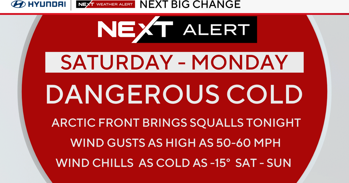
THE WEEKEND
This is the last Fall weekend of 2011, and it's going to be a cold one.
Saturday will be partly cloudy with highs in the upper 30s while Sunday will be partly cloudy with highs in the lower 30s. Brrr!
Saturday night is starting to show snow showers for coastal areas, especially the Cape/Islands.
There could be a coating to an inch or two in some areas where these light bands of snow set up.
The beginning of next week is showing a quiet pattern.
Starting on Wednesday, the models are showing a system producing rain and snow showers for the region.
Then, if you're dreaming of a white Christmas, there is another area of low pressue that heads our way next Friday.

This system has potential of bringing us some snow just in time for Christmas (if the air is cold enough).
We'll be keeping a close eye.
Happy FRRRiday! :)
Melissa