Take A Walk...On the Mild Side!
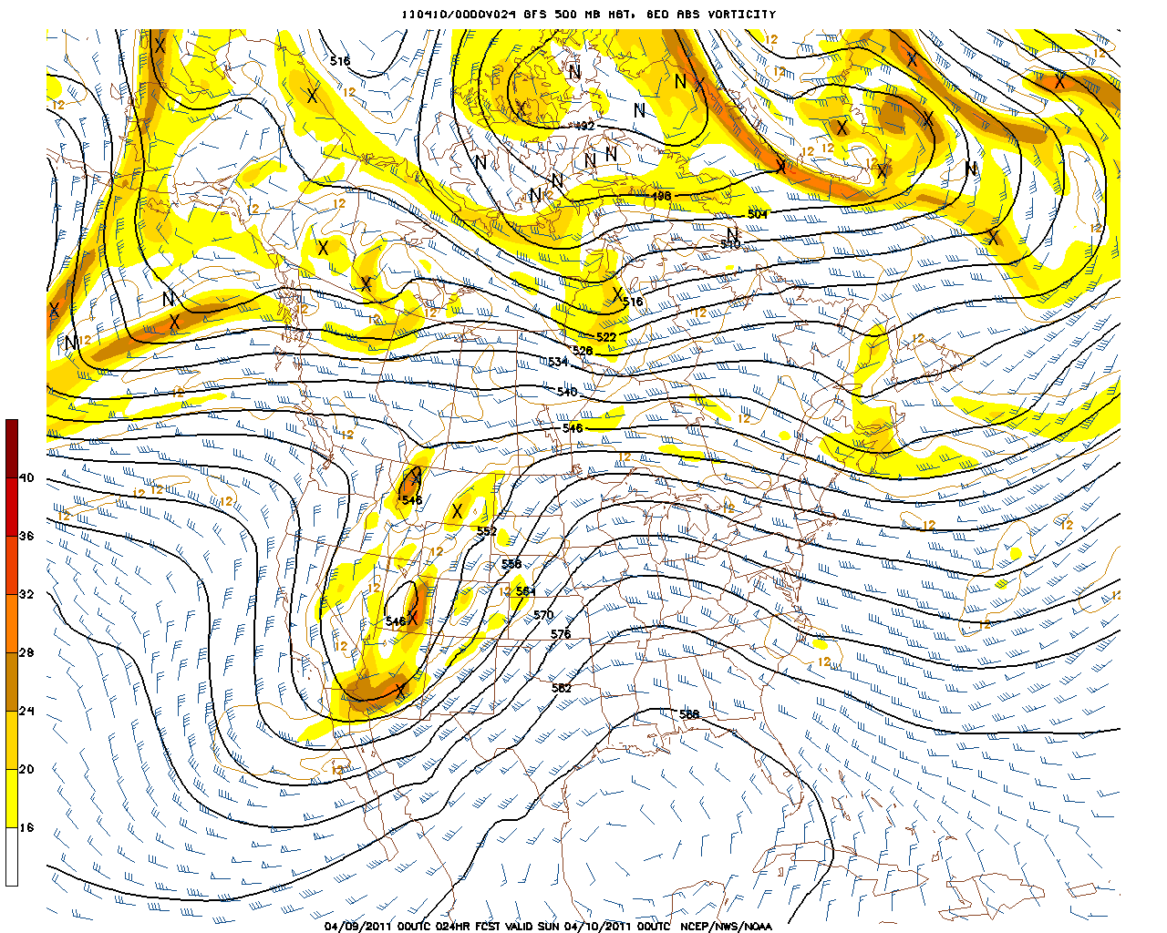
An upper level ridge continues to shift eastward towards the coast providing plenty of sinking stable air across the northeast. High altitude clouds spilling over the ridge into New England under a NW flow aloft which will once again create a milky appearance to the afternoon sky. Temps on the rise today with highs climbing into the Lwr 60's, with light SE winds keeping in in the 50's at our beaches. Sunday will be similar in temperature with clouds on the increase ahead of a warm front which will provide the surge of warmth behind it across the Northeast.
Ed from Sutton asked "Is it too earlyto plant grass?" If you are comfortable outside...you can plant grass. So go for it Ed! Just make sure the soil is loose and keep the seeds moist. All the best! I know my lawn needs a lot of help. Not easy work especially when you are dealing with PH issues in the soil.
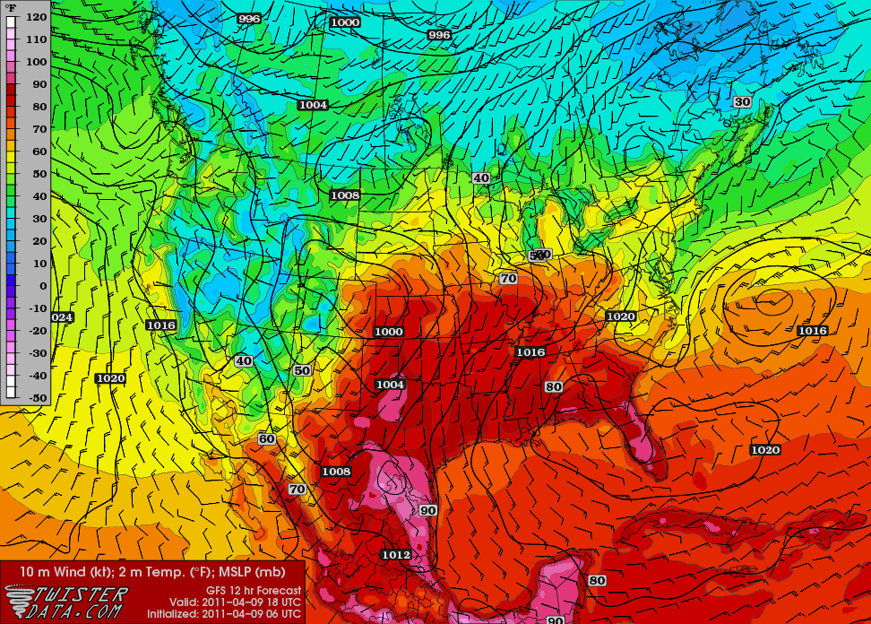
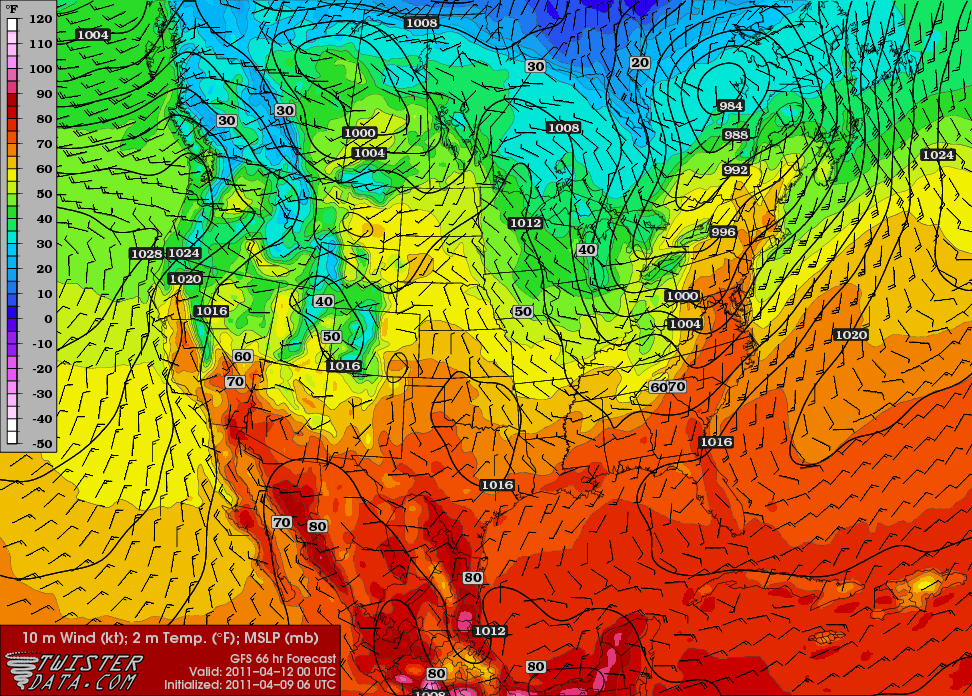
Under the ridge, temperatures are warming to summer time levels in the midwest with many areas climbing to 90 degrees today. This warmth will eventually be shifting east...but will not quite make it all the way into New England...but it will certainly help to make us warmer!
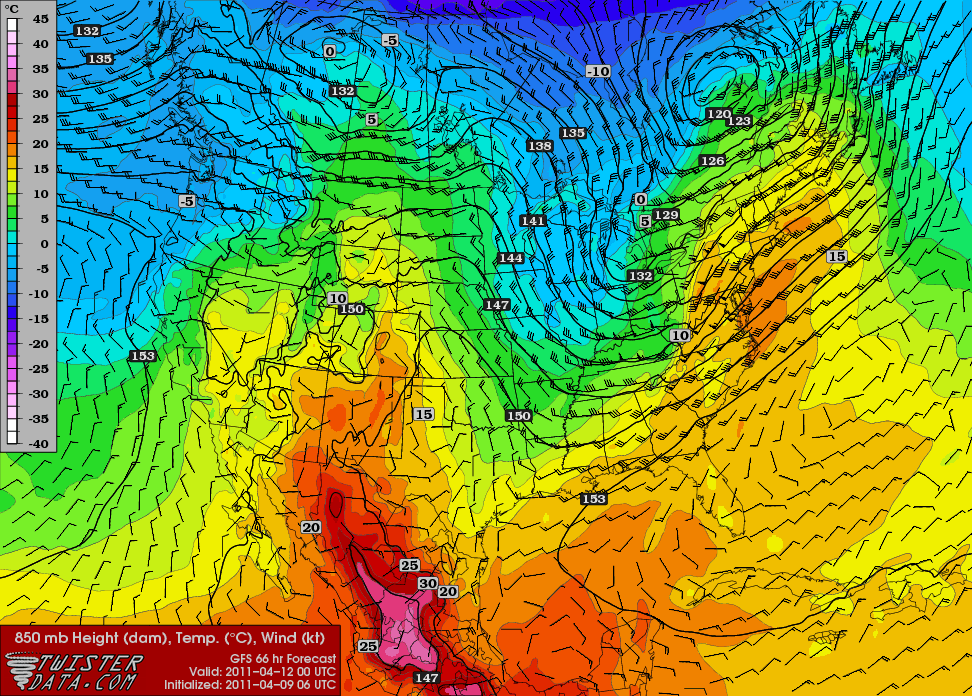
By Monday, winds aloft all the way to the ground will be coming out of the SW. Temps will warm considerably behind the passage of a slow moving warm front Monday. 850 mb Temps are 14-16 C which can support temps into the 70's even 80's if significant sunshine is in place. That remains the question.
The GFS is fast to push the warm front through Monday morning. The NAM gets the front a little more caught up with a weak wave of low pressure on the front and NE winds coming in from the Gulf of Maine. Cooler air could try to hold in Northern New England, so there is a concern about clouds helping to keep a bit cooler, and those on the cooler side of the front across the north being stuck in the 50's and 60's. Southern New England, SNH, SVT should have no trouble breaking into the warm sector with temps in the 70's nearing 80 inland away from the cooling influence of the water. SW winds will keep it all a tad cooler in the 60's in Southeast MA....50's possible on Cape Cod...While we near 80 in the Merrimack Valley. One of those days. Clouds could be an X factor to prevent the real warm up...but I am forecasting for breaking afternoon sun and for temps to fully reach their potential across many inland areas.
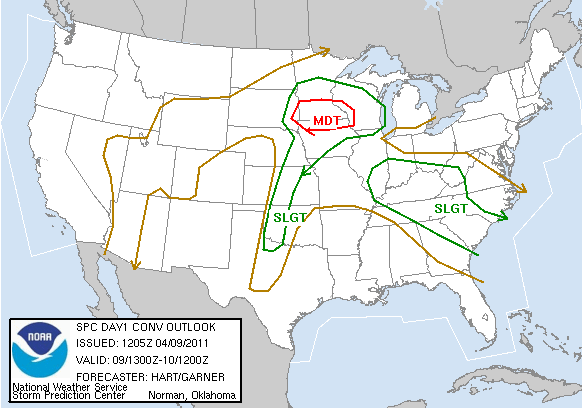
Meanwhile, the Severe Storms Prediction Center has their hands full this weekend with scattered severe storms developing with the heat of the day in this developing hot and humid airmass in the heartland of the nation. As cooler drier air comes down off the Rockies strong storms will be developing. Potential for tornadoes in S. Minnesota and Iowa today.
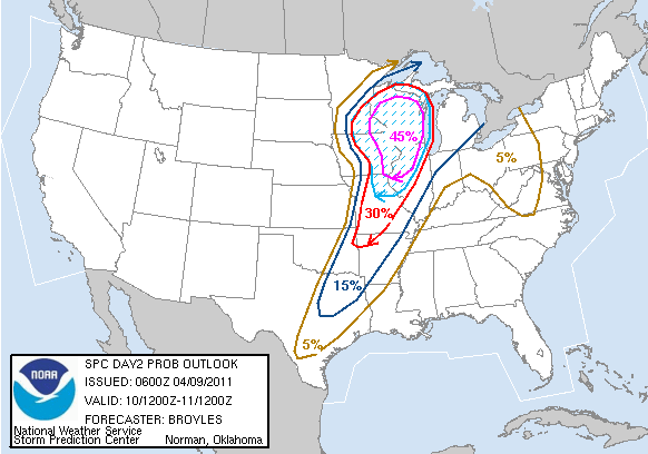
There is the risk of very powerful thunderstorms, some with strong tornadoes, over part of the central Plains into the Midwest Sunday. Best chance for tornadoes will be in Wisconsin, Missouri and Illinois tomorrow.
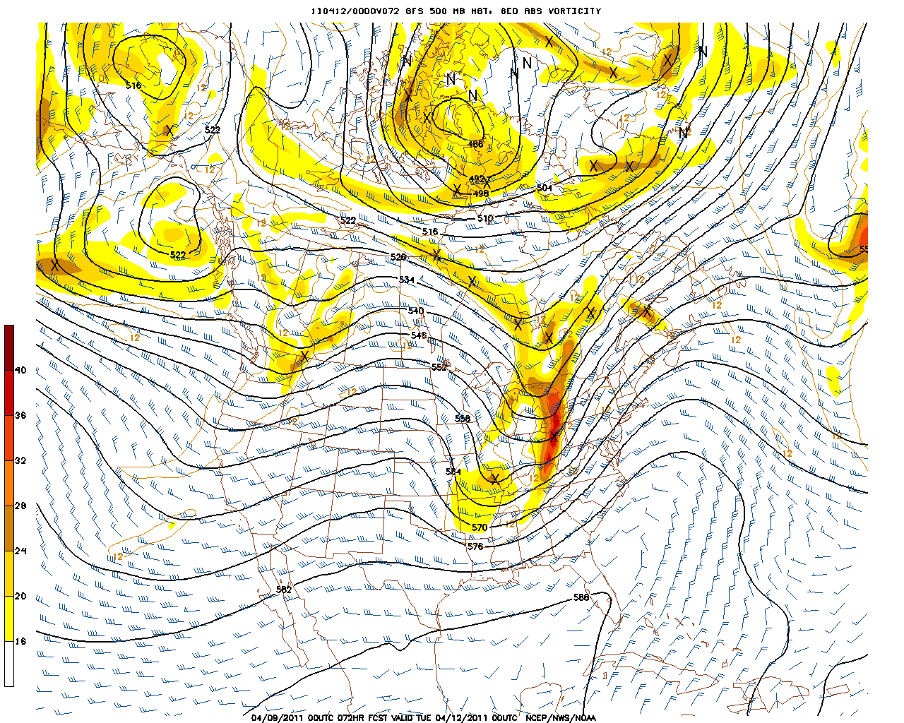
These intense storms will push towards the Ohio Valley Monday. This cold front will push through New England in a much weakened state Monday Night-Tuesday morning with a few showers and maybe a thunderstorm?
Any chance of a strong storm would be across the north.
The Severe weather season in all reality is just getting under way.
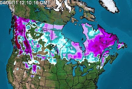
Check out the current snow pack in Canada. This will keep just enough cool involved in the pattern
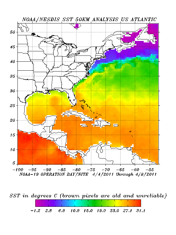
Then look at how the Gulf of mexico has warmed up. This will provide the heat and humidity into the country. These two do not mix. As the cool will periodically swing down, it will run into the warm humid unstable air to create more severe thunderstorms and tornadoes in the coming weeks. Very Typical for spring...but some severe seasons can be more active than others...especially when the Gulf gets this warm.
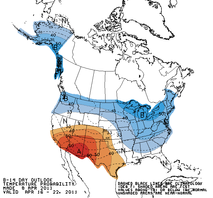
Here we go again...the Climate Prediction Center is predicting the next 8-14 days to average below normal in the east and Northeast. Hmm?
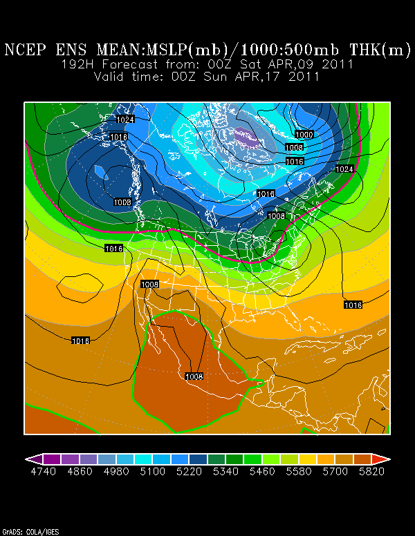
Well...the next 7 days are likely to average at or above normal...But at day 8...it must get pretty cold right? There is some rain heading our way for next weekend with a low tracing up through the Appalachians. That will keep it a bit cooler. A trough returns to the northeast behind this departing low with seasonally cool temps...but not cold.
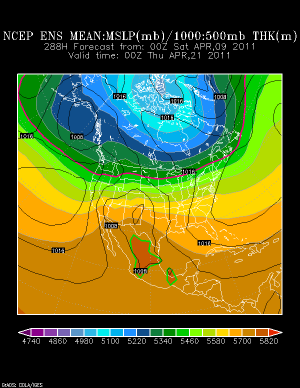
By Wednesday the 20th, the flow of the jetstream has a flat zonal flow. Winds at the ground are from the SW with the coldest air still locked up towards James Bay. Not a very cold look overall...the cool in question will come with the unsettled conditions next weekend and a day or two after. I think the CPC cool forecast for the 8-14 days is on target..but may be a bit extreme.
