Swing...
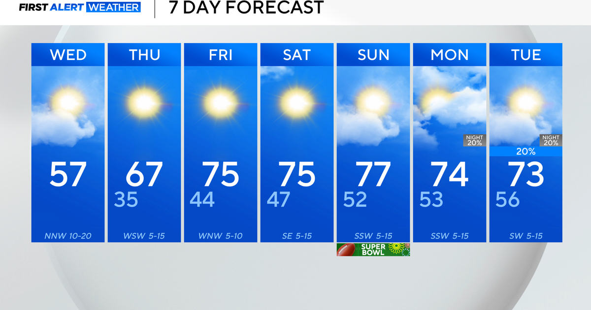
Temps over the next few days will be swinging back and forth as the coldest air of the season closes in on Southern New England. A coldfront draped through the Great Lakes will sweep in tomorrow afternoon, along it I expect a thin line of briefly heavy showers and gusty winds midday then clearing and a temp drop to follow for the afternoon and evening.
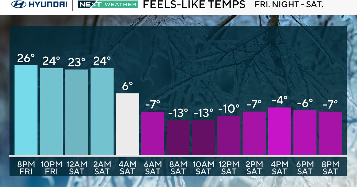
Freeze Watches have been posted by the National Weather Service and have been expanded all the way to the coastline including the neighborhoods of Boston too! Temps will dip down into the lower 30s near the coast and 20s across the interior valleys. This will be cold enough to effectively end the growing season and it is now time to bring in potted plants from the deck or patio. High pressure will lead to ample un during the day and temps will respond into the mid 50s for the afternoon with limited wind..a fine Autumn afternoon.
By Sunday, warm air will be advecting back into New England on the backside of the high on SW winds. With its arrival numerous mid and high clouds will be around limiting the sun but by afternoon the warmfront should be through and brighter skies will take over for the afternoon. Behind the warmfront look for temperatures to reach the upper 60s...a nice rebound considering the 20s and 30s from the prior day!


