Big temperature change, the "Fujiwhara Effect" and a supermoon in the forecast for Massachusetts
BOSTON - The biggest weather headline this week continues to be the drought. It will be a much cooler week overall than what we have experienced thus far in November, but unfortunately, there is still no significant rainfall in sight.
Drought conditions in Massachusetts
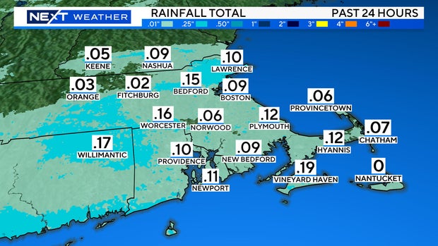
Well, we finally got some rainfall Sunday night, but it didn't add up to much. About a tenth of an inch for most, literally a drop in the bucket.
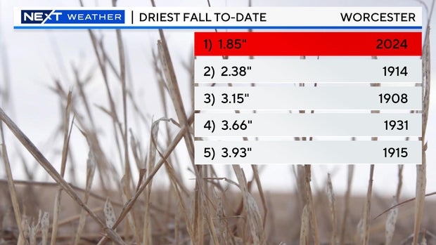
Add on the rain from the last 24 hours and there remains no change in status to Boston or Worcester on the record for driest fall seasons. Boston remains #2 and Worcester #1.
The outlook for the next seven days is for more of the same.
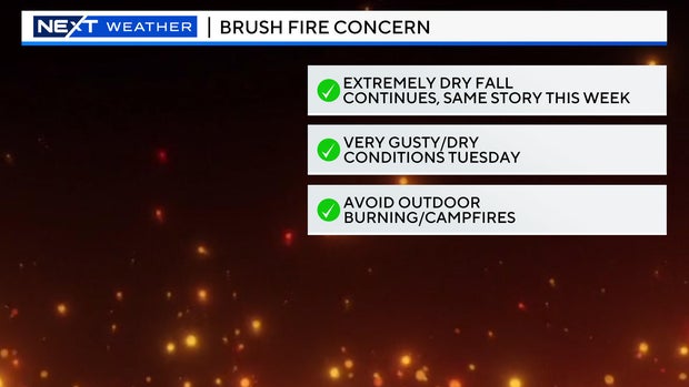
We will likely see red flag warnings posted again for Tuesday as we expect very gusty winds along with extremely dry air.
The next chance for rainfall comes later this week but, it is far from a certainty and doesn't look like anything appreciable.
Boston weather forecast
The biggest change this week will be in the temperature department. A cold front moves through Monday night and ushers in a much chillier airmass.
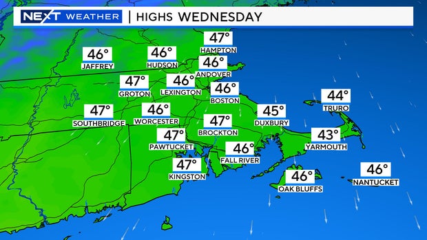
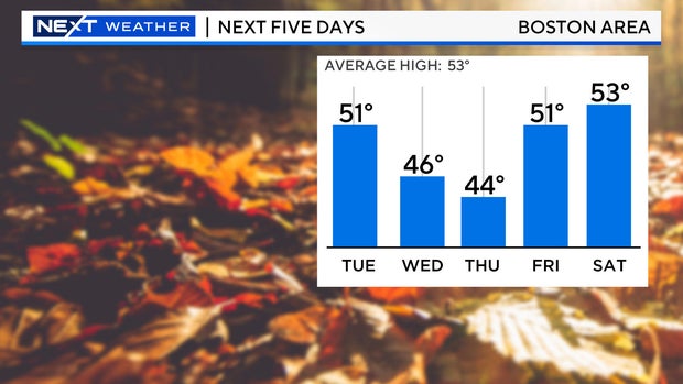
Highs will be in the 40s and low 50s for the next several days which is slightly below average for this time of year.
Winds will gust 30-40 mph on Tuesday making it feel more like the 30s.
The Fujiwhara Effect
It's never too early to look ahead to next weekend.
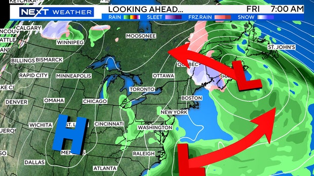
This is actually a rather tricky forecast. On Friday there will be two areas of low pressure off the East Coast - one around Nova Scotia and the other off the Carolinas.
These two storms will pinwheel around each other, something we call the "Fujiwhara Effect."
The storm near Nova Scotia will actually retrograde westward, backing into northern New England over the weekend. Whether or not we can squeeze any precipitation out of it in southern New England remains to be seen. Much of the stormy weather may be relegated well to our north.
Tropical activity
Hurricane Rafael is long gone and currently there are no active storms in the Atlantic.
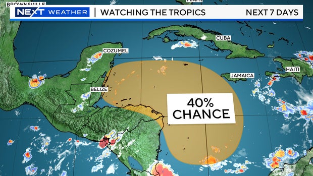
We are watching an area near the Yucatan for possible development later this week. Some models actually have this feature developing into a tropical system in the longer range and heading in the direction of Florida, but that is a ways off.
November's Beaver supermoon and chance of northern lights
The sun remains very active, and experts are saying there is a 30% chance of an X-class flare in the next few days. If that were to occur, we could be on the lookout for more auroras this week.
There is a very weak meteor shower happening Monday night, the northern Taurids. It's not really even worth mentioning but there is a chance of seeing a rogue shooting star overnight. That will be followed up by the Leonid meteor shower over the weekend. This shower has been known to be decent over the years but with a full moon lighting up the sky it may be hard to see much.
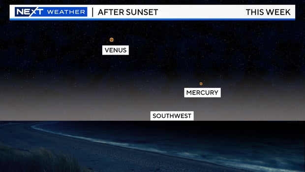
Check out southwestern sky after sunset this week and you will see Venus (shining very brightly) along with Mercury (much less bright).
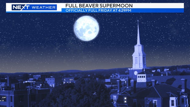
Last but certainly not least, we have the fourth and final supermoon of 2024 coming up this week.
The "beaver" moon will be full Friday ay 4:29 p.m. and given its proximity to Earth in its orbit, it will also be a supermoon. This means it will appear slightly larger and brighter than an average full moon.
