Summer In May, Spring Returns For June
Find Eric Fisher on Twitter and Facebook
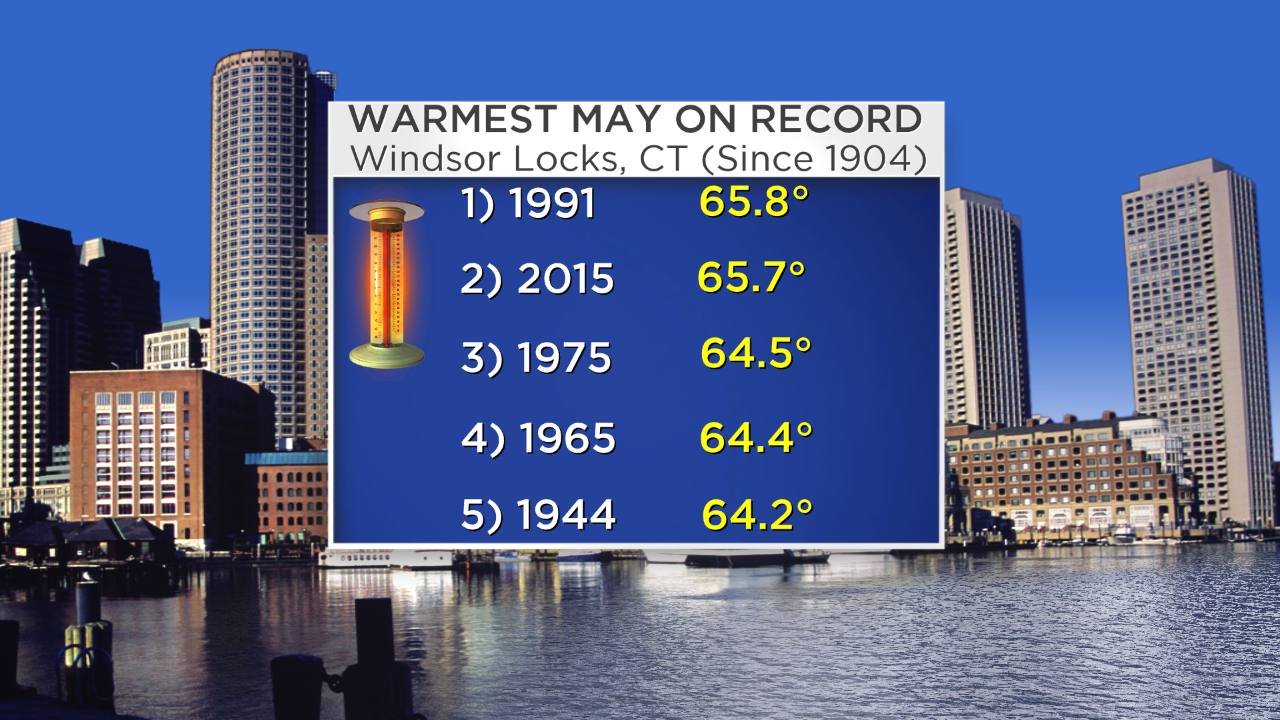
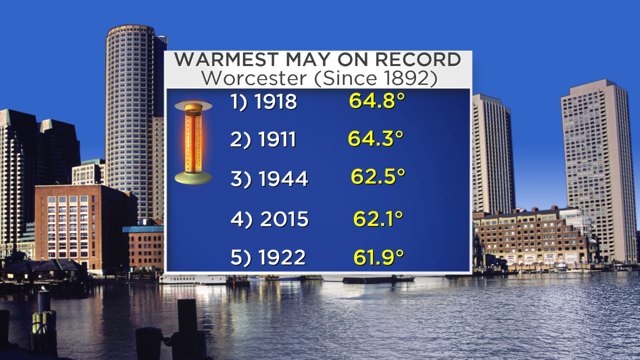
Since we've been soaking up summer warmth and sunshine for nearly all of May, it's only natural that we slip back into the spring we only got a taste of as June begins. That's certainly how it's looking as we head into the weekend. We all know it's been a dry May, but it's also been sneaky warm. Windsor Locks, CT is very possibly going to finish out with the warmest May ever recorded! Farther east, Worcester is set to land in a Top 3 all-time warmest May standing. Pretty remarkable considering Worcester just recorded its coldest month on the books (February), its largest snowstorm on record (blizzard January 26th-27, 34.5") and its snowiest month on record (February, 53.4"). Records in the city date back to 1892. That's some serious weather whiplash.
These figures are through Thursday, with updated standings to come this weekend.
Saturday brings one more day of temps well above average which should solidify Windsor Locks' top spot finish and Worcester's (at least) #3 finish. Highs will soar into the 80s inland, with cooler air along the South Coast/Cape Islands maxing out in the 60s to around 70 degrees. Clouds will also be a little more persistent for those southern coasts as gusty southwest winds blow off the water at 10-25mph. To the west a cold front will draw near, but most of the thunderstorm action will stay out across NY/PA and western New England. A stray storm or shower can't be ruled out as far east as Worcester County or southwest New Hampshire. We'll also see the dew points start to head up again, reaching into the 60s and bringing back a muggy summertime feel.
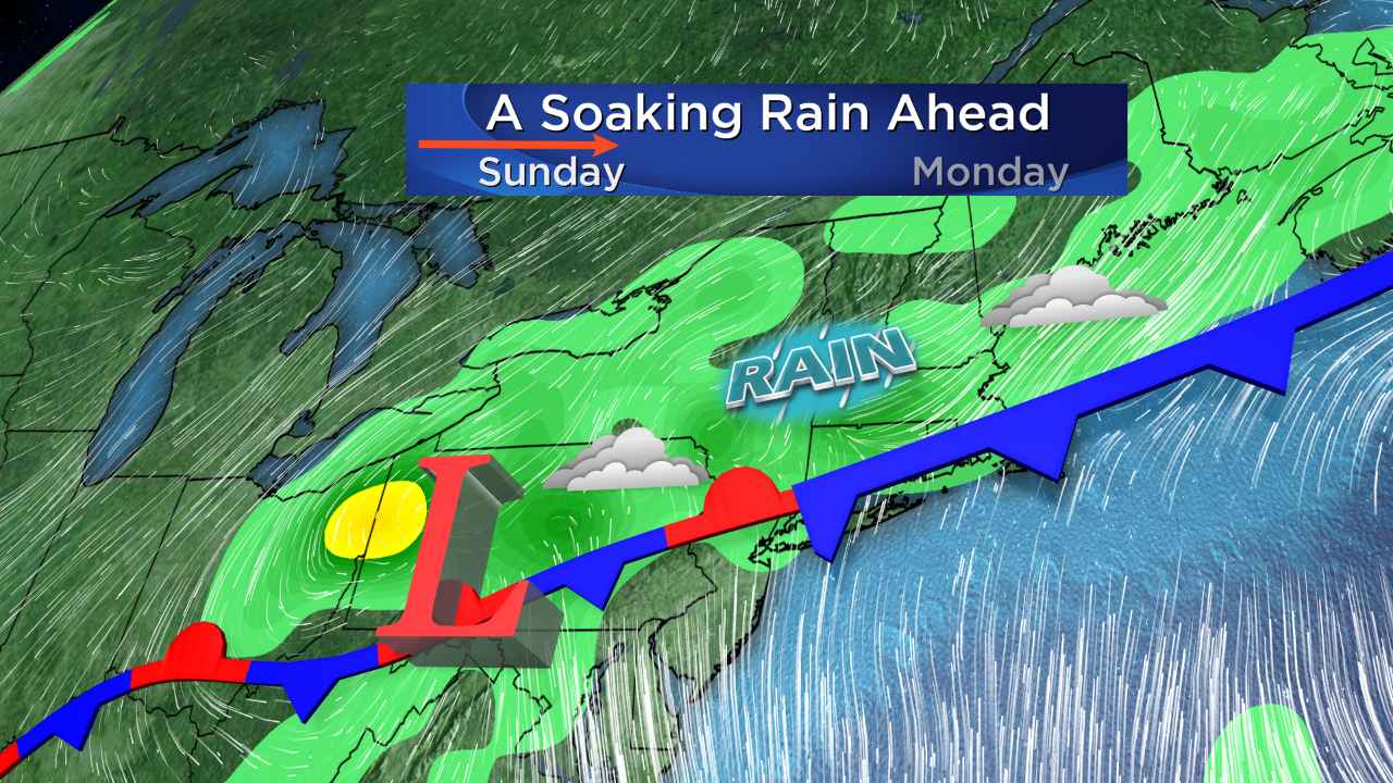
The 'game changer' day is Sunday as that front drops south. The drier part of the day looks to be in the morning, but there should still be some shower activity and lots of clouds. It'll also be on the soupy side with humid air and temps into the 70s. But as that front settles down toward the Pike, showers and storms will become more numerous and cooler air will blow down on northerly winds. By the afternoon and evening, temps may be down into the 50s for northern MA/NH! It doesn't appear to be a full-on washout day, but it's also not a great one for outdoor plans. We'll be tracking areas of showers and thunderstorms, but don't expect there to be much of any severe weather like we saw on Thursday.
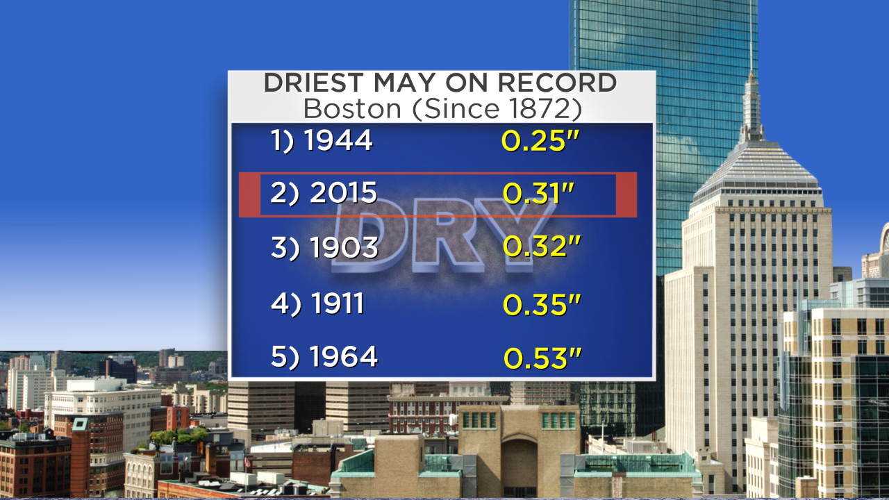
If Boston somehow gets missed by all showers and storms on Sunday, it would end up as the 2nd driest May ever recorded in the city. However, I do think the city should get at least some rain Sunday, which would drop it down the standings pretty quickly.
A wave of low pressure will ride along this front as it stalls out south of the Pike and bring more areas of rainfall on Monday. The atmosphere will be saturated, so downpours and locally heavy rain could produce some pretty hefty totals. Little wiggles on where this front sets up will determine which towns end up with the most rain. Models are definitely trending more 'bullish', but I think they may be overdone. So often do they 'juice up' getting closer to an event and then back off at the last minute, especially in a dry pattern. I'm thinking that the rain will linger into Tuesday, and by the time it all wraps up the 3-day rain totals will be in the 1-2" range with some isolated 3" totals possible. That would be the most moisture we've seen from a storm in a very long time, and none too soon. This should provide a much needed break for dried out land that needs a drink.
From Sunday night through Tuesday, winds will turn from the north to onshore NE/E and that Atlantic water is still plenty cool. Highs are expected to stay in the 50s for the first day of June! Can't imagine that it's going to feel too comfortable, particularly right along the shore. On Tuesday we'll again see 50s and some 60s and scattered areas of showers should stick around. This system should shove off on Wednesday, providing some drier and brighter weather. The end of the week, as it stands, is looking much more enjoyable with warming temps and lots of sun.
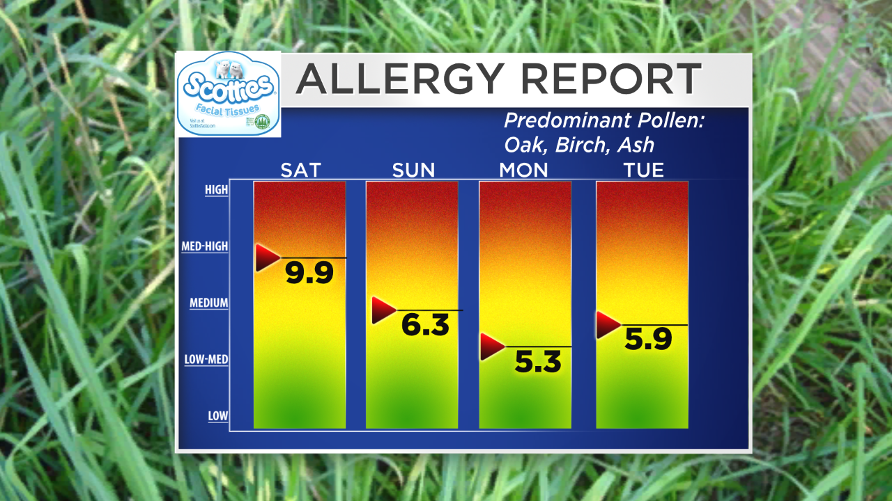
Benefit of wet and cool weather? Lower pollen counts! Bring it on.
So our best case scenario is that we end up with some scattered downpours on Sunday but not enough to ruin the day, a nice cool soaking on Monday to quench the parched land, some more showers on Tuesday, and then a nice seasonal couple days to follow. That would go a long way toward easing this very dry stretch and keeping the flora happy here in New England.
