Stunning Imagery From April 27th-30th Severe Weather Outbreak
Find Eric Fisher on Twitter and Facebook
Even when it's turning tragic, one can't help but notice the stunning power and spectacle of weather. We're seeing it at work this week as numerous severe storms have been popping up since Sunday. This has easily been the biggest outbreak of the year so far, and largest since early on in 2013. In fact, there may be as many confirmed tornadoes before this exits on Thursday than we saw for all of 2014 across the U.S. leading up to it. And once the tornadoes stopped spinning up, prolific and devastating flash flooding took center stage. Here's a look at some images I've captured during this severe weather outbreak.
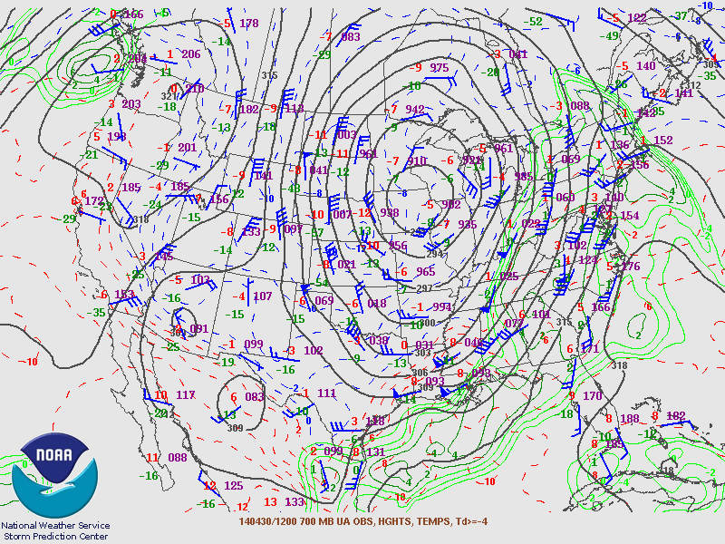
Source: NOAA
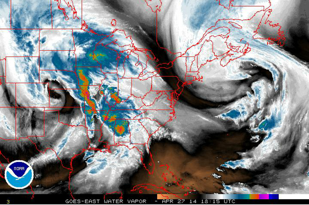
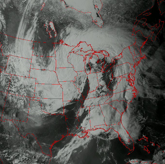
Here's where we started on the 27th of April. Due to a huge area of high 'blocking' pressure over Canada/Greenland, these storms had nowhere to go. Two classic mid-lattitude cyclones spinning and impacting the U.S.
Source: @USTornadoes on Twitter
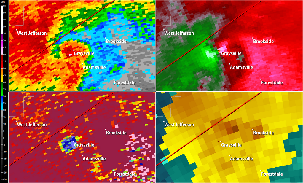
Many signatures like this over the past several days. This one comes via @USTornadoes. Base reflectivity is in the upper left, storm relative velocity is the upper right, correlation coefficient is bottom left. What you're seeing is a classic 'hook' echo, a tight couplet where winds are converging and rotating, and a TDS - tornado debris signature. The correlation coefficient is a relatively new tool for Meteorologists. When NOAA upgraded all their radar sites, this become standard. It helps us see 'like' hydrometers in the air. All the pink showing up is rain, but the donut hole shows where debris is being tossed up in the tornado. You'll notice that it's co-located with the 'debris ball' on the BR and velocity couplet on the SRV. This essentially confirms to us that a tornado is on the ground.
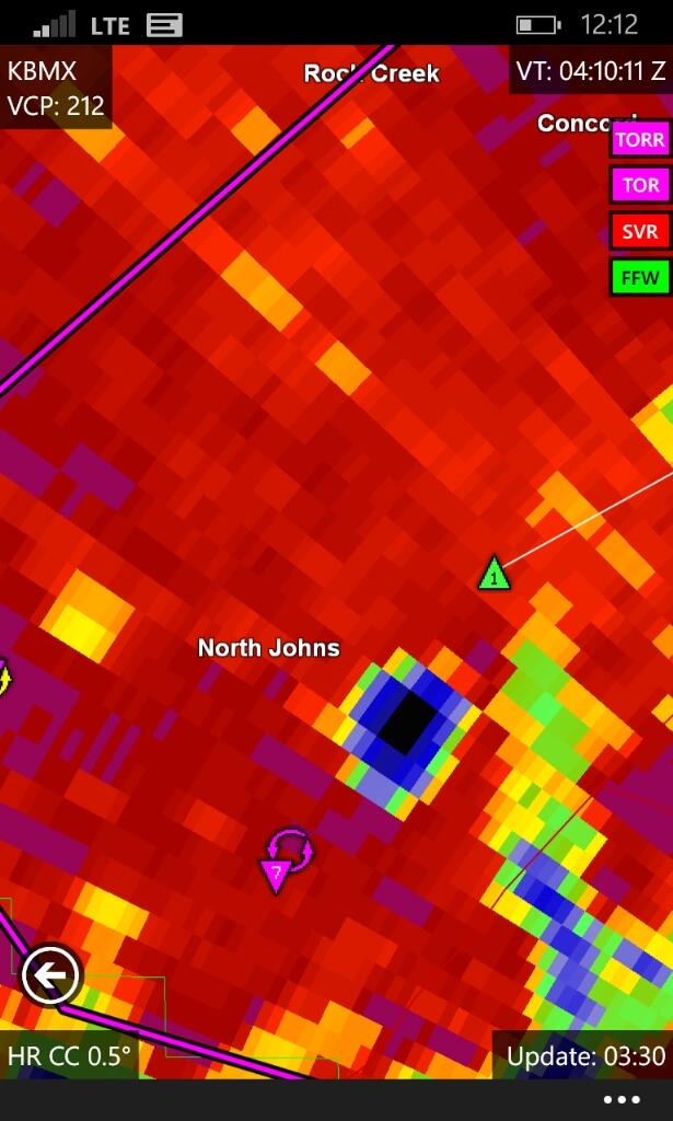
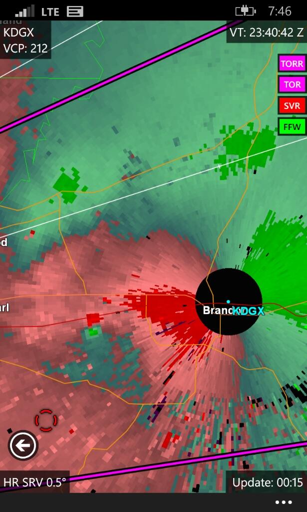
This was a particularly stunning TDS near North Johns, AL Monday night. I grabbed the radar image from an app on my phone, MRlevel3 (for Windows Phone). At this point the debris signature was 3/4-1 mile wide!
Above is some incredible video of one of the biggest tornadoes of the day, in Louisville, MS. It was rated an EF-4 with winds topping out near 190mph. If this tornado had hit a major metro area, it would have been absolutely devastating. 6 people were killed by this storm in Winston County, but it certainly could have been much worse.
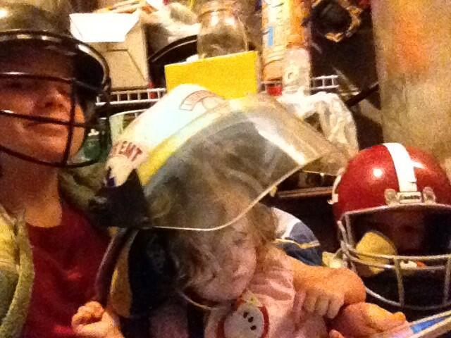
A group of kids, via @AngelAllred03 on Twitter, doing exactly what everyone should do when they're under a Tornado Warning! We always recommend going to the lowest level of your house, and into an interior space if possible (putting as many walls as possible between you and the storm). Bathrooms are typically the strongest rooms to find shelter in. But it's also helpful to wear helmets and boots, to prevent head trauma from blunt force and for walking around after the storm if there's widespread debris.
Stunning power of a tornado - it sent this piece of wood flying 30 miles away.
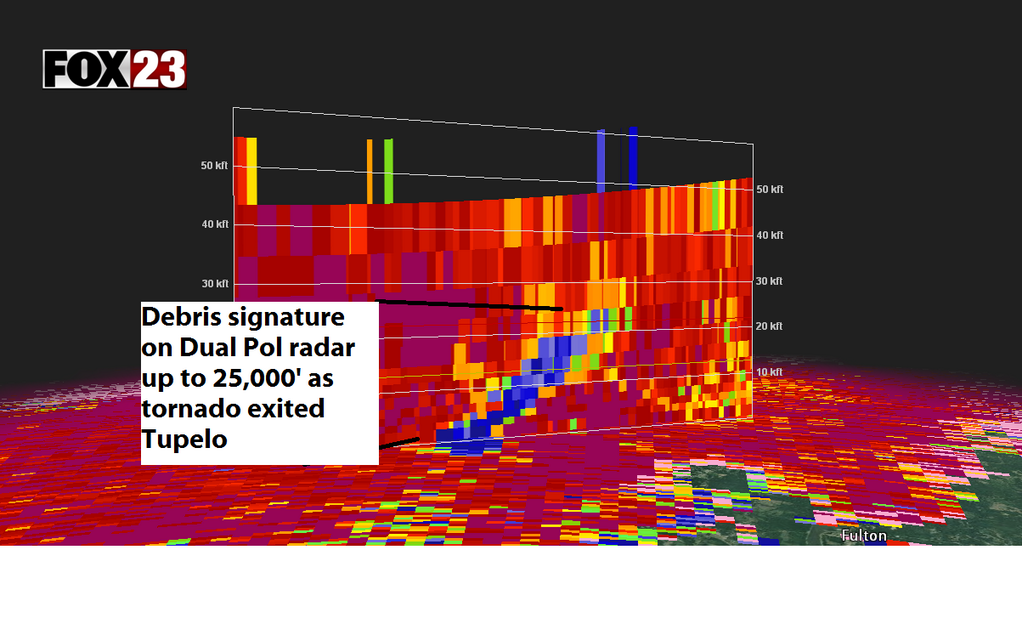
Speaking of debris....these supercells can have intense updrafts capable of lofting debris to very high altitudes. This 'slice' of a supercell near Tupelo, MS (Courtesy of FOX 23) shows the debris signature nearly 5 miles high in the storm! Debris is often found miles and miles away from the parent storms.
Source: Wright-Weather.com
The main system producing all this severe weather is roughly 2,000 miles wide with 'tentacles' of clouds swirling around it. Cut-off from the main jet stream flow, it's been meandering with its occluded center over Iowa. There's been snow in the Rockies and even the northern Plains due to this, and it's helping to draw an onshore flow of air into southern New England, too.
A critical tool for forecasting severe weather is radar, and we almost lost one Monday night. Shortly before this tornado approached, the KDGX Doppler Radar in Brandon, MS was struck by lighting. The National Weather Service Office was able to re-start it, but then this twister came barreling right for it. The tornado is where those two red/green pixels touch each other due west of the site. Fortunately for the radar, it entered the cone of silence and then reappeared just to the SE. A miss!
Source: NOAA Storm Prediction Center
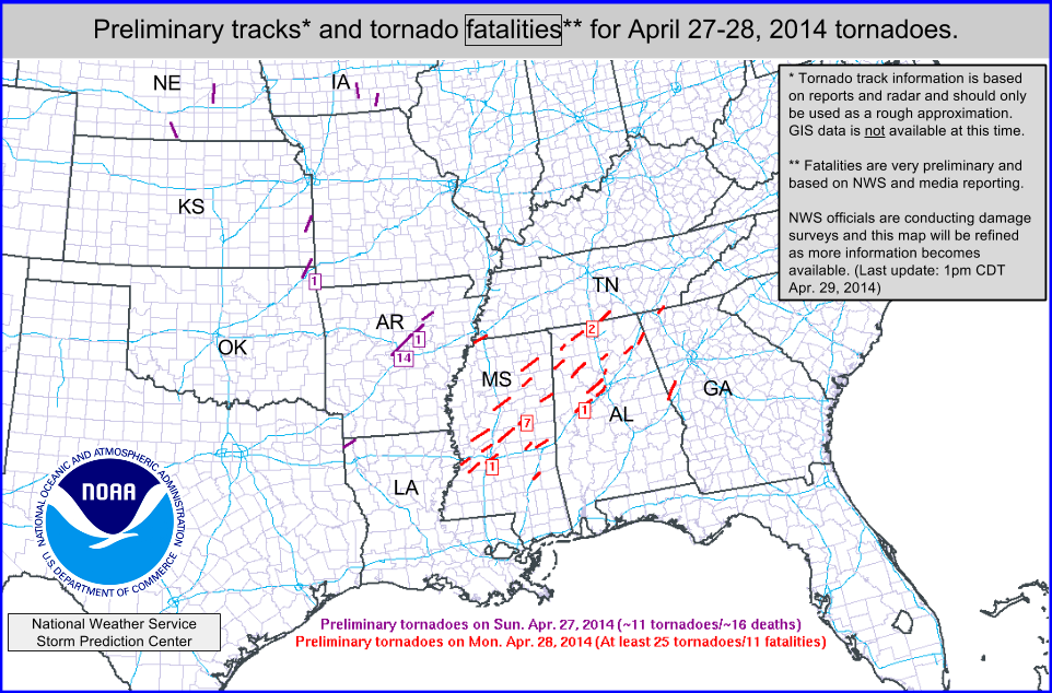
When tornadoes strike, NWS crews head out into the field to do storm surveys. They look at damage patterns and determine how many individual tornadoes there were, how strong they were, and how long they were on the ground for. This is a preliminary map, and will continue to be updated on the SPC site. It's likely that at least 50 tornadoes have touched down, and perhaps close to 100 by the time the outbreak comes to an end.
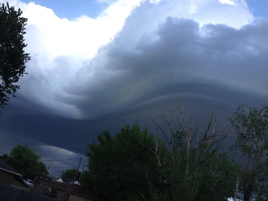
Some wild looking clouds have been captured by cameras across the south, and this one was seen by @TheKristenLeigh in Belden, MS Tuesday evening.
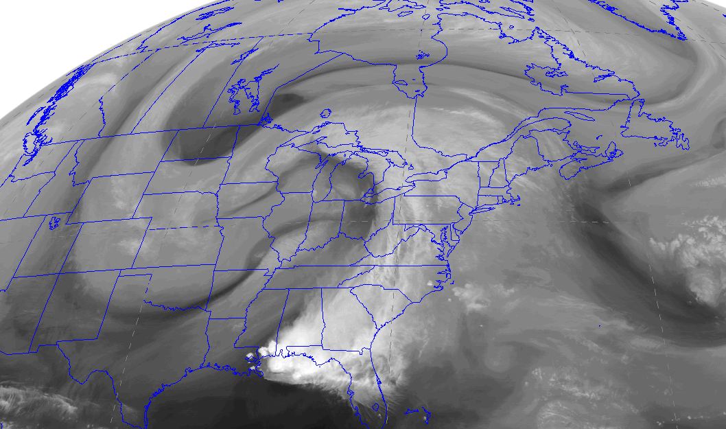
A very funky ying-yang pattern on Water Vapor imagery Tuesday evening as the overall jet stream pattern remains very blocked up.
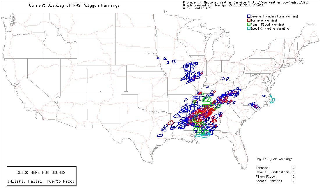
All the Warnings issued by crews at various NWS offices on Monday. In all, 145 tornado warnings. The progression of technology and the widespread use of media now saves countless lives. While tragically many have been lost during this outbreak, a similar system 50 years ago likely would have killed well over 100 people, who would have had little to zero warning.
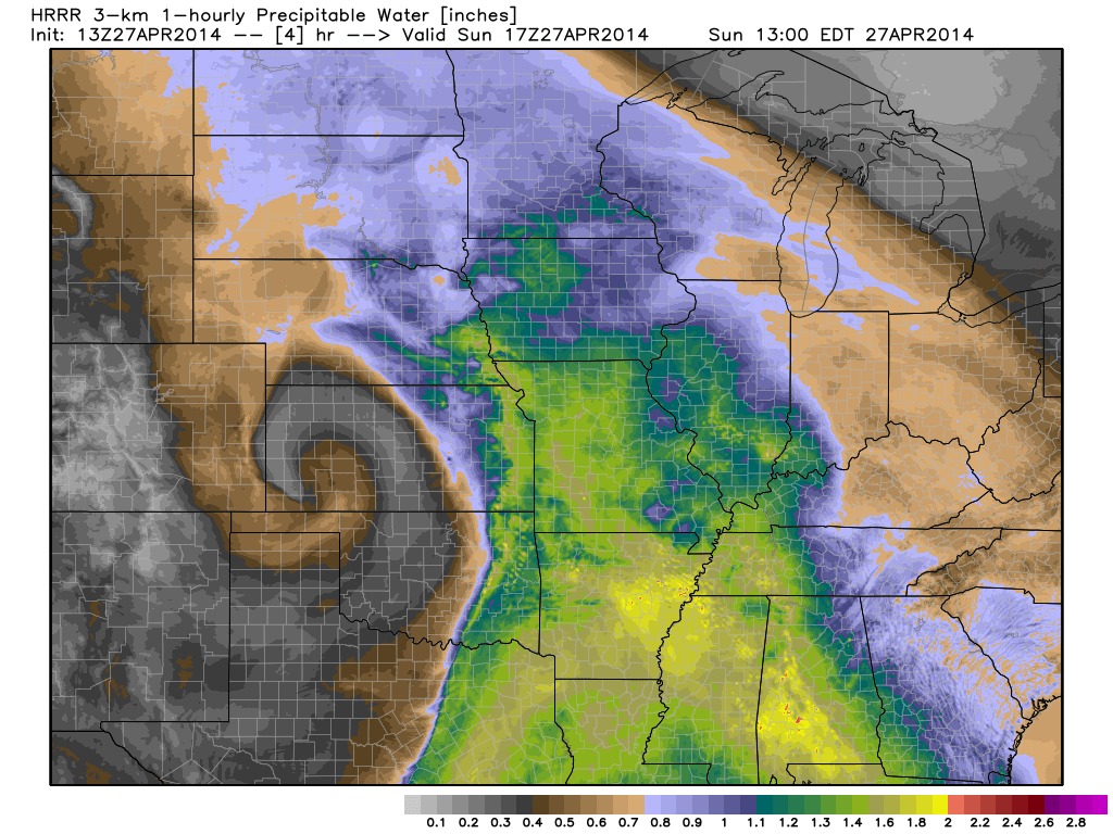
Source: Ryan Maue of WeatherBell.com.
Early on as the system was developing, this is a look at precipitable water values (essentially how much water vapor is in a column of the atmosphere). You can see the low curling up across the Plains as it developed on the lee side of the Rockies, with a moisture-rich environment developing across the south.
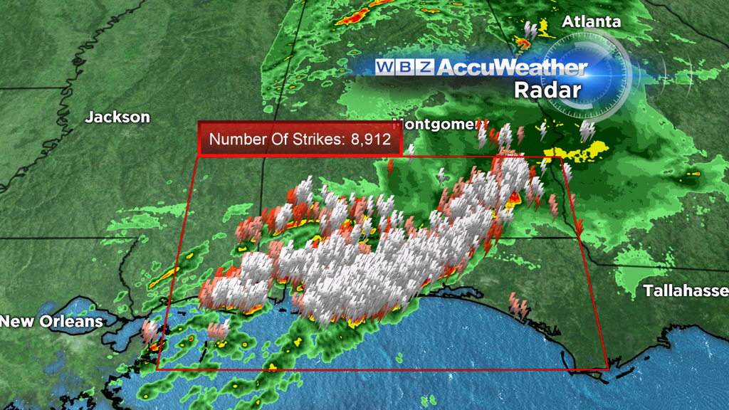
As Tuesday night came along, a giant MCS exploded along the Gulf Coast. The light show was out of this world...at times there were 9,000 strikes per every 15 minutes in this cluster, and I saw a max estimate of 60,000 strikes in an hour. That's ~17 strikes a second!
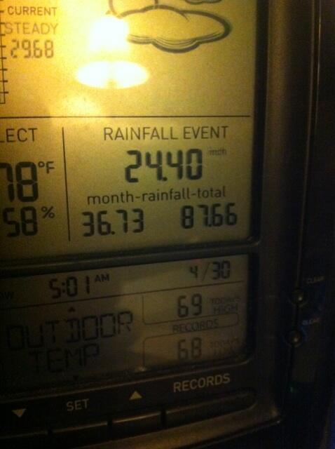
The constant updates of one Pensacola resident on Twitter (@rmcgahen) were incredible to follow. This is what his backyard rain gauge read by the end of the event, most of which fell in under 16 hours. Nearly 40" of rain has fallen in Pensacola this month, which is how much we average around here for a YEAR!
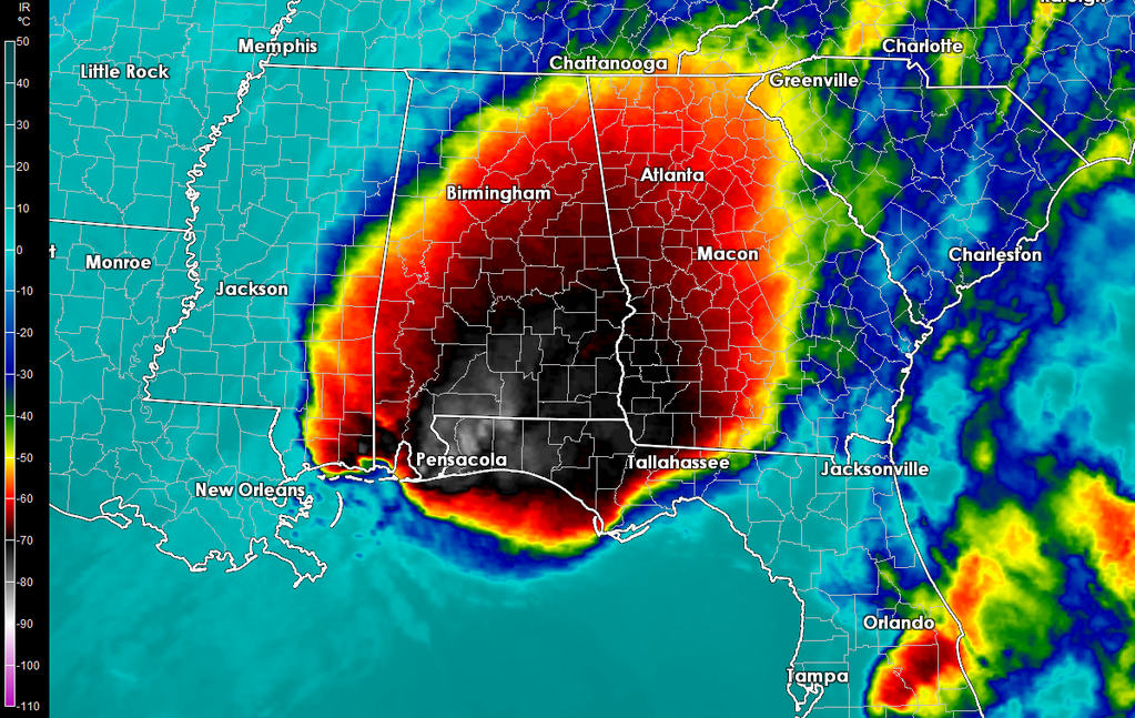
Here's what the MCS looked like from space. This is an infrared satellite shot, which measures the temperature of cloud tops. When thunderstorms build way up to the top of the troposphere, they are extremely cold. So the dark blacks and whites on this image are extremely cold cloud tops, around -80ºC.
Source: @ExtremeStorms on Twitter
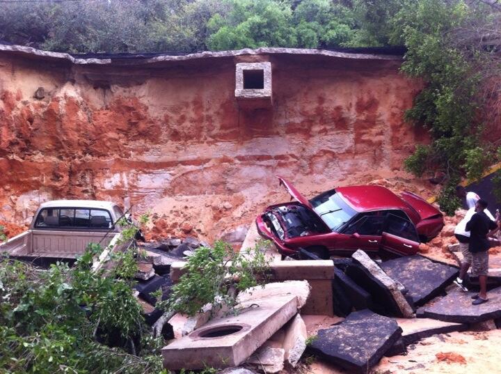
Just one of many images that came out of Pensacola, FL in the aftermath. Here are some astonishing numbers from the city:
- April 29th was the ALL-TIME wettest calendar day ever recorded in the city. 15.55" was estimated between what fell at the weather station and radar (the station failed a little after 10p local time). This is a place that sees frequent hurricane landfalls, and still none of them compared to the deluge that put the city under siege Tuesday night.
- 5.68" of rain fell in ONE HOUR, between 9-10pm CT. That is unheard of, and frankly is as much as I've ever seen fall in that amount of time. The National Weather Service says seeing that much rain in one hour is a 1 in 200-500 year event. Much more rain fell in that one hour than fell in Los Angeles, CA all of 2013 (3.60").
Source: NOAA
A giant, stacked area of low pressure the culprit for all this weather madness. Without and push from the jet stream, this low has been blocked, cut-off, and nearly stationary for days.
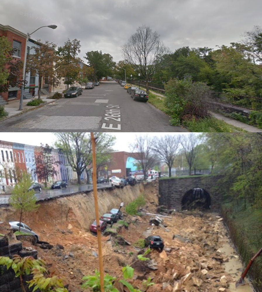
Source: @designhawg on Twitter
The torrential rain is on the move, and headed up the East Coast. This was the scene in Baltimore, MD Wednesday afternoon as a retaining wall/road collapsed and went sliding down into a ditch, taking at least 10 cars along for the ride.
