Stuck in the Middle With Sun!
We are stuck between two weather systems today...but stuck in the sunshine on a Sunday on the first day of May is pretty good place to be.
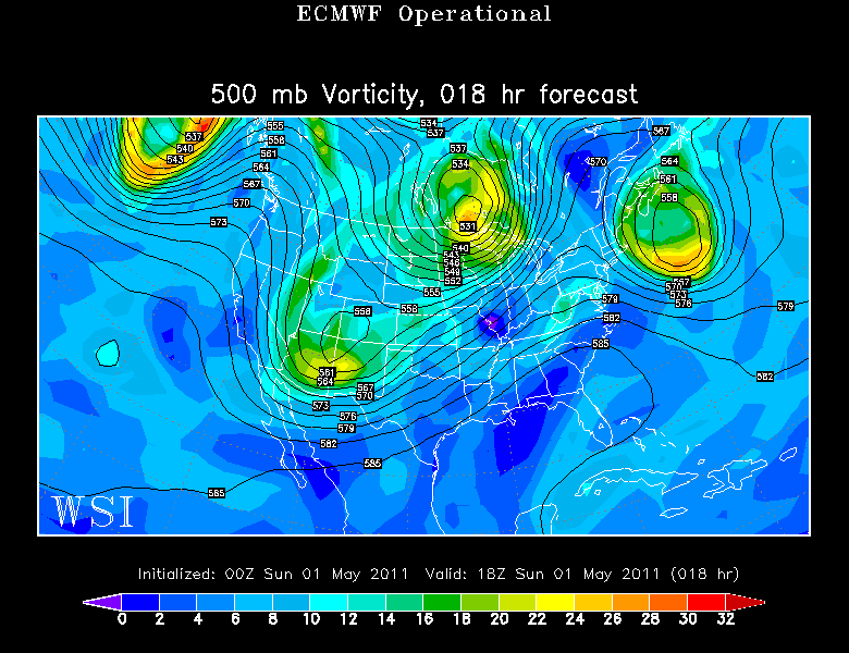
An upper Low is strengthening over Georges Bank and slowly pulling away. This low provided the cooler air aloft for the instability clouds yesterday. Today, the low is far enough off the coast now that it is wrapping in the dry air out of Canada with building high pressure out of Canada. A gorgeous day! NE winds will keep it cooler at the coastline in the Lwr-mid 50's. Away from the onshore winds, temps will continue to warm through the day into the Lwr-mid 60's, near 70 west.
As the upper low pulls away, the upper level ridge will shift east with high pressure at the surface holding strong through Monday. Plenty of sunshine with winds shifting back to the south will allow temps to be mild in the mid 60's in many locations with increasing high clouds in the afternoon. There is a slight risk of a late day shower in the North and west along with a cold front which will be slowing and stalling west of New England. A wave of low pressure will eventually ride up along this boundary.
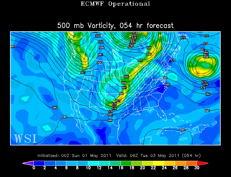
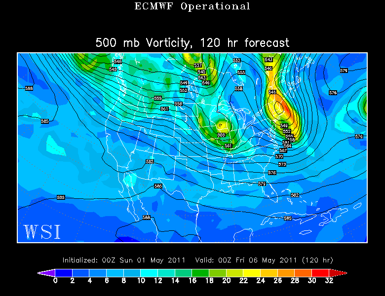
An energized trough will be swinging through the Northeast through the midweek. Warm SW winds aloft will transport the moisture lade air into the northeast. Plenty of clouds will be in place Tuesday with the approaching "stationary front" which will help to trigger a few scattered shower early and late on Tuesday. Look at the ridge below...this will help give the best chance of showers occurring in Northern and Western New England...a drier outlook through Tuesday towards the coast.
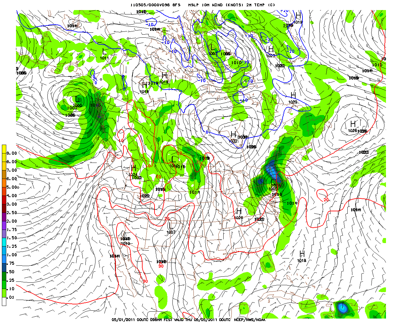
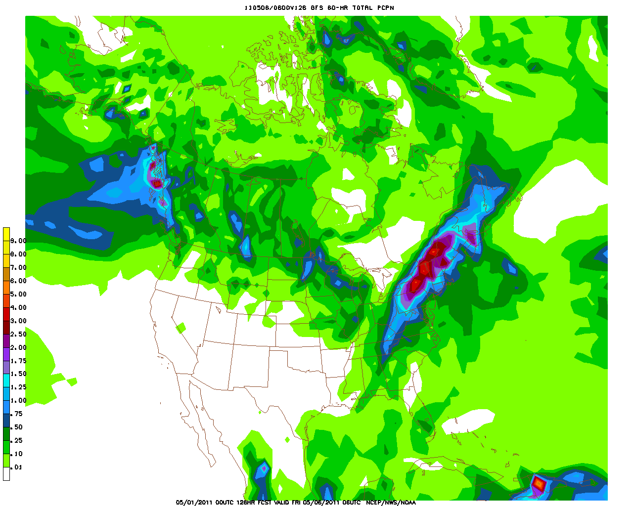
The main area of low pressure will finally get a move the stalled on Tuesday night in the Mid-Atlantic and then track towards the region on Wednesday. Where the low eventually tracks will determine how warm we can get and who gets the heaviest of the rain. The 00Z run of the GFS takes the Low on an inside track up New jersey and the Hudson Valley Wednesday, then weakening a bit right over southern New England by evening.
This track brings the heaviest QPF for Northern and western New England. Still a good slug of rain will push through for all of Wednesday and should deliver about .50-1.5" of rainfall. Some areas in the NW may exceed 2".
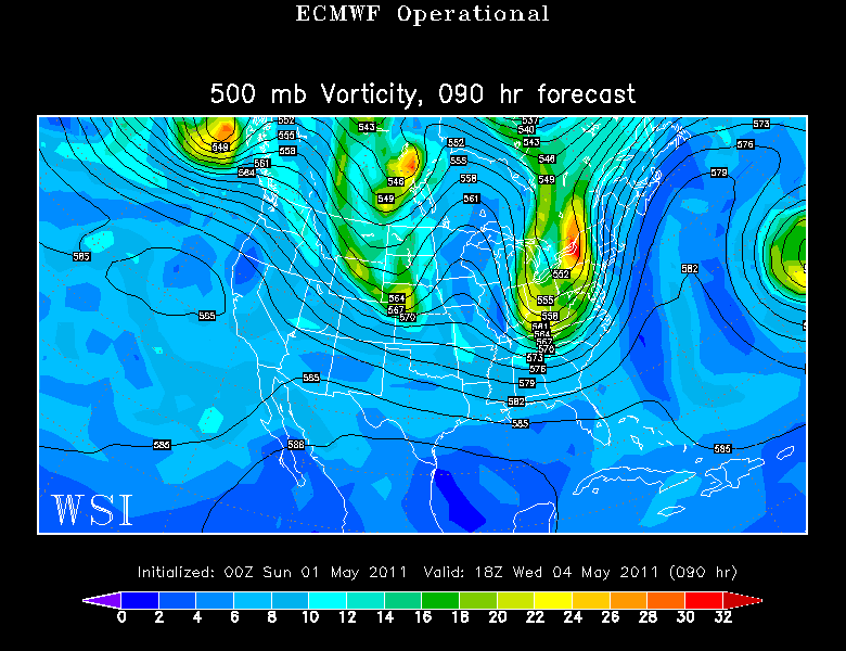
The low begins to drift off the coast Thursday, wrapping in cool raw NE winds with cloudy cool damp conditions, scattered showers. The trough remains firmly in place across the region. There is the potential we may even mix in some snow across the NE mountains in the higher elevations.
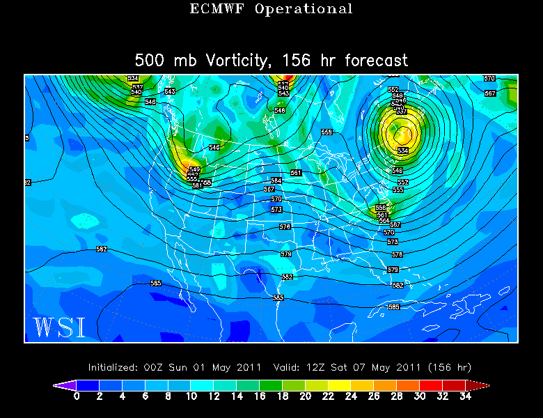
Here is where it gets interesting. The upper low digs in and gets cutoff from the jetstream..Friday and Saturday. This will be wrapping in drying NW winds at the ground...but plenty of cool air aloft will mean abundant cloud cover and the threat for scattered hit or miss instability showers...especially north. the best chance of breaks of sun will be south.
Temps will obviously average below normal for the middle to the end of the week. A Persistent trough in the northeast for the overall trend through the middle of May is likely. Not much warmth to be found...but this time of year...a little sun can go a long way towards warming things up!
