Storm could bring light snow to Massachusetts Thursday
There's a little more wind in the forecast this week and potentially a few inches of snow for parts of Massachusetts on Thursday.
February has been a winter beast. Just 18 days in and we already have more snow this month in Boston than the rest of winter combined.
February has also been our coldest month of the winter thus far. With an average temperature of 28.6 degrees, it is currently the coldest month we have had since January of 2022.
Cold temperatures in Boston
The cold will persist for a few more days. Wind chills ranged between -5 and 5 degrees Wednesday morning.
Air temperatures won't get back above freezing for the majority of our area until Friday.
Bottom line, very little melting over the next few days and more baby steps around the sidewalks and driveways.
One more storm to watch
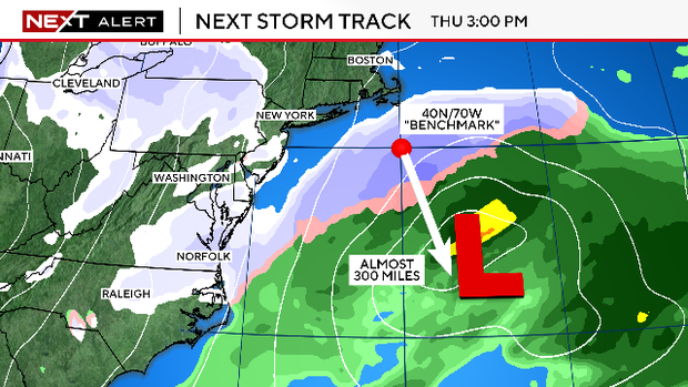
Before we can sound the "all clear" for weather this week, we have one more storm to watch.
The track this time will be too far south for any major impacts in southern New England, but we will catch just the northern fringe of the storm.
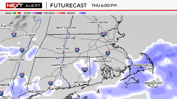
There may be some light flurries in the air as early as midday on Thursday, particularly along the coastline.
The steadier snow will arrive along the South Coast later in the afternoon and last roughly from about 5 p.m. Thursday to 2 a.m. Friday.
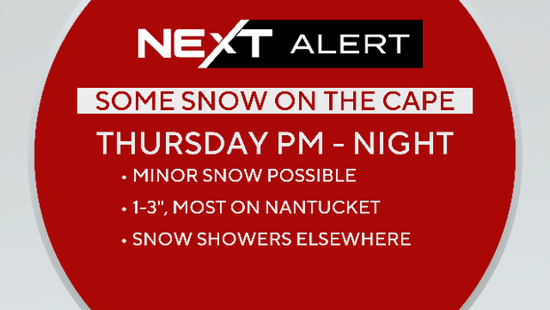
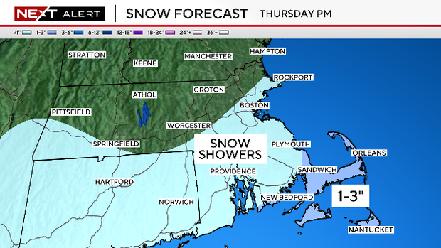
How much snow will Massachusetts get on Thursday?
Any accumulation will be confined to far southeastern Massachusetts with just a few scattered flurries elsewhere.
We are forecasting 1-3" from roughly the Cape Cod Canal eastward, including Martha's Vineyard and Nantucket.
Call it a private affair just for Cape residents...
Weekend weather
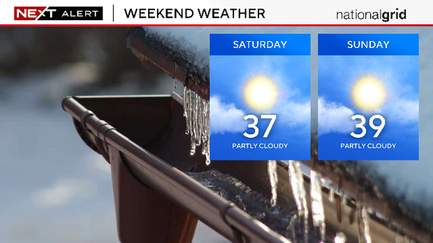
After that storm passes, we get a weekend off! It will be a quiet/dry couple of days and temperatures will allow for a good deal of melting as well.