'Dramatic turn': Bitterly cold air behind damaging rain storm
By Terry Eliasen, Meteorologist, WBZ-TV Exec. Weather Producer
BOSTON - I don't know about you, but I find it tough to get in the holly, jolly holiday mood when it is pouring rain outside. Mother Nature clearly has no sense of timing, sending this "Grinch-mas" storm our way just hours before Santa's arrival.
Thousands of flight delays and cancellations, tens of thousands of power outages in Massachusetts alone, flooded out roadways and dozens of reports of trees and limbs down....NOT an ideal way to start your holiday weekend.
What is a bomb cyclone? | See storm damage photos
I do have SOME good news. The heaviest rain is done and the worst of the inland flooding has already occurred.
Later Friday, the weather story took a dramatic turn. The frigid air that invaded much of the Midwest arrived here in New England. Temperatures dropped from the 50s to the 20s in a very short period of time.
I know everyone has a LOT to do, places to go, people to see...let me try and take you through all the weather changes ahead so you know what's next.
Saturday
Mid-winter feel. Highs will be stuck in the 20s and wind chills in the teens and single digits. Winds will stay active, gusting between 20-30 mph all day long.
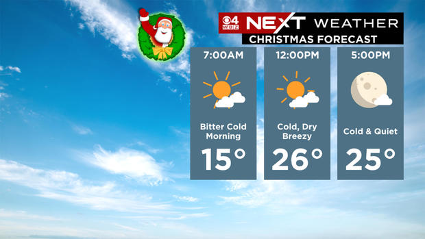
Christmas
More of the same. Highs in the 20s and wind chills mainly in the teens with a biting, gusty wind. This will be our coldest Christmas in nearly a decade.
