Soon to be Going Up...
As suspected yesterday...MOS guidance for today was way too low...the temp made it up to 29 at Logan...again, 850mb temps are the way to go. We bottom out tonight then we go on a warm streak. Tonight's lows will be the coldest of the stretch...while I don't see temps getting as low as GFS MOS is indicating (Way Below Zero), I will shade on the colder-side tonight with ideal radiational cooling conditions...clear, dry and calm will allow for a nocturnal inversion to set-up and with rising thicknesses that inversion will get enhanced trapping the cold at the lowest layer. This means that many will be in the single digits and the really sheltered locals will go below zero...due to the heat island effect, I expect the city to stay in the teens.
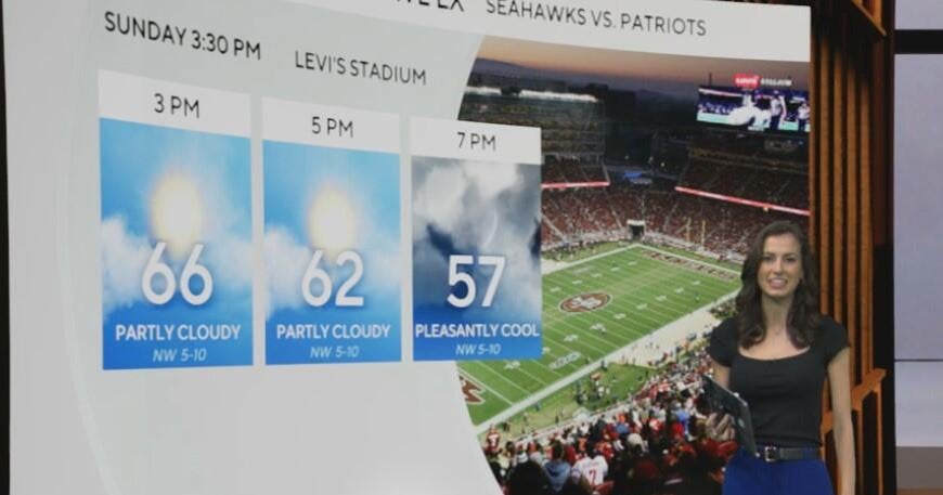
Significant and deep layer warm air advection will be occurring over the weekend...models are very moist...likely too moist indicating low clouds throughout. While I see warm advection clouds Friday night and Saturday morning and snowpack induced fog Saturday night, there is a good chance we see some sun Saturday afternoon and if the next system continues to show signs of slowing down we could break into sun on Sunday too...which in turn would give us a chance to hit 60!
The next system for Sunday night and Monday will be very sluggish and loaded with moisture. In fact, we are likely looking at 1-2" of rain...enough to elevate the flood threat again.