Maps show where snow will coat parts of Massachusetts Sunday night into Monday


BOSTON - A fast storm system is set to bring another round of light snow to Massachusetts on Sunday night and into early Monday. While accumulations will be light, the snow could bring some slick travel Sunday night and ahead of the Monday morning commute.
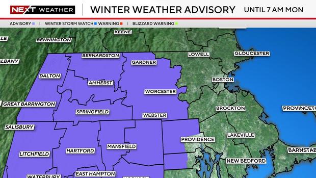
The WBZ Next Weather Team has issued a Next Weather Alert through Monday morning.

Sunday night snow coating
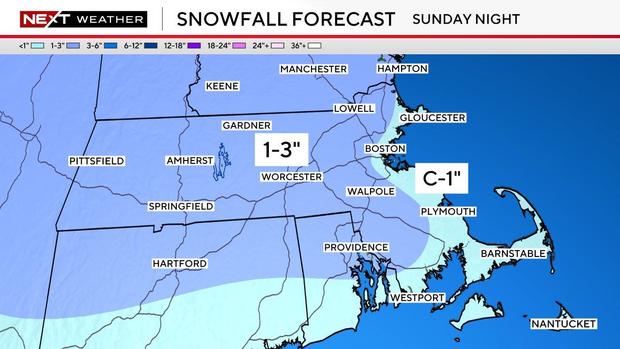
Most areas will be looking at up to 1 to 3 inches of accumulation, with lighter amounts of a coating to one inch closer to the coast. Western Massachusetts has the best chance of getting up to 3 inches.
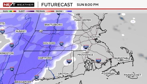
We'll be dry most of Sunday, with increasing clouds and highs in the 20s to around 30 degrees. The snow will then start between 7 and 9 p.m., coming in from west to east. It will wrap up before daybreak and Monday morning's commute.


When to expect snow?
The bulk of the snow, when some periods of moderate snow will be possible, is expected between 9 p.m. and 1 a.m.
In terms of type, we expect it to be all snow, with temperatures in the between 20 to 30 degrees. Some light rain showers or mixing, though, are possible on the tail end along the islands and outer Cape Cod early Monday morning.
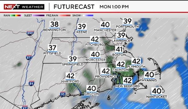
The coating from the fast-moving system won't be here long, though. Temperatures on Monday are expected to climb into the low to mid-40s, which will clear and melt most of the snow.
Winter Weather Advisory
Looking ahead, we will have another system moving in on Thursday, which looks to bring more of a wintry mix. We will keep you updated on that storm system.