Maps show where up to 6 inches of snow could fall in Massachusetts from Thursday storm
BOSTON - Depending where you live in Massachusetts, you may need a shovel, snow blower or nothing at all for Thursday's storm.
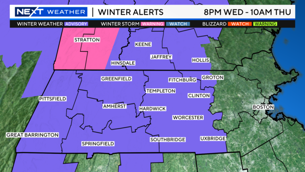
A winter weather advisory remains in effect through 10 a.m. Thursday for central and western Massachusetts and southwestern New Hampshire. There is a winter storm warning (in pink) for parts of southern Vermont; this denotes an area that is likely to meet or exceed the 6-inch mark.
Snowstorm timeline for Massachusetts
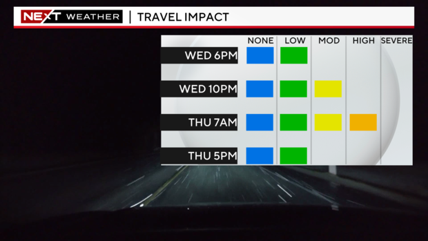
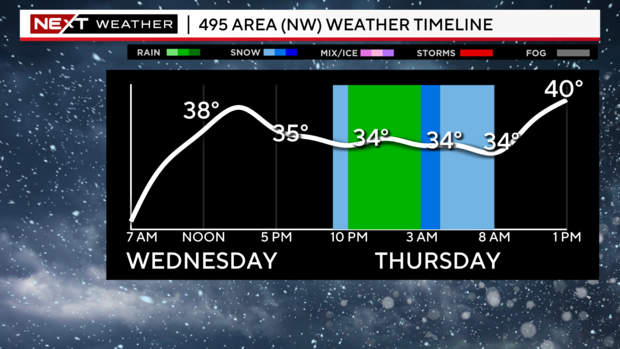
Thursday morning's commute is going to be a rough one. The rain/snow line will inch a bit eastward and snow or a wintry mix will be falling in most of Boston's northern and western suburbs. The steady precipitation will taper off between 8 a.m. and 10 a.m.
Beyond that, there will just be a midday and early afternoon rain/snow showers as the cold front sweeps through, ushering in much colder air.
This will not be a major storm by any means. This will, however, be the first snow accumulation of the season for many folks in interior southern New England.
Where will snow fall in Massachusetts?
Conditions will vary quite a bit from region to region.
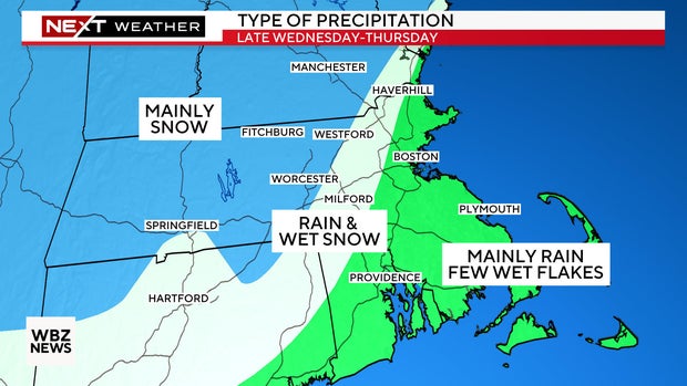
I-95 corridor-eastward, including eastern Essex county, the Boston area and all of southeastern Mass: Mainly rain with perhaps, just a few wet flakes mixing in toward the end.
I-95 west to 495 (northern section), including a big section of MetroWest, the Mass Pike, western Essex county and most of Middlesex County: This is the toughest call. There will be a mix of rain and wet snow here and the potential for a slushy/wet coating to an inch in spots.
West of 495, including most of Worcester County, western Mass. and southern New Hampshire away from the coast: Mainly snow.
How much snow could Massachusetts get?
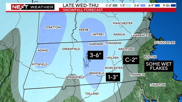
The best chance for a widespread, plowable snow will be in the higher elevations of Worcester County, southwest New Hampshire and the Berkshires. If you live in any of these areas, definitely gas up the snowblower. We are forecasting 3-6" of snow.
We expect 1-3" in the lower elevations in Worcester County and in westernmost Middlesex County, west of 495. Have the shovels handy.
We are forecasting a coating to an inch of wet snow around and just inside 495.
Closer to the coast, near and east of I-95, it will be mainly rain with some wet flakes mixing in here and there.
The toughest call with this storm is the in-between area where there will be a mix of rain and snow, generally right around 495 from the Pike northward to 93/95. The stakes aren't all that high but obviously a degree or two difference in temperature could mean a bit more snow (or rain). It wouldn't be shocking for a few towns in the "coating to 1 inch" area to receive an extra inch or two.
Cold weather returns after the storm
After the storm, it's back to the cold. Another blast from Canada arrives on Friday. Expect high temperatures in the 20s and low 30s Friday and Saturday with overnight lows in the teens.
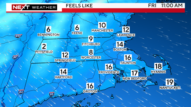
Factor in a gusty wind and "feels like" temperatures will be in the single digits and teens on Friday.
